MyTopo
Wolbach Nebraska US Topo Map
Couldn't load pickup availability
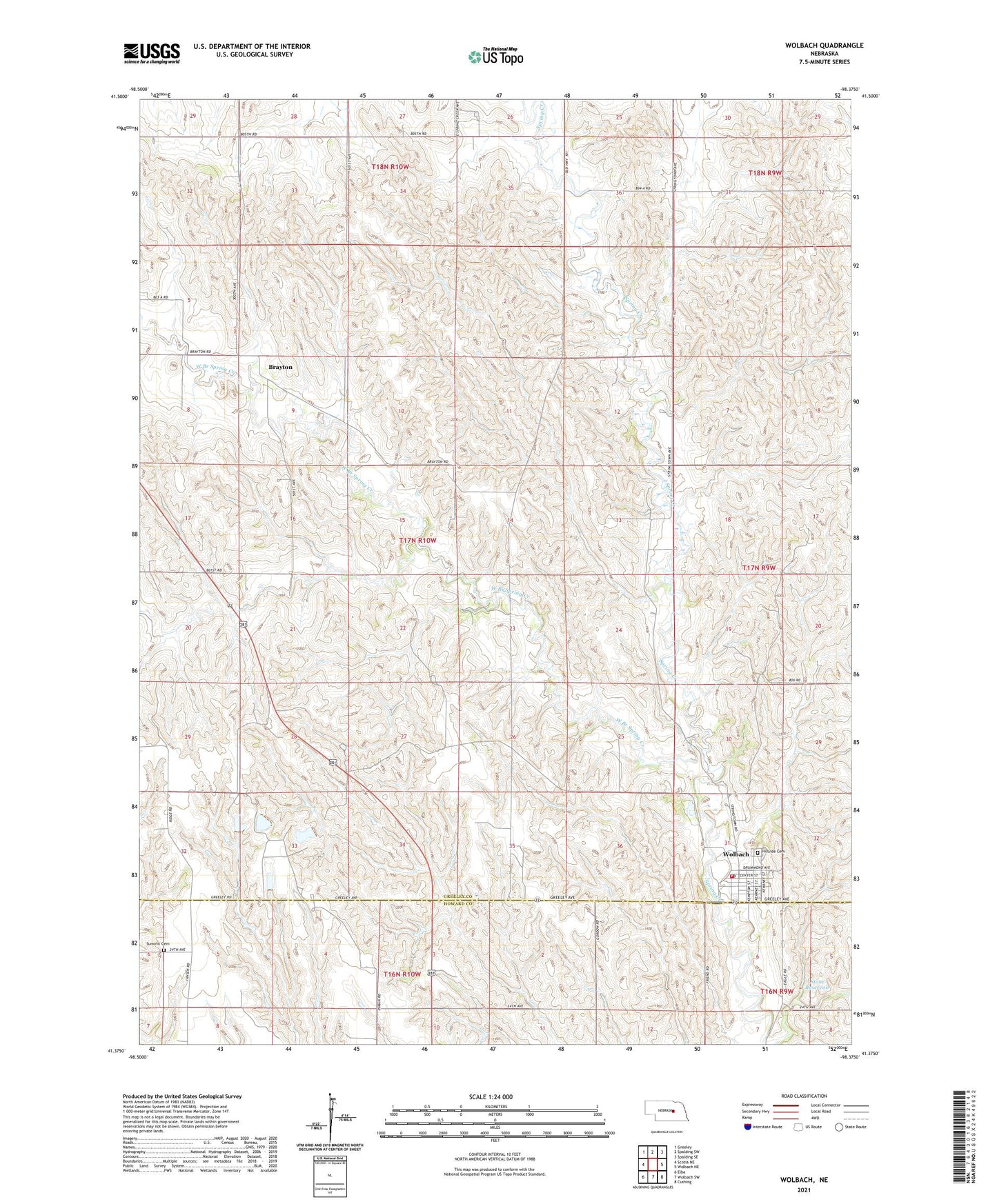
2021 topographic map quadrangle Wolbach in the state of Nebraska. Scale: 1:24000. Based on the newly updated USGS 7.5' US Topo map series, this map is in the following counties: Greeley, Howard. The map contains contour data, water features, and other items you are used to seeing on USGS maps, but also has updated roads and other features. This is the next generation of topographic maps. Printed on high-quality waterproof paper with UV fade-resistant inks.
Quads adjacent to this one:
West: Scotia NE
Northwest: Greeley
North: Spalding SW
Northeast: Spalding SE
East: Wolbach NE
Southeast: Cushing
South: Wolbach SW
Southwest: Elba
Contains the following named places: Brayton, Brayton Post Office, College Knob School, Dino Mini Park, Farmers Union Co-op Elevator, Hillside Cemetery, Midway School, Saint Josephs Catholic Church, School Number 37, Stone Dam, Stone Reservoir, Summit Cemetery, Summit Post Office, Summit School, Township of Brayton, Village of Wolbach, West Branch Spring Creek, Wolbach, Wolbach City Park, Wolbach Election Precinct, Wolbach Lutheran Church, Wolbach Methodist Church, Wolbach Number 1 Election Precinct, Wolbach Police Department, Wolbach Post Office, Wolbach Public Library, Wolbach Public Schools, Wolbach Volunteer Fire and Rescue, ZIP Code: 68882