MyTopo
Wood Lake Nebraska US Topo Map
Couldn't load pickup availability
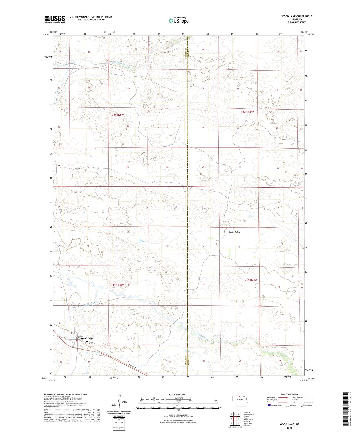
2021 topographic map quadrangle Wood Lake in the state of Nebraska. Scale: 1:24000. Based on the newly updated USGS 7.5' US Topo map series, this map is in the following counties: Cherry, Brown. The map contains contour data, water features, and other items you are used to seeing on USGS maps, but also has updated roads and other features. This is the next generation of topographic maps. Printed on high-quality waterproof paper with UV fade-resistant inks.
Quads adjacent to this one:
West: Arabia
Northwest: Sparks SE
North: Muleshoe Creek
Northeast: Norden
East: Wood Lake NE
Southeast: Johnstown
South: Brush Creek
Southwest: Arabia SE
Contains the following named places: Mount Hope Cemetery, Porter Valley, Porter Valley School, Village of Wood Lake, Wood Lake, Wood Lake City Park, Wood Lake City Park Campground, Wood Lake Fire Department, Wood Lake Post Office, Wood Lake Public School, Wood Lake Union Church