MyTopo
Acoma Nevada US Topo Map
Couldn't load pickup availability
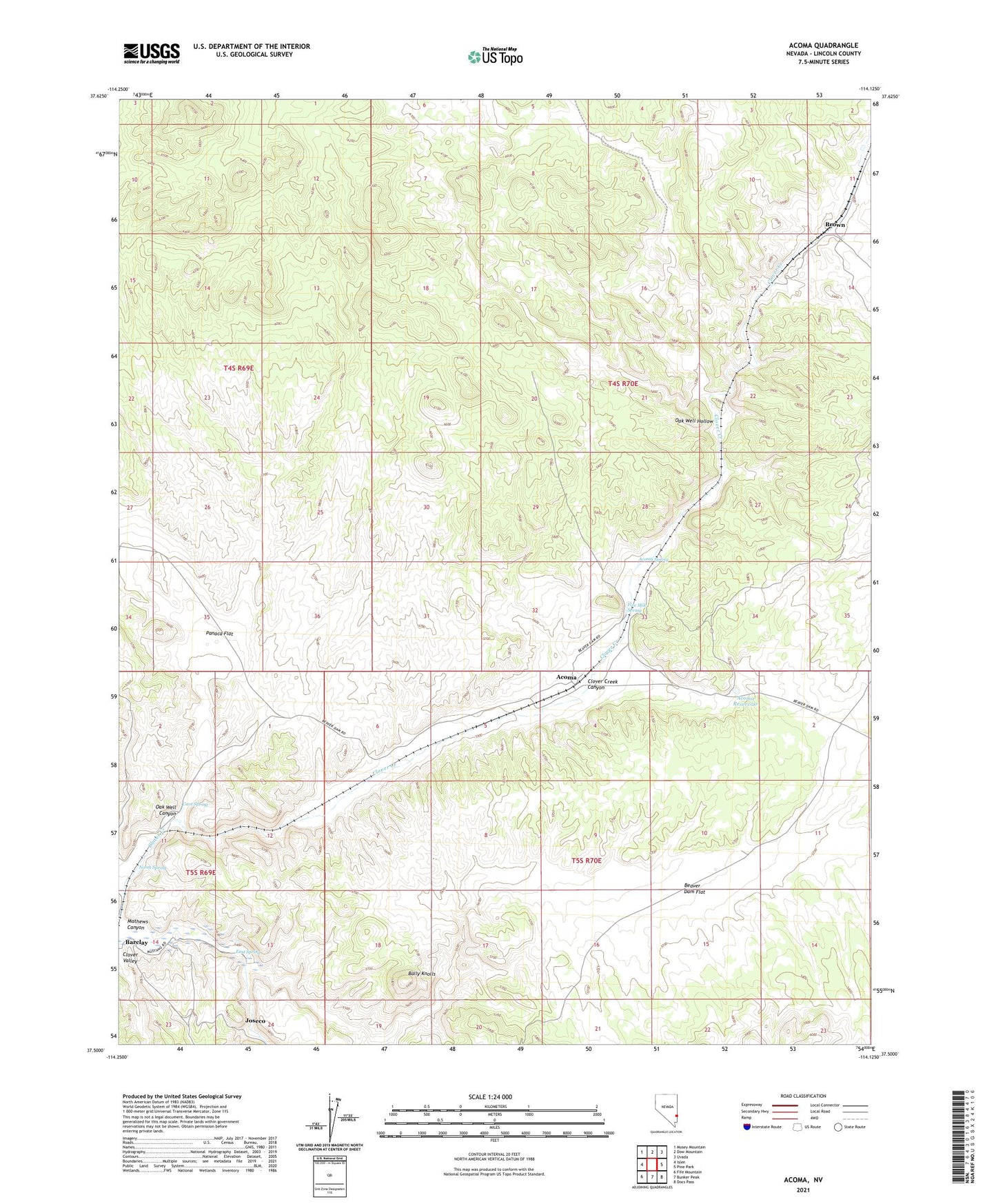
2021 topographic map quadrangle Acoma in the state of Nevada. Scale: 1:24000. Based on the newly updated USGS 7.5' US Topo map series, this map is in the following counties: Lincoln. The map contains contour data, water features, and other items you are used to seeing on USGS maps, but also has updated roads and other features. This is the next generation of topographic maps. Printed on high-quality waterproof paper with UV fade-resistant inks.
Quads adjacent to this one:
West: Islen
Northwest: Mosey Mountain
North: Dow Mountain
Northeast: Uvada
East: Pine Park
Southeast: Docs Pass
South: Bunker Peak
Southwest: Fife Mountain
Contains the following named places: Acoma, Acoma Mine, Acoma Post Office, Acoma Reservoir, Acoma Spring, Bally Knolls, Beaver Dam Flat, Boykin Mine, Brown, Browns Well, Cave Spring, East Spring, Five Mile Spring, Joseco, Joseco Post Office, Mathews Canyon, North Spring, Oak Well Canyon, Oak Well Hollow, Panaca Flat