MyTopo
Adelaide Nevada US Topo Map
Couldn't load pickup availability
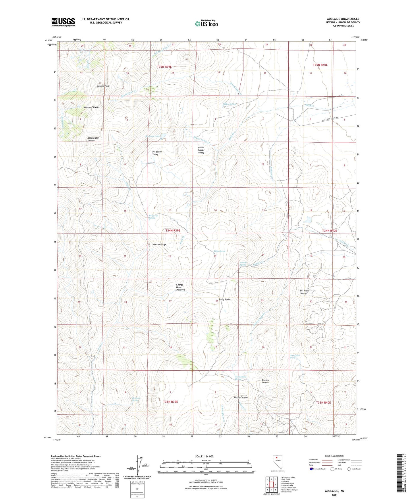
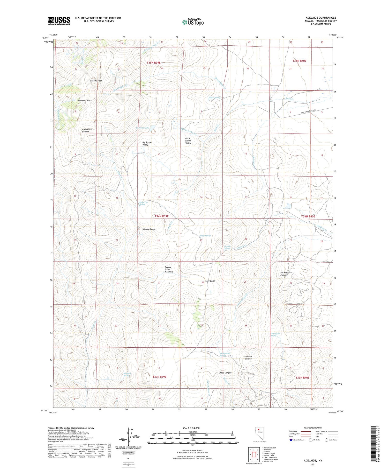
2021 topographic map quadrangle Adelaide in the state of Nevada. Scale: 1:24000. Based on the newly updated USGS 7.5' US Topo map series, this map is in the following counties: Humboldt. The map contains contour data, water features, and other items you are used to seeing on USGS maps, but also has updated roads and other features. This is the next generation of topographic maps. Printed on high-quality waterproof paper with UV fade-resistant inks.
Quads adjacent to this one:
West: Sonoma Canyon
Northwest: Winnemucca East
North: Pole Creek
Northeast: Golconda
East: Goldrun Creek
Southeast: Smelser Pass
South: Sheep Ranch Canyon
Southwest: Clear Creek Ranch
Contains the following named places: Adelaide, Adelaide Crown Mines, Big Squaw Valley, Broad Gulch Creek, Cumberland, Cumberland Mine, Cumberland Spring, George Baine Meadows, Gold Run, Gold Run Mining District, Granite Spring, Harry Kaul Spring, Layson Creek, Little Squaw Valley, Reinhart Spring, Ridge Spring, Ridge Top Spring, Rock Creek Ranch, Sibbald Corral, Sonoma Lake, Sonoma Peak, Squaw Valley Creek, Stony Basin, Willow Spring