MyTopo
Alkali Peak Nevada US Topo Map
Couldn't load pickup availability
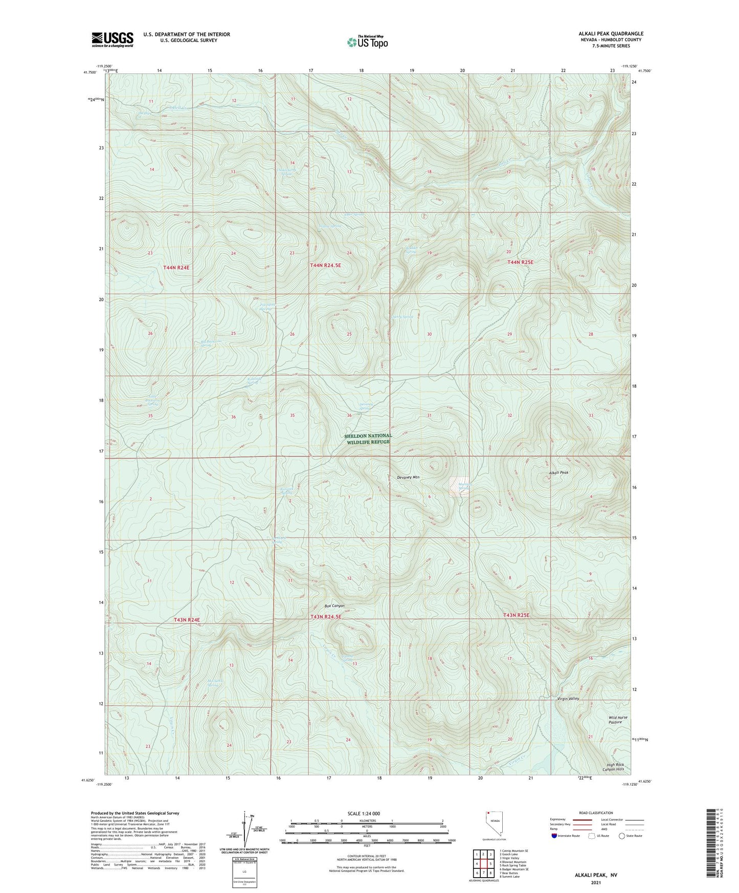
2021 topographic map quadrangle Alkali Peak in the state of Nevada. Scale: 1:24000. Based on the newly updated USGS 7.5' US Topo map series, this map is in the following counties: Humboldt. The map contains contour data, water features, and other items you are used to seeing on USGS maps, but also has updated roads and other features. This is the next generation of topographic maps. Printed on high-quality waterproof paper with UV fade-resistant inks.
Quads adjacent to this one:
West: Blowout Mountain
Northwest: Catnip Mountain SE
North: Gooch Lake
Northeast: Virgin Valley
East: Rock Spring Table
Southeast: Summit Lake
South: Bear Buttes
Southwest: Badger Mountain SE
Contains the following named places: Alkali Flat, Alkali Peak, Alkali Reservoir, Alkali Reservoir Dam, Big Buckaroo Spring, Boulder Spring, Box Canyon, Cherry Spring, Chokecherry Spring, Devaney Camp, Devaney Mountain, Devaney Spring, Elder Spring, Hell Creek, Little Buckaroo Spring, Martinez Spring, McClusky Spring, Pat Hurd Spring, Porcupine Spring, Pothole Spring, Rimrock Spring, Roadside Spring, Sand Creek, South Hell Creek, The Dip, Willow Spring