MyTopo
Arc Dome Nevada US Topo Map
Couldn't load pickup availability
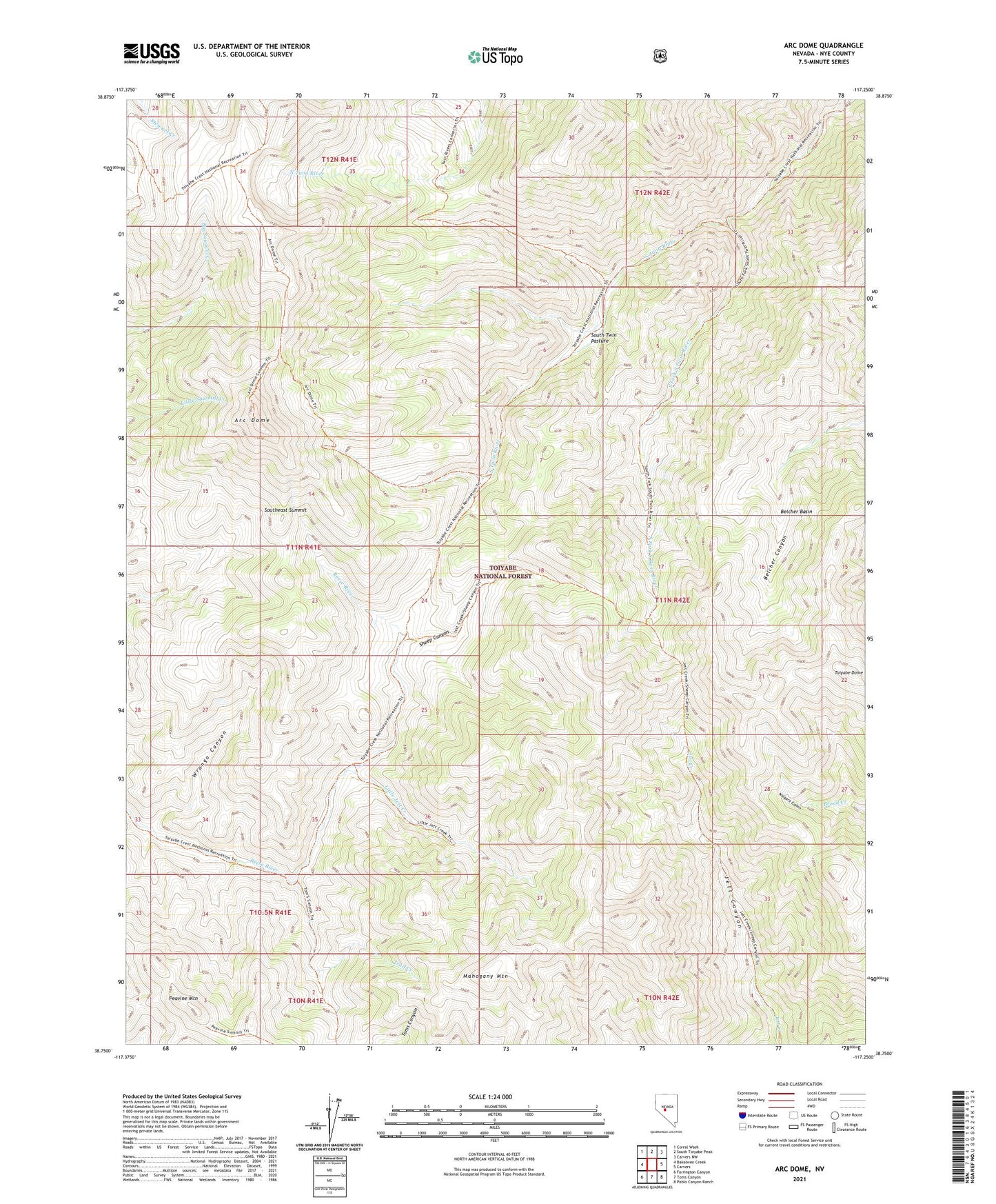
2021 topographic map quadrangle Arc Dome in the state of Nevada. Scale: 1:24000. Based on the newly updated USGS 7.5' US Topo map series, this map is in the following counties: Nye. The map contains contour data, water features, and other items you are used to seeing on USGS maps, but also has updated roads and other features. This is the next generation of topographic maps. Printed on high-quality waterproof paper with UV fade-resistant inks.
Quads adjacent to this one:
West: Bakeoven Creek
Northwest: Corral Wash
North: South Toiyabe Peak
Northeast: Carvers NW
East: Carvers
Southeast: Pablo Canyon Ranch
South: Toms Canyon
Southwest: Farrington Canyon
Contains the following named places: Arc Dome, Arc Dome Wilderness, Belcher Basin, Little Jett Creek, Mahogany Mountain, Peavine Mountain, Sheep Canyon, South Fork South Twin River, South Twin Pasture, South Twin Pasture Administrative Site, Southeast Summit, Toiyabe Dome, Trail Creek, Upper Corral, Wrango Canyon