MyTopo
Badger Creek Nevada US Topo Map
Couldn't load pickup availability
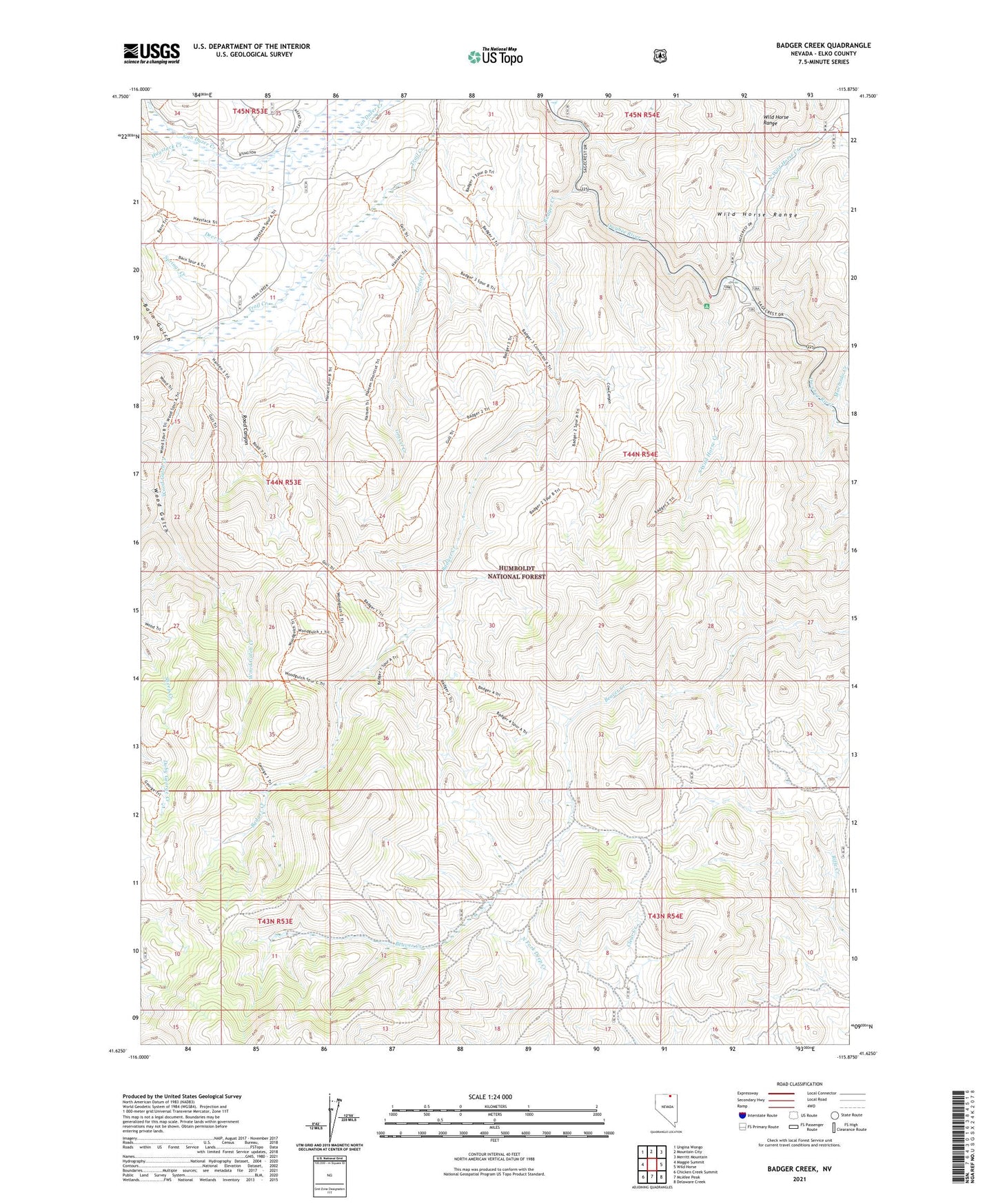
2021 topographic map quadrangle Badger Creek in the state of Nevada. Scale: 1:24000. Based on the newly updated USGS 7.5' US Topo map series, this map is in the following counties: Elko. The map contains contour data, water features, and other items you are used to seeing on USGS maps, but also has updated roads and other features. This is the next generation of topographic maps. Printed on high-quality waterproof paper with UV fade-resistant inks.
Quads adjacent to this one:
West: Maggie Summit
Northwest: Ungina Wongo
North: Mountain City
Northeast: Merritt Mountain
East: Wild Horse
Southeast: Delaware Creek
South: McAfee Peak
Southwest: Chicken Creek Summit
Contains the following named places: Badger Creek, Baker Ranch, Barn Gulch, Byington Ranch, Byington Ranch Airport, Cow Canyon, Deer Creek, Gravel Creek, Hansen Ranch, Haystack Creek, Machado Creek, North Wild Horse Creek, Road Canyon, South Wild Horse Creek, Springs Creek, Thompson Ranch, Wild Horse Crossing, Wild Horse Crossing Campground, Wood Gulch, Wood Gulch Creek, Wood Gulch Mine