
MyTopo
Bartine Ranch Nevada US Topo Map
Couldn't load pickup availability
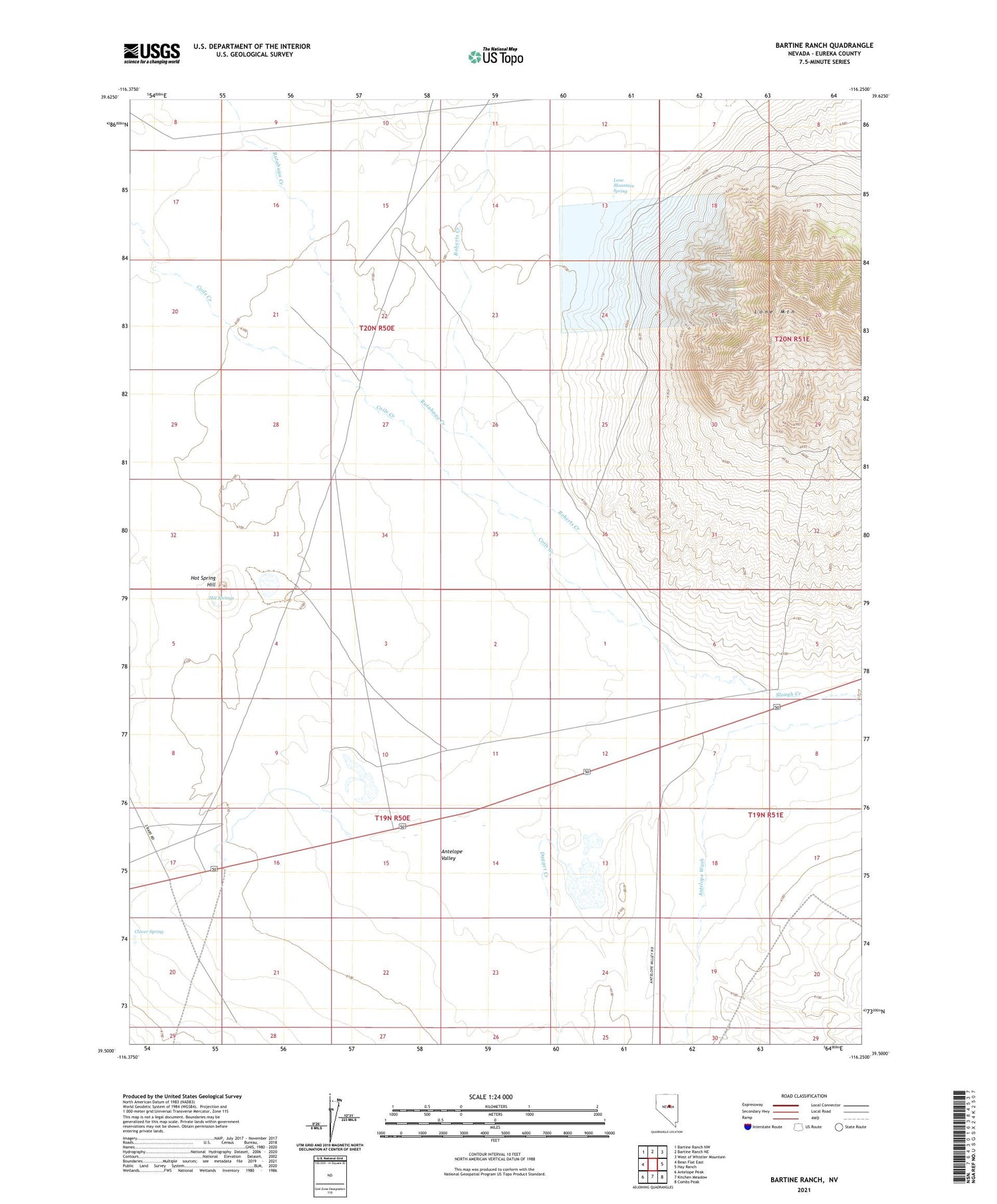
2021 topographic map quadrangle Bartine Ranch in the state of Nevada. Scale: 1:24000. Based on the newly updated USGS 7.5' US Topo map series, this map is in the following counties: Eureka. The map contains contour data, water features, and other items you are used to seeing on USGS maps, but also has updated roads and other features. This is the next generation of topographic maps. Printed on high-quality waterproof paper with UV fade-resistant inks.
Quads adjacent to this one:
West: Bean Flat East
Northwest: Bartine Ranch NW
North: Bartine Ranch NE
Northeast: West of Whistler Mountain
East: Hay Ranch
Southeast: Combs Peak
South: Kitchen Meadow
Southwest: Antelope Peak
Contains the following named places: Antelope Wash, Bartine Ranch, Clover Spring, Coils Creek, Dagget Creek, Hot Spring Hill, Hot Springs, Lone Mountain, Lone Mountain Mine, Lone Mountain Mining District, Lone Mountain Spring, Mountain View Extension Mine, Mountain View Mine, Roberts Creek, Treasure Well


