MyTopo
Bunnell Mountain New Hampshire US Topo Map
Couldn't load pickup availability
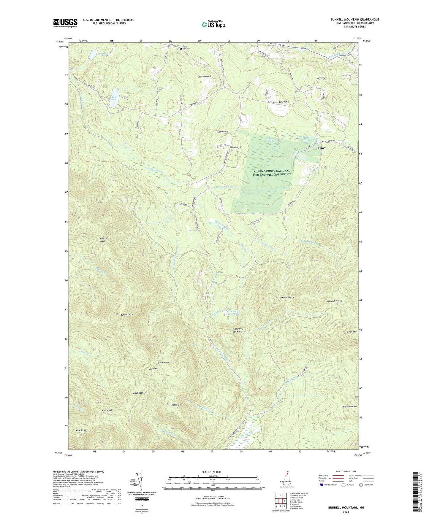
2021 topographic map quadrangle Bunnell Mountain in the state of New Hampshire. Scale: 1:24000. Based on the newly updated USGS 7.5' US Topo map series, this map is in the following counties: Coos. The map contains contour data, water features, and other items you are used to seeing on USGS maps, but also has updated roads and other features. This is the next generation of topographic maps. Printed on high-quality waterproof paper with UV fade-resistant inks.
Quads adjacent to this one:
West: Tinkerville
Northwest: Monadnock Mountain
North: Lovering Mountain
Northeast: Diamond Pond
East: Dixville Notch
Southeast: Dummer Ponds
South: Percy Peaks
Southwest: Stratford
Contains the following named places: Blueberry Swamp, Bog Brook, Bungy, Bunnell Mountain, Carlton Hill, Castle Mountain, Cilley Hill, Cleveland Notch, Cleveland School, Columbia Brook, Cranberry Bog Notch, Cranberry Bog Pond, East Branch Simms Stream, East Columbia Church, Fish Pond, Fitch Mountain, Gadwah Notch, Gore Mountain, Gore Notch, Grand Vision School, Johnson Brook, Lime Pond, Lime Pond Dam, Marshall Hill, Mohawk School, Moran Brook, Moran Notch, Muise Mountain, Nash Bog Pond, Notch Mountain, Number Three Brook, Pike Brook, Roaring Brook, Town of Columbia, Union School, Uran Brook, West Branch Simms Stream, West Peak