MyTopo
Dixville Notch New Hampshire US Topo Map
Couldn't load pickup availability
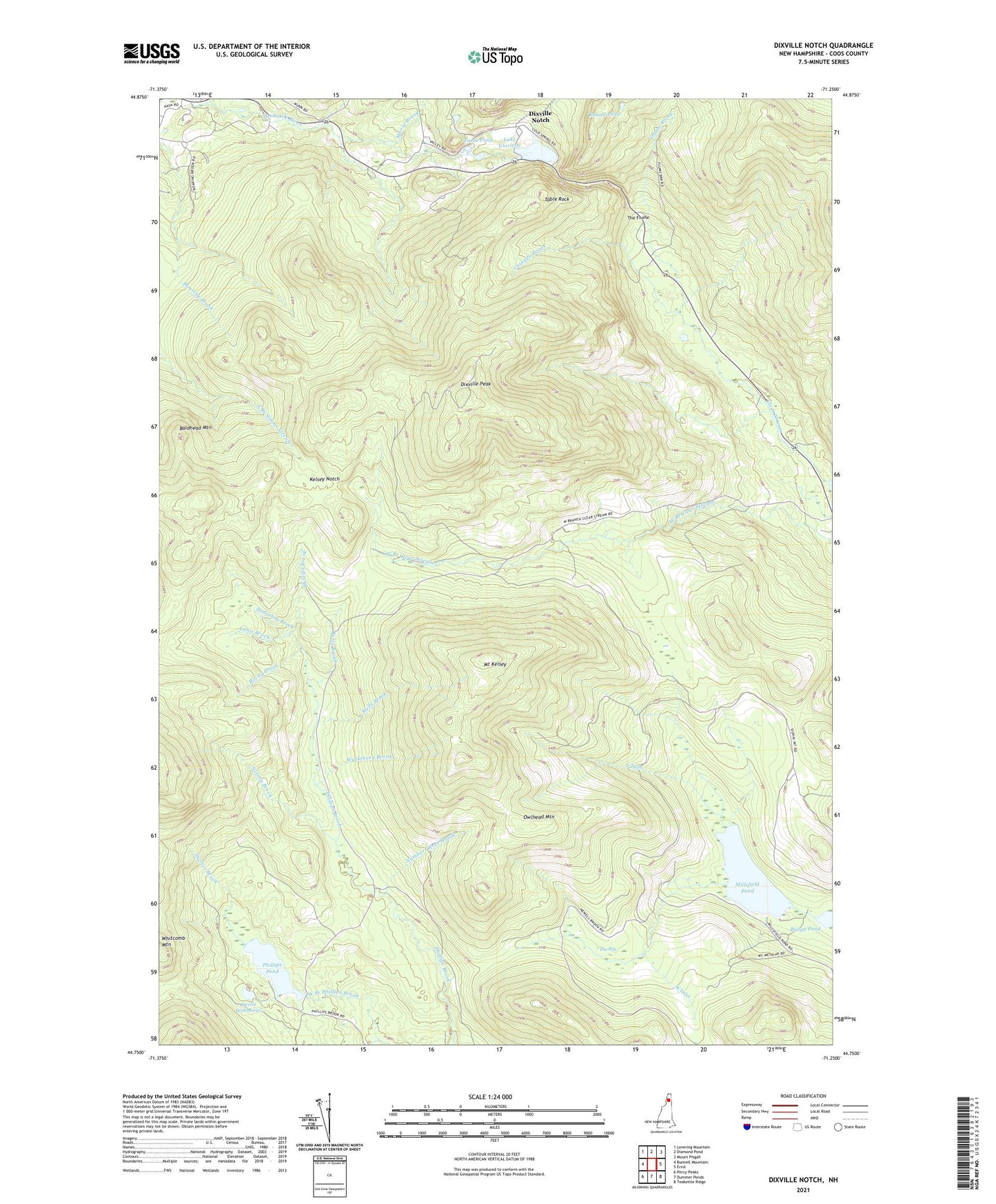
2021 topographic map quadrangle Dixville Notch in the state of New Hampshire. Scale: 1:24000. Based on the newly updated USGS 7.5' US Topo map series, this map is in the following counties: Coos. The map contains contour data, water features, and other items you are used to seeing on USGS maps, but also has updated roads and other features. This is the next generation of topographic maps. Printed on high-quality waterproof paper with UV fade-resistant inks.
Quads adjacent to this one:
West: Bunnell Mountain
Northwest: Lovering Mountain
North: Diamond Pond
Northeast: Mount Pisgah
East: Errol
Southeast: Teakettle Ridge
South: Dummer Ponds
Southwest: Percy Peaks
Contains the following named places: Annis Brook, Baldhead Mountain, Balsams-Wilderness Ski Area, Bragg Pond, Cascade Brook, Devils Washbowl, Dixville Notch, Dixville Notch State Park, Dixville Peak, Ervings Location, Farm Pond, Farm Reservoir Dam, Flume Brook, Hedgehog Brook, Kelly Brook, Kelsey Notch, Kingston Dam, Lake Abeniki, Lake Abeniki Dam, Lake Gloriette, Lake Gloriette Dam, Lake Gloriette Dike, Lake Metalak, Millsfield Pond, Moose Brook, Mount Kelsey, Nelson Brook, North Inlet, Number Four Dam, Number Three Brook, Owlhead Mountain, Phillips Pond, Phillips Pond Dam, Rocky Brook, Round Pond, Sypher Brook, Table Rock, The Bog, The Flume, Township of Millsfield, Watkinson Brook, Wells Brook, West Inlet