MyTopo
Enfield Center New Hampshire US Topo Map
Couldn't load pickup availability
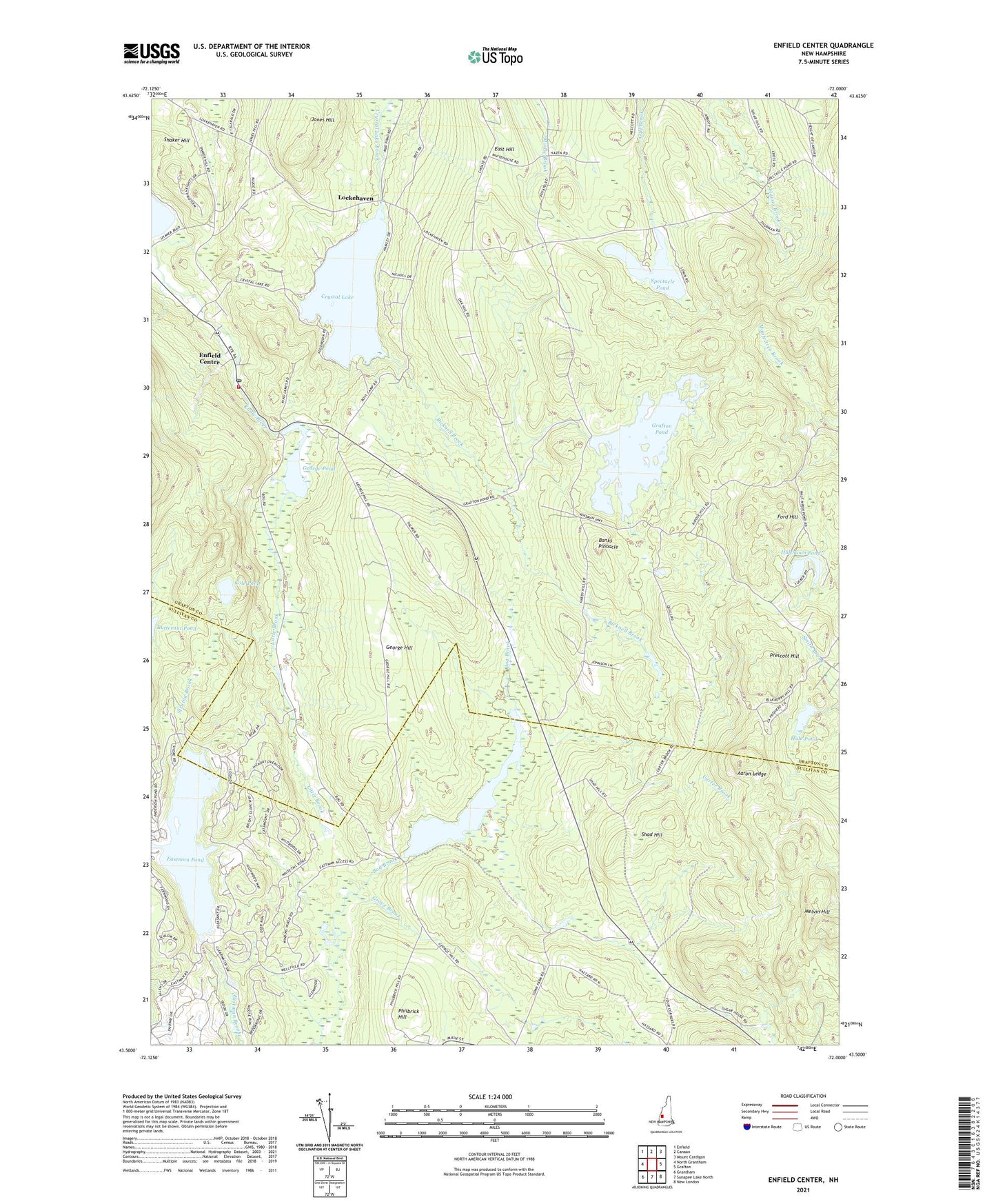
2021 topographic map quadrangle Enfield Center in the state of New Hampshire. Scale: 1:24000. Based on the newly updated USGS 7.5' US Topo map series, this map is in the following counties: Grafton, Sullivan. The map contains contour data, water features, and other items you are used to seeing on USGS maps, but also has updated roads and other features. This is the next generation of topographic maps. Printed on high-quality waterproof paper with UV fade-resistant inks.
Quads adjacent to this one:
West: North Grantham
Northwest: Enfield
North: Canaan
Northeast: Mount Cardigan
East: Grafton
Southeast: New London
South: Sunapee Lake North
Southwest: Grantham
Contains the following named places: Aaron Ledge, Banks Pinnacle, Bicknell Brook, Bog Brook Dam, Butternut Pond, Carter Brook, Cole Pond, Crescent Beach, Crystal Lake, Crystal Lake Enfield Dam, East Hill, East Hill School, Eastman, Eastman Pond, Enfield Center, Enfield Center Post Office, Enfield Fire Department Center Station, Enfield Wildlife Management Area, Fish Market, Ford Hill, George Hill, George Hill School, George Pond, George Pond Dam, Grafton Pond, Grafton Pond Dam, Grove Brook, Hale Pond, Halfmoon Pond, Height of Land School, Jones Hill, Jones Hill School, Little Brook, Lockehaven, Maxfield School, McDaniels Marsh State Wildlife Management Area, Melvin Hill, Philbrick Hill, Prescott Hill, Shad Hill, Shaker Hill, Smith Pond, Smith Pond Dam, Spectacle Pond, Stroing Brook, Town of Enfield, Union Church, Washburn Corner