MyTopo
Gossville New Hampshire US Topo Map
Couldn't load pickup availability
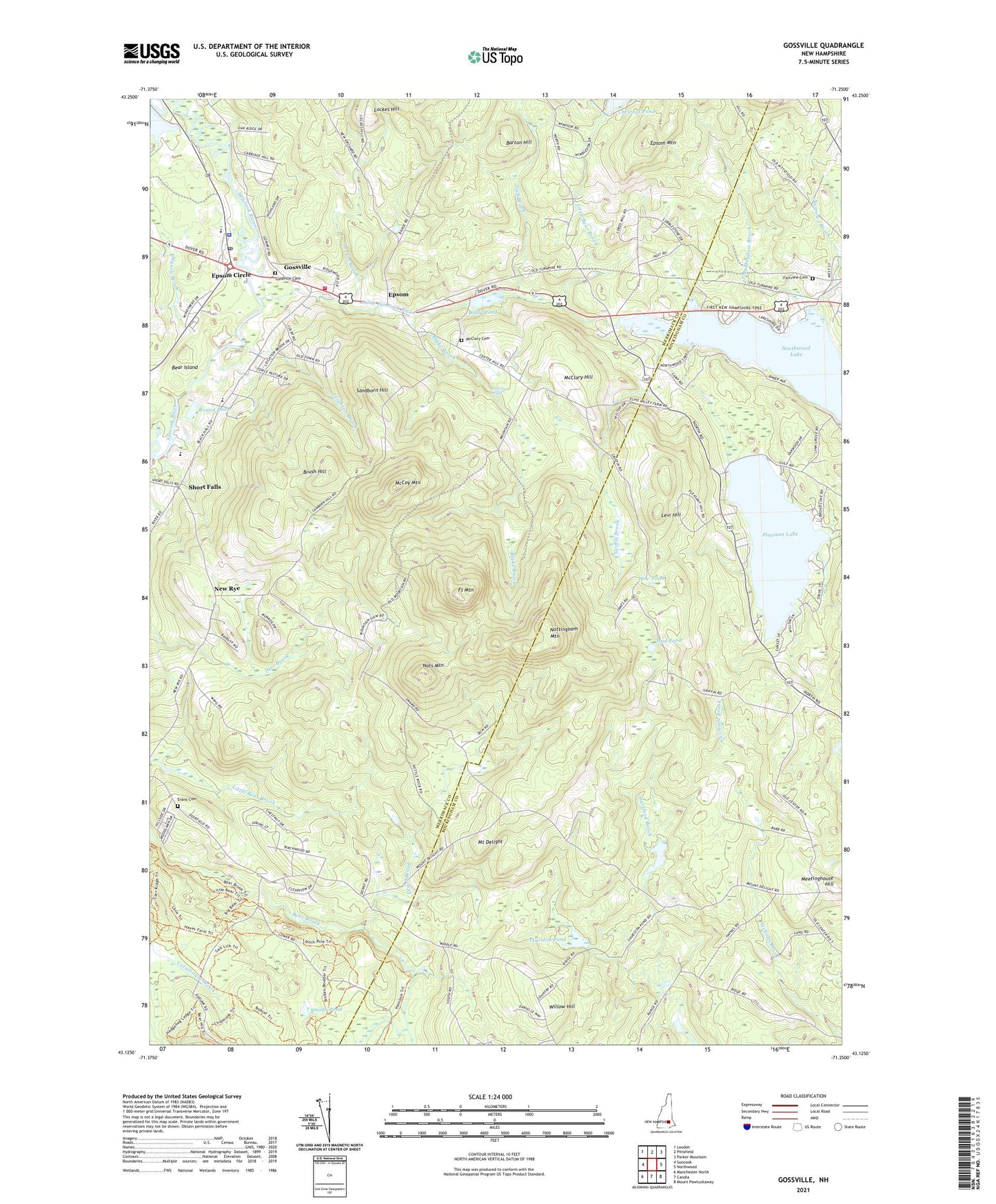
2021 topographic map quadrangle Gossville in the state of New Hampshire. Scale: 1:24000. Based on the newly updated USGS 7.5' US Topo map series, this map is in the following counties: Merrimack, Rockingham. The map contains contour data, water features, and other items you are used to seeing on USGS maps, but also has updated roads and other features. This is the next generation of topographic maps. Printed on high-quality waterproof paper with UV fade-resistant inks.
Quads adjacent to this one:
West: Suncook
Northwest: Loudon
North: Pittsfield
Northeast: Parker Mountain
East: Northwood
Southeast: Mount Pawtuckaway
South: Candia
Southwest: Manchester North
Contains the following named places: Barton Hill, Bear Island, Bixby Pond, Bixby Pond Dam, Blake Brook, Brush Hill, Catamount Trail, Center School, Cornerstone Christian Academy, Dow Pond, Epsom, Epsom Baptist Church, Epsom Central School, Epsom Circle, Epsom Fire Department, Epsom Mountain, Epsom Police Department, Epsom Post Office, Evans Cemetery, Fairview Cemetery, Flat Meadow Brook, Fort Mountain, Gossville, Gossville Cemetery, Griffin Brook, Gulf Brook, Hayes Swamp Dam, Huckins Dam, Leighton Brook, Levi Hill, Little Bear Brook, Little River Reservoir, Little Suncook River, Lockes Brook, Lockes Hill, Mason Brook, McClary Cemetery, McClary Hill, McCoy Mountain, Meetinghouse Hill, Mount Delight, Mountain School, Mud Pond, Narrows Brook, Nats Mountain, New Orchard School, New Rye, New Rye Congregational Church, North Road School, Northwood Lake, Northwood Lake Dam, Nottingham Mountain, Number 13 School, Pathfinder Academy, Pease Brook, Pleasant Lake, Pleasant Lake Dam, Round Pond, Sandborn Hill, Short Falls, Smiths Pond, Steeles Falls, Thurston Pond, Town of Deerfield, Town of Epsom, Willow Hill, WNHT-TV (Concord), ZIP Code: 03234