MyTopo
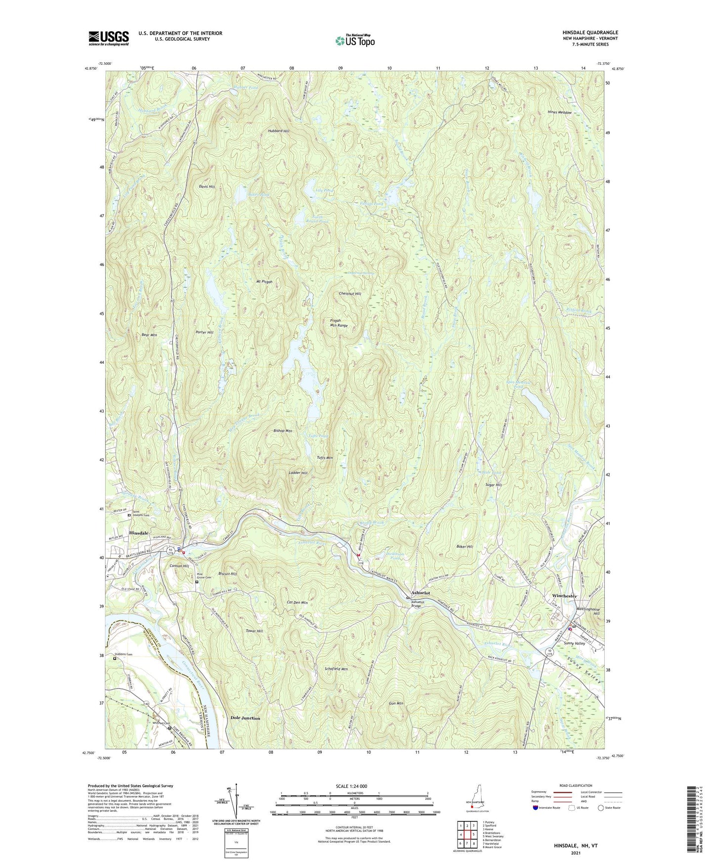
Hinsdale New Hampshire US Topo Map
Couldn't load pickup availability
2021 topographic map quadrangle Hinsdale in the states of Vermont, New Hampshire. Scale: 1:24000. Based on the newly updated USGS 7.5' US Topo map series, this map is in the following counties: Cheshire, Windham. The map contains contour data, water features, and other items you are used to seeing on USGS maps, but also has updated roads and other features. This is the next generation of topographic maps. Printed on high-quality waterproof paper with UV fade-resistant inks.
Quads adjacent to this one:
West: Brattleboro
Northwest: Putney
North: Spofford
Northeast: Keene
East: West Swanzey
Southeast: Mount Grace
South: Northfield
Southwest: Bernardston
Contains the following named places: Ashuelot, Ashuelot Bridge, Ashuelot Fire Company, Ashuelot Post Office, Ashuelot River, Ashuelot River Dam, Ashuelot River Reservoir, Baker Hill, Baker Pond, Bear Mountain, Bear Mountain State Forest, Biscuit Hill, Bishop Mountain, Blodgett Airport, Broad Brook, Cannon Hill, Cat Den Mountain, Center Church, Chestnut Hill, Conant Public Library, Davis Hill, Dickinson Pond, Dogwood Swamp, Dole Junction, First Congregational Church, Fullam Pond, Fullam Pond Dam, Grace Christian Fellowship, Gun Mountain, Hale Pond, Hines Meadow, Hinsdale, Hinsdale Census Designated Place, Hinsdale Elementary School, Hinsdale Fire Department, Hinsdale Middle and High School, Hinsdale Police Department, Hinsdale Post Office, Hinsdale Public Library, Hog Tongue Brook, Hubbard Hill, Hubner Pond, Hubner Pond Dam, Kilburn Brook, Kilburn Pond, Kilburn Pond Dam, Ladder Hill, Lily Pond, Meetinghouse Hill, Mirey Brook, Mount Pisgah, New England Box Company Dam, North Round Pond, Pine Grove Cemetery, Pisgah Brook, Pisgah Mountain Range, Pisgah Reservoir, Pisgah Reservoir Dam, Pisgah State Park, Porter Hill, Roaring Brook, Robertson Dam, Round Pond, Saint Josephs Cemetery, Saint Michaels Church, Saint Stanislaus Church, Schofield Mountain, Snow Brook, Spot Meadow Brook, Spot Meadow Pond, Stebbins Cemetery, Sugar Hill, Sunny Valley, Thayer High School, Thayer Junior High School, Tower Hill, Town of Winchester, Tufts Brook, Tufts Mountain, Tufts Pond, United Church of Winchester, Whithed Cemetery, Winchester, Winchester Census Designated Place, Winchester Fire Department Ambulance, Winchester Police Department, Winchester Post Office, Winchester School, WYRY-FM (Hinsdale), ZIP Code: 03441