MyTopo
Beach Haven New Jersey US Topo Map
Couldn't load pickup availability
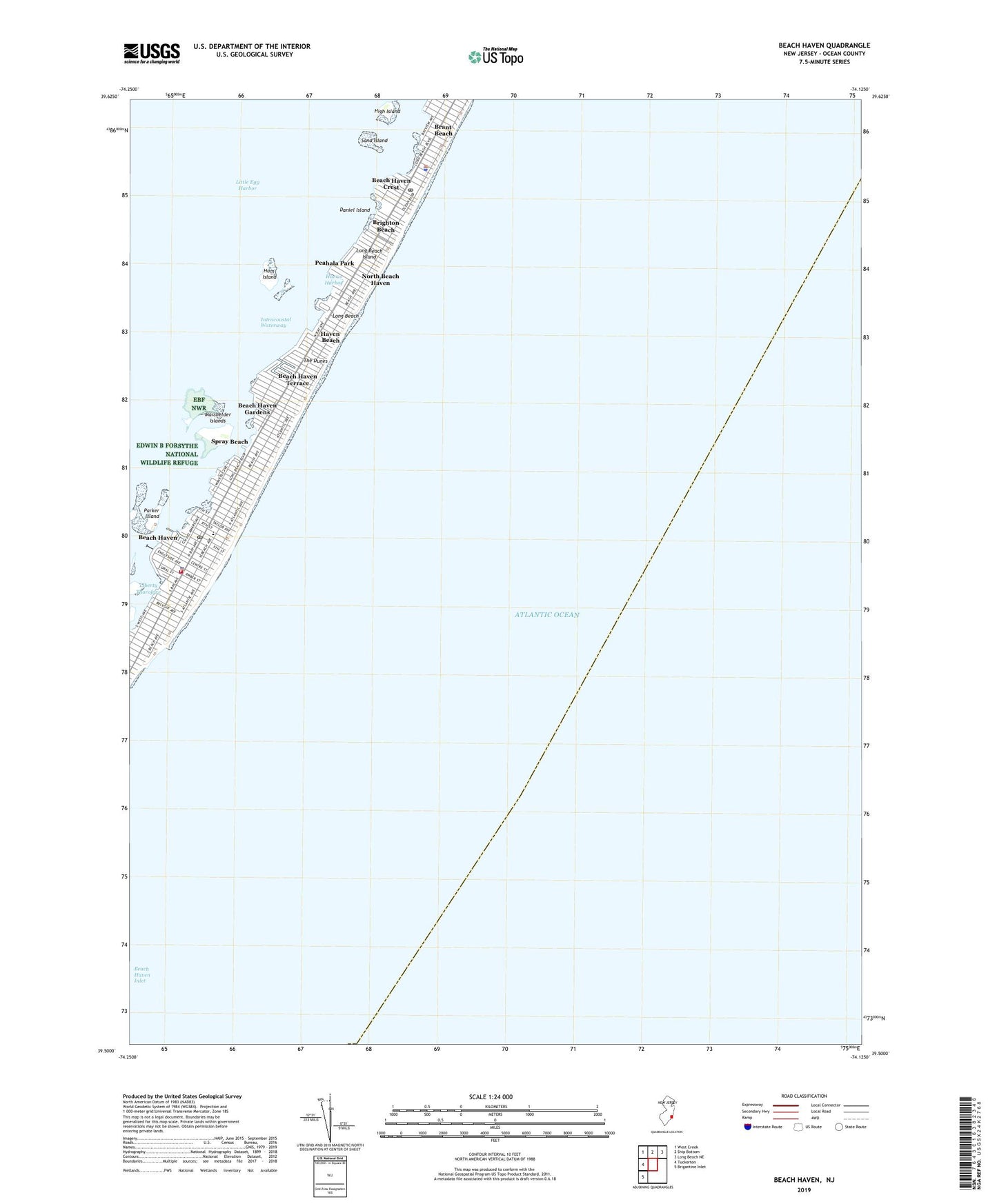
2019 topographic map quadrangle Beach Haven in the state of New Jersey. Scale: 1:24000. Based on the newly updated USGS 7.5' US Topo map series, this map is in the following counties: Ocean. The map contains contour data, water features, and other items you are used to seeing on USGS maps, but also has updated roads and other features. This is the next generation of topographic maps. Printed on high-quality waterproof paper with UV fade-resistant inks.
Quads adjacent to this one:
West: Tuckerton
Northwest: West Creek
North: Ship Bottom
Northeast: Long Beach NE
Southwest: Brigantine Inlet
Contains the following named places: Beach Haven, Beach Haven Crest, Beach Haven Elementary School, Beach Haven First Aid Squad, Beach Haven Gardens, Beach Haven Inlet, Beach Haven Park, Beach Haven Police Department, Beach Haven Post Office, Beach Haven Terrace, Beach Haven Volunteer Fire Company 1, Borough of Beach Haven, Brant Beach, Brighton Beach, Daniel Island, Ham Island, Harris Harbor, Haven Beach, High Island, Liberty Thorofare, Long Beach Post Office, Long Beach Township Police Department, Marshelder Islands, North Beach Haven, North Beach Haven Census Designated Place, Parker Island, Peahala Park, Sand Island, Spray Beach, The Dunes, Township of Long Beach