MyTopo
Bloomsbury New Jersey US Topo Map
Couldn't load pickup availability
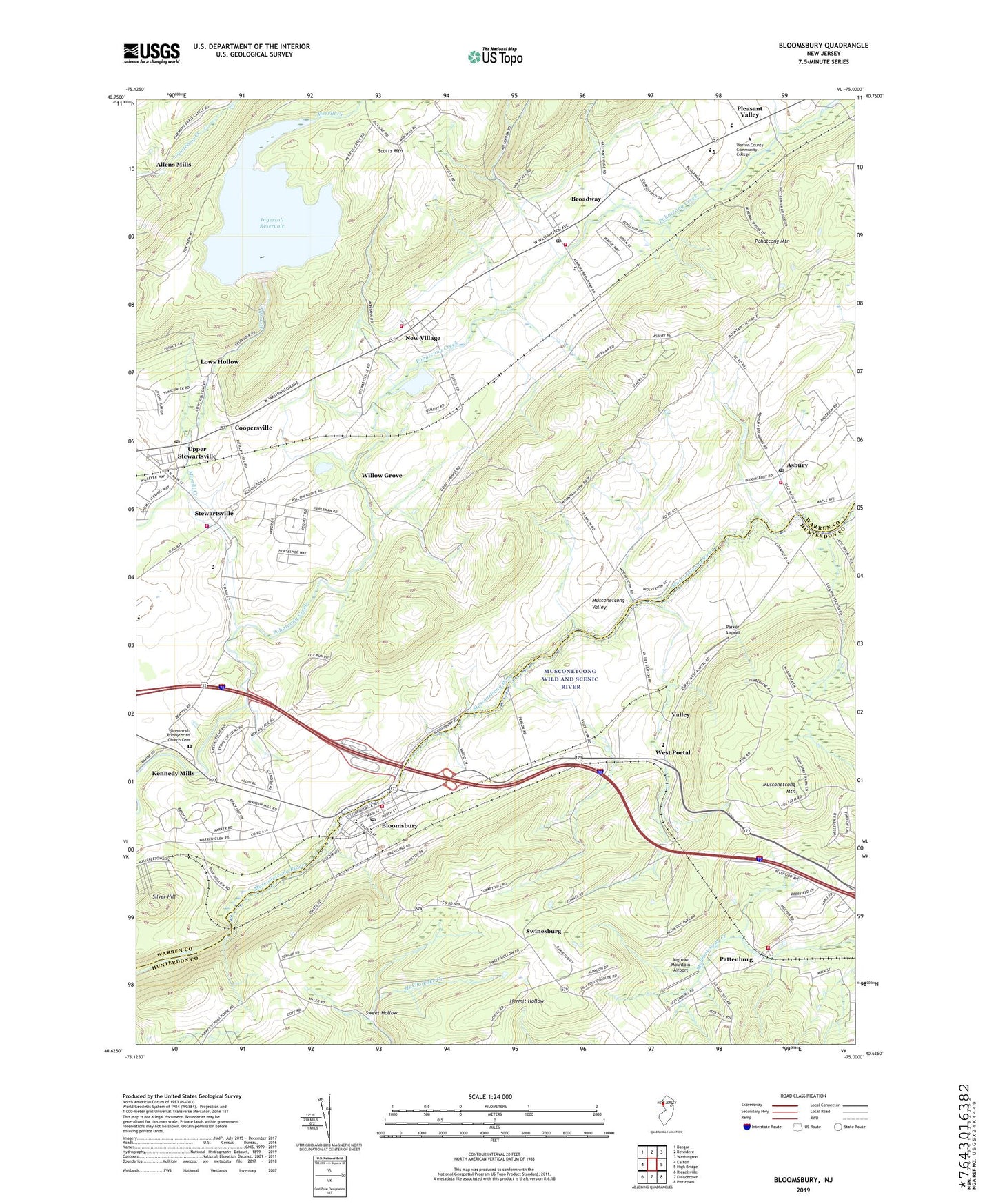
2019 topographic map quadrangle Bloomsbury in the state of New Jersey. Scale: 1:24000. Based on the newly updated USGS 7.5' US Topo map series, this map is in the following counties: Warren, Hunterdon. The map contains contour data, water features, and other items you are used to seeing on USGS maps, but also has updated roads and other features. This is the next generation of topographic maps. Printed on high-quality waterproof paper with UV fade-resistant inks.
Quads adjacent to this one:
West: Easton
Northwest: Bangor
North: Belvidere
Northeast: Washington
East: High Bridge
Southeast: Pittstown
South: Frenchtown
Southwest: Riegelsville
Contains the following named places: Allens Mills, Asbury, Asbury Census Designated Place, Asbury Post Office, Bethlehem School, Bloomsbury, Bloomsbury Elementary School, Bloomsbury Hose Company 1, Bloomsbury Post Office, Bloomsbury Rescue Squad, Borough of Bloomsbury, Brass Castle Creek, Broadway, Broadway Census Designated Place, Broadway Post Office, Coopersville, Ethel Hoppock Middle School, Feather Ridge Farm, Franklin Township Elementary School, Franklin Township Fire / EMS, Franklin Township Fire Department Station 3, Franklin Township Rescue Squad, Franklin Township Volunteer Fire Department, Good Shepherd Christian Academy School, Greenwich Presbyterian Church Cemetery, Greenwich Township Emergency Squad, Greenwich Township Police Department Stewartsville, Hart Farm, Hoser Farm, Ingersoll Dam, Ingersoll Reservoir, Jugtown Mountain Airport, Kennedy Mills, Lows Hollow, Ludlow Station, Merrill Creek, Musconetcong Mountain, Musconetcong Valley, New Village, New Village Census Designated Place, Old Greenwich Church, Parker Airport, Pattenburg, Pattenburg Quarry, Pattenburg Volunteer Fire Company, Pleasant Valley Mill Dam, Pohatcong Mountain, Scotts Mountain, Silver Hill, Stewartsville, Stewartsville Census Designated Place, Stewartsville Elementary School, Stewartsville Post Office, Stewartsville Volunteer Fire Company 1, Swinesburg, The Hickory, Township of Bethlehem, Township of Franklin, Township of Greenwich, Union Church, Upper Stewartsville Census Designated Place, Valley, View Finder Balloonport, Warren County Community College, Warren County Fire Marshal, Warren County Special Services School, Warren County Technical School, West Portal, Willow Grove, ZIP Codes: 08802, 08804, 08808, 08886