MyTopo
Branchville New Jersey US Topo Map
Couldn't load pickup availability
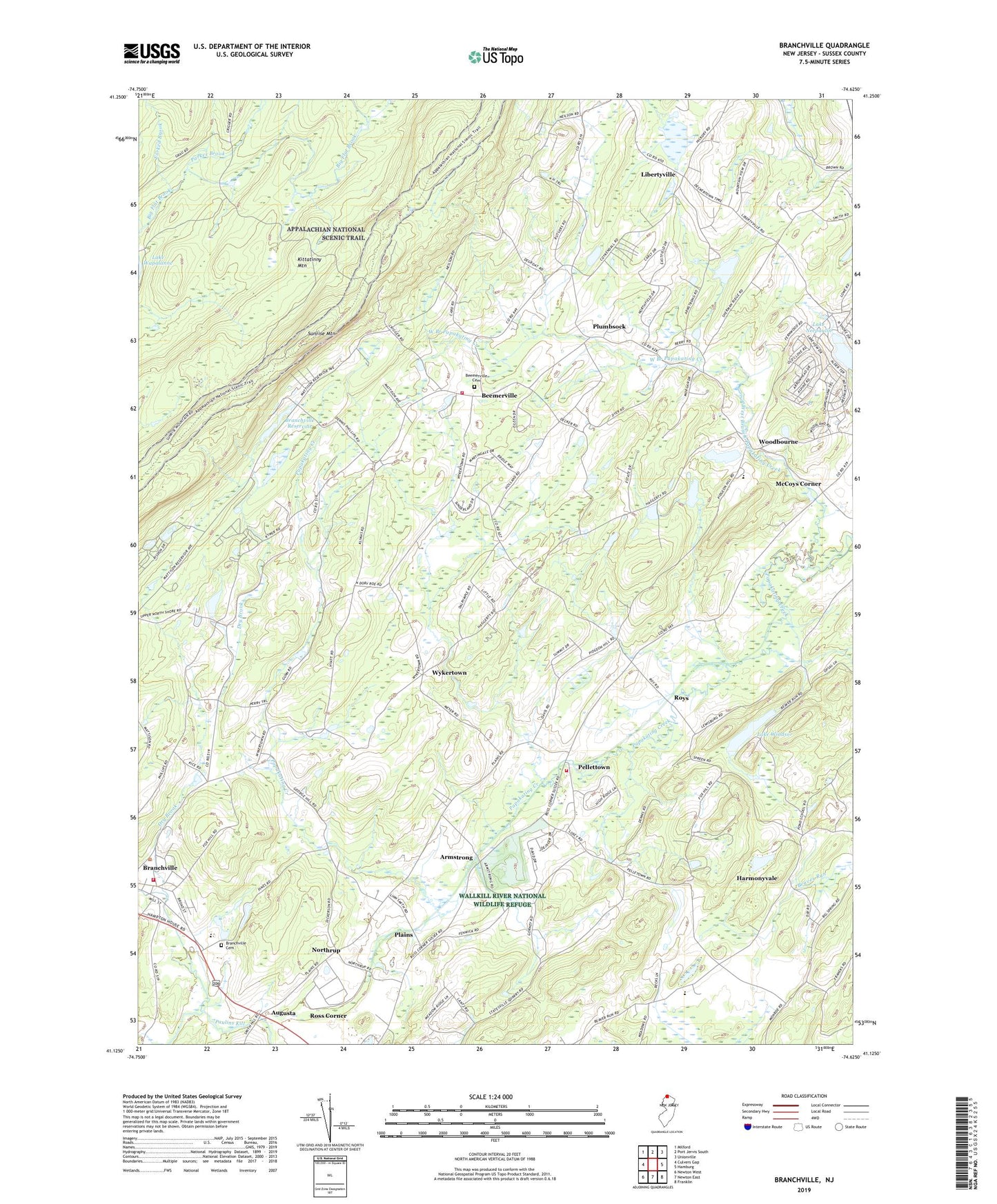
2019 topographic map quadrangle Branchville in the state of New Jersey. Scale: 1:24000. Based on the newly updated USGS 7.5' US Topo map series, this map is in the following counties: Sussex. The map contains contour data, water features, and other items you are used to seeing on USGS maps, but also has updated roads and other features. This is the next generation of topographic maps. Printed on high-quality waterproof paper with UV fade-resistant inks.
Quads adjacent to this one:
West: Culvers Gap
Northwest: Milford
Northeast: Unionville
East: Hamburg
Southeast: Franklin
South: Newton East
Southwest: Newton West
Contains the following named places: Armstrong, Augusta, Beemerville, Beemerville Cemetery, Beemerville Fire Department / Wantage Township Company 1, Beemerville Orchards, Borough of Branchville, Branchville Cemetery, Branchville Hose Company 1, Branchville Reservoir, Branchville Reservoir Dam, Culvers Creek, Dry Brook, Forked Brook, Frankford Plains Church, Frankford Township Fire Department Station 2, Harmonyvale, Hopkins Corner, Lake Neepaulin, Lake Neepaulin Dam, Lake Windsor, Lake Windsor Dam, Libertyville, McCoys Corner, Mosefund Farm, Northrup, Parker Brook, Pellettown, Plains, Plumbsock, Roys, Sunrise Mountain, Sussex County, Tamarack Flyers Heliport, TGP-325 Heliport, Township of Frankford, Township of Wantage, West Branch Papakating Creek, Woodbourne, Wykertown, ZIP Code: 07822