MyTopo
Abiquiu New Mexico US Topo Map
Couldn't load pickup availability
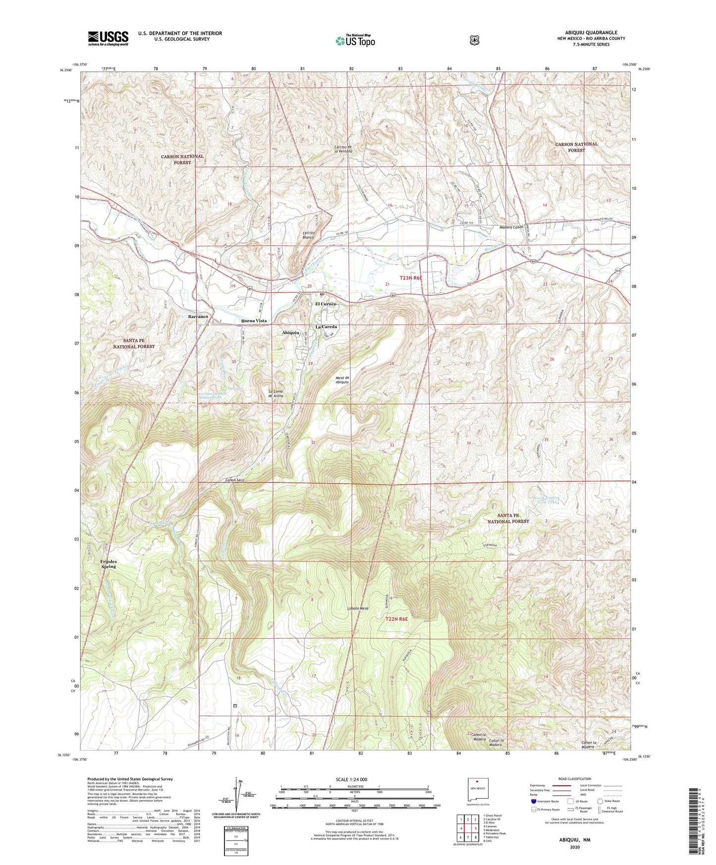
2020 topographic map quadrangle Abiquiu in the state of New Mexico. Scale: 1:24000. Based on the newly updated USGS 7.5' US Topo map series, this map is in the following counties: Rio Arriba. The map contains contour data, water features, and other items you are used to seeing on USGS maps, but also has updated roads and other features. This is the next generation of topographic maps. Printed on high-quality waterproof paper with UV fade-resistant inks.
Quads adjacent to this one:
West: Canones
Northwest: Ghost Ranch
North: Canjilon SE
Northeast: El Rito
East: Medanales
Southeast: Chili
South: Vallecitos
Southwest: Polvadera Peak
Contains the following named places: Abeyta Trujillo Ditch, Abiquiu, Abiquiu Catholic Cemetery, Abiquiu Census Designated Place, Abiquiu Creek, Abiquiu Historical Marker, Abiquiu Post Office, Agua Caliente, Arroyo Blanco, Arroyo de los Frijoles, Arroyo del Cerrito Negro, Arroyo del Cobre, Arroyo Hondo, Arroyo Seco, Barranca, Barranca Ditch, Barranca Post Office, Barranca Trail, Buena Vista, Canon Seco, Cerrito Blanco, Cerrito de la Ventana, Cerrito Recreation Site, Dominguez-Velez de Escalente Trail Historical Marker, East Morada at Abiquiu Historic Site, El Curuco, Espinosa Trail, Frijoles Spring, Haqiqah Osrah School, La Careda, La Careda Census Designated Place, La Loma de Arena, La Madera Arroyo, Lily Belle, Lobato Tank, Los Ojitos de Agua Salada Danosa, Madera Canon, Mesa de Abiquiu, North Erosion Trick Tank, Ojito Seco, Old Spanish Trail Historical Marker, Rancho Abiquiu Ditch, Rancho de Abiquiu, RG-5971 Water Well, Santa Rosa de Lima de Abiquiu, Tawid School, Town of Abiquiu Grant, Vallecitos Creek, White Deposit