MyTopo
Abo New Mexico US Topo Map
Couldn't load pickup availability
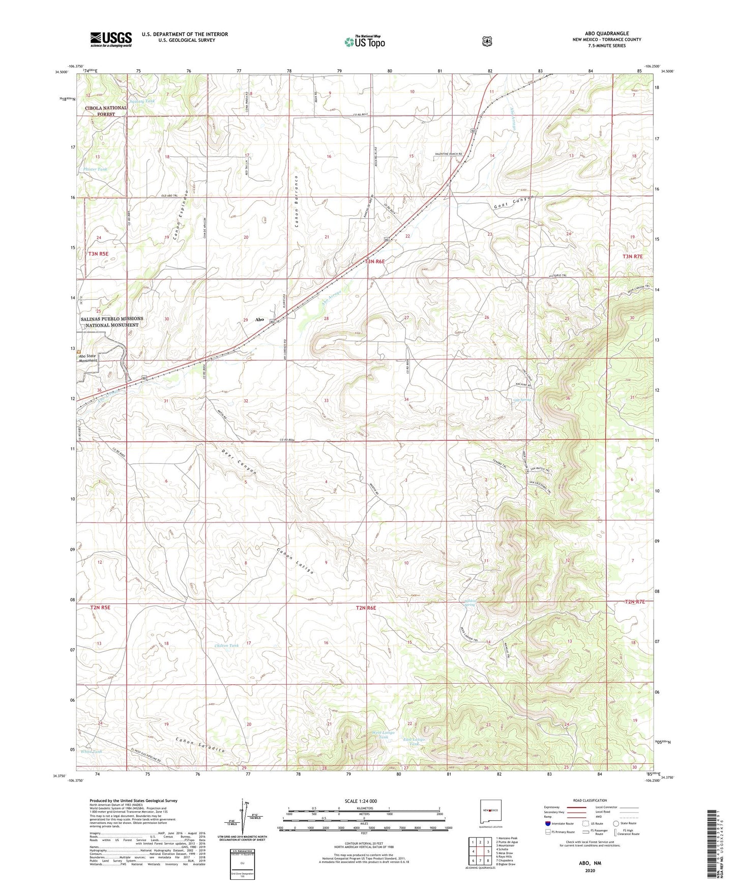
2020 topographic map quadrangle Abo in the state of New Mexico. Scale: 1:24000. Based on the newly updated USGS 7.5' US Topo map series, this map is in the following counties: Torrance. The map contains contour data, water features, and other items you are used to seeing on USGS maps, but also has updated roads and other features. This is the next generation of topographic maps. Printed on high-quality waterproof paper with UV fade-resistant inks.
Quads adjacent to this one:
West: Scholle
Northwest: Manzano Peak
North: Punta de Agua
Northeast: Mountainair
East: Mesa Draw
Southeast: Bigbee Draw
South: Chupadera
Southwest: Rayo Hills
Contains the following named places: Abo, Abo Post Office, Abo Ruins, Abo Ruins Salinas National Monument Historical Marker, Abo State Monument, Canon Barranco, Chilton Tank, Deer Canyon, Deer Canyon Census Designated Place, East Latigo Tank, Goat Canyon, Gyp Spring, Phister Tank, Squatty Tank, West Latigo Tank, White Tank, Wildcat Spring