MyTopo
Acoma Pueblo New Mexico US Topo Map
Couldn't load pickup availability
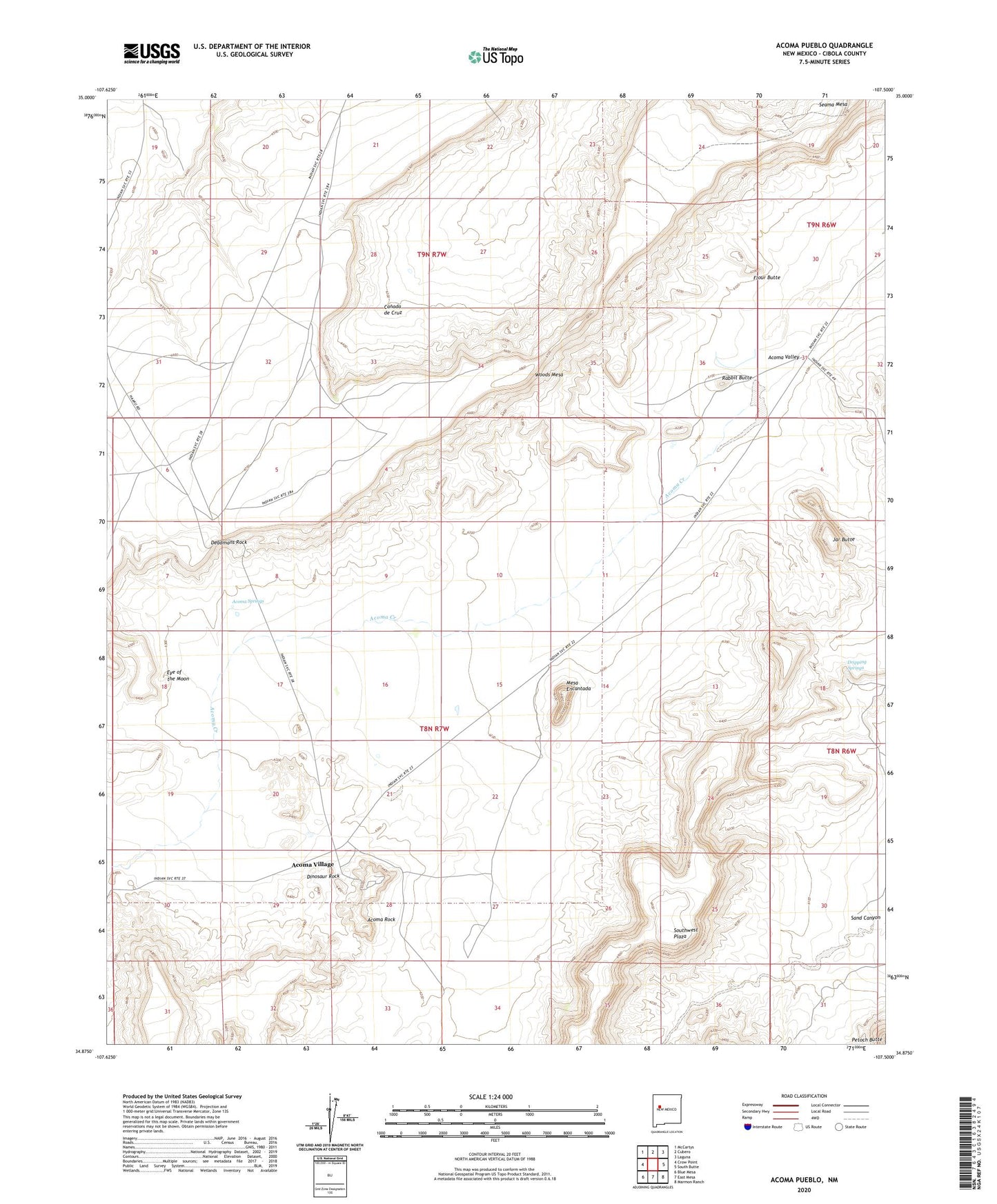
2020 topographic map quadrangle Acoma Pueblo in the state of New Mexico. Scale: 1:24000. Based on the newly updated USGS 7.5' US Topo map series, this map is in the following counties: Cibola. The map contains contour data, water features, and other items you are used to seeing on USGS maps, but also has updated roads and other features. This is the next generation of topographic maps. Printed on high-quality waterproof paper with UV fade-resistant inks.
Quads adjacent to this one:
West: Crow Point
Northwest: McCartys
North: Cubero
Northeast: Laguna
East: South Butte
Southeast: Marmon Ranch
South: East Mesa
Southwest: Blue Mesa
Contains the following named places: Acoma Community Library Resource Center, Acoma Museum, Acoma Pueblo, Acoma Rock, Acoma Springs, Acoma Valley, Acoma Village, Acomita Pit, Balo Deposit, Canada de Cruz, Cebolleta Historical Marker, Deadmans Rock, Dinosaur Rock, Dripping Springs, Eye of the Moon, Flour Butte, Jar Butte, Laguna 6 Water Well, Limestone Quarry, Mesa Encantada, Pueblo of Acoma Historical Marker, Rabbit Butte, San Esteban Del Rey Mission Cemetery, San Estevan de Acoma Mission Church Historic Site, Sand Canyon, Seama Mesa, Sky City Community, Woods Mesa