MyTopo
Agua Fria Peak New Mexico US Topo Map
Couldn't load pickup availability
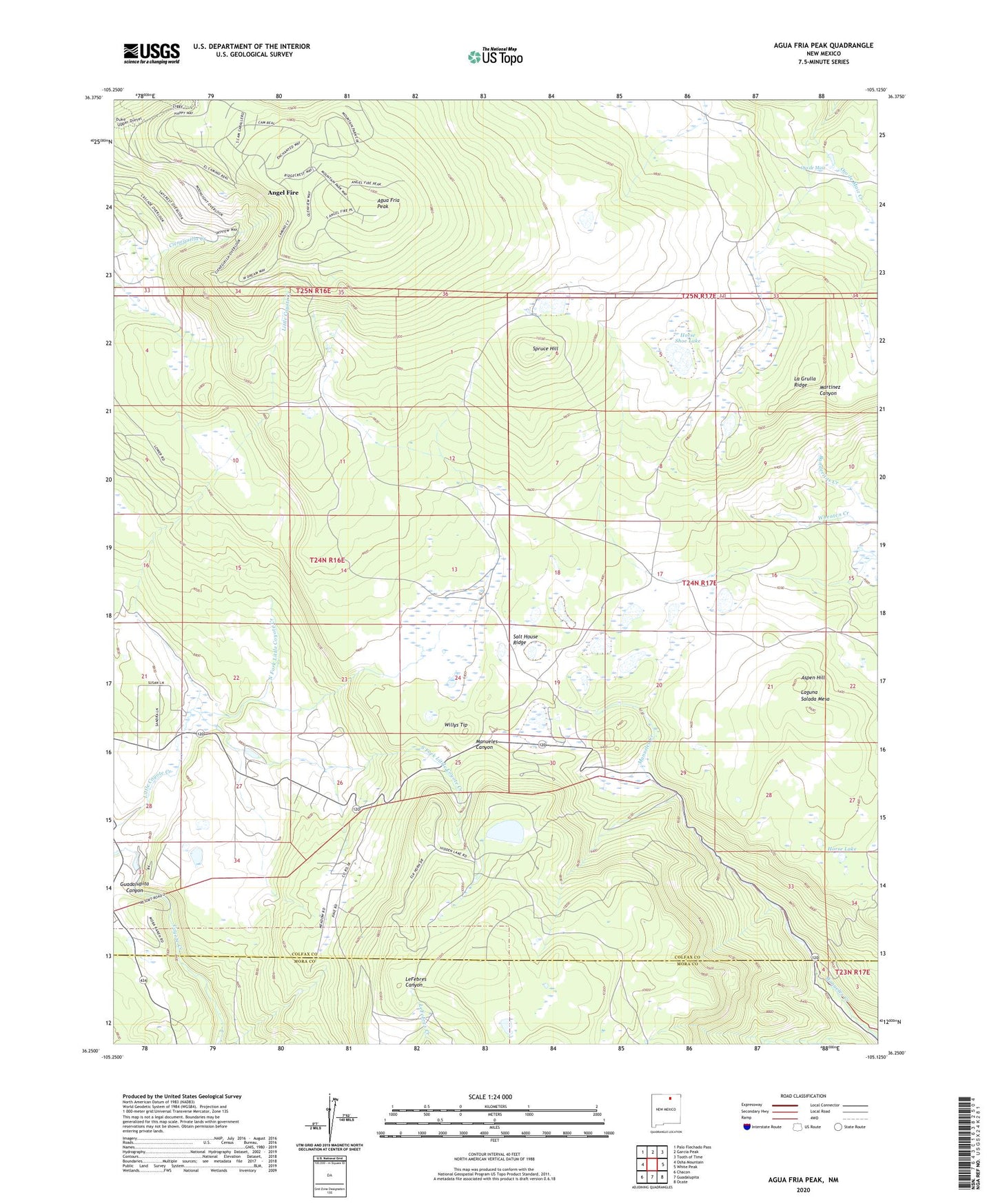
2020 topographic map quadrangle Agua Fria Peak in the state of New Mexico. Scale: 1:24000. Based on the newly updated USGS 7.5' US Topo map series, this map is in the following counties: Colfax, Mora. The map contains contour data, water features, and other items you are used to seeing on USGS maps, but also has updated roads and other features. This is the next generation of topographic maps. Printed on high-quality waterproof paper with UV fade-resistant inks.
Quads adjacent to this one:
West: Osha Mountain
Northwest: Palo Flechado Pass
North: Garcia Peak
Northeast: Tooth of Time
East: White Peak
Southeast: Ocate
South: Guadalupita
Southwest: Chacon
Contains the following named places: Agua Fria Park, Agua Fria Peak, Aspen Hill, Black Lake Post Office, Black Lake Resorts, Blacklake Resorts, Hidden Lake, Horse Lake, Horse Shoe Lake, Laguna Salada Mesa, North Fork Little Coyote Creek, Ocate Creek, Ojo de Maiz, Salt House Ridge, South Fork Little Coyote Creek, Spruce Hill, Upper Coyote Creek Dam, Willys Tip, ZIP Code: 87710