MyTopo
Alamo Mesa East New Mexico US Topo Map
Couldn't load pickup availability
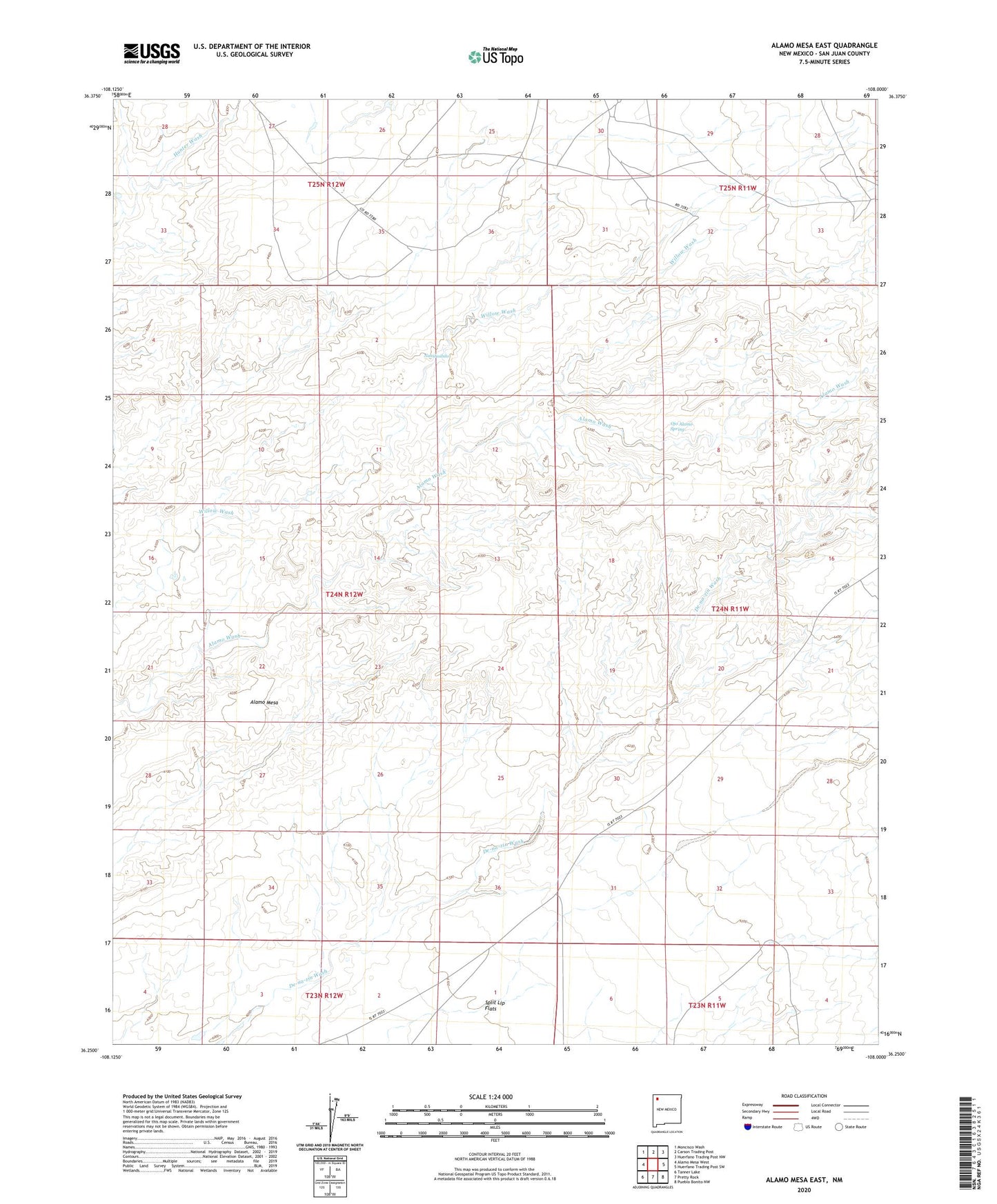
2020 topographic map quadrangle Alamo Mesa East in the state of New Mexico. Scale: 1:24000. Based on the newly updated USGS 7.5' US Topo map series, this map is in the following counties: San Juan. The map contains contour data, water features, and other items you are used to seeing on USGS maps, but also has updated roads and other features. This is the next generation of topographic maps. Printed on high-quality waterproof paper with UV fade-resistant inks.
Quads adjacent to this one:
West: Alamo Mesa West
Northwest: Moncisco Wash
North: Carson Trading Post
Northeast: Huerfano Trading Post NW
East: Huerfano Trading Post SW
Southeast: Pueblo Bonito NW
South: Pretty Rock
Southwest: Tanner Lake
Contains the following named places: Alamo Mesa, Bisti/De-Na-Zin Wilderness, Naashoibito, Napi Headquarters Division, Ojo Alamo Spring, Split Lip Flats