MyTopo
Antelope Sink New Mexico US Topo Map
Couldn't load pickup availability
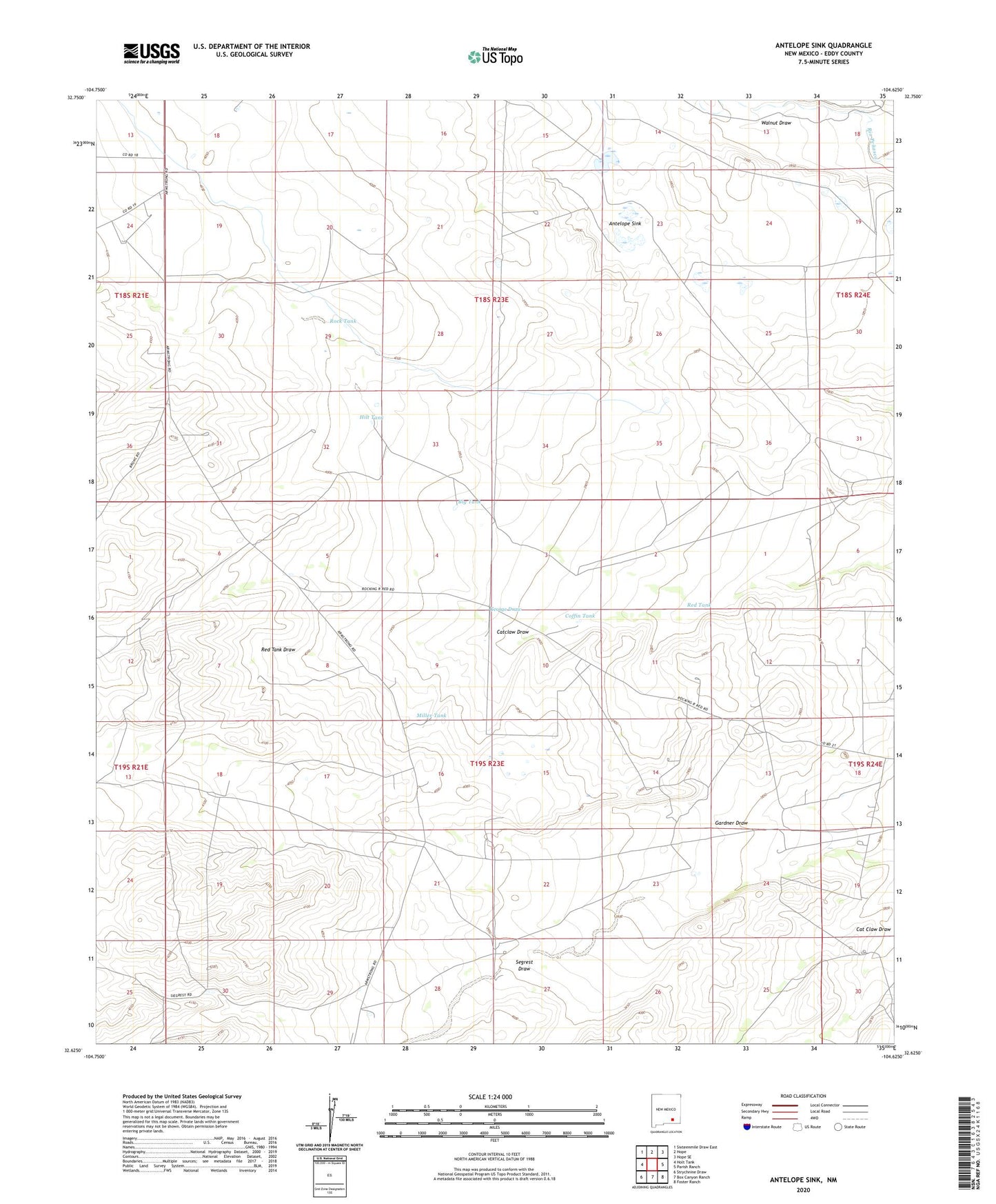
2020 topographic map quadrangle Antelope Sink in the state of New Mexico. Scale: 1:24000. Based on the newly updated USGS 7.5' US Topo map series, this map is in the following counties: Eddy. The map contains contour data, water features, and other items you are used to seeing on USGS maps, but also has updated roads and other features. This is the next generation of topographic maps. Printed on high-quality waterproof paper with UV fade-resistant inks.
Quads adjacent to this one:
West: Holt Tank
Northwest: Sixteenmile Draw East
North: Hope
Northeast: Hope SE
East: Parish Ranch
Southeast: Foster Ranch
South: Box Canyon Ranch
Southwest: Strychnine Draw
Contains the following named places: 10108 Water Well, 10147 Water Well, Antelope Sink, Big Tank, Bunting Ranch, Catclaw Draw, Coffin Tank, Hilt Tank, Hilt Well, Miller Tank, RA-7804 Water Well, Red Tank, Ridge Tank, Rock Tank, Runyan Ranch, Walnut Draw, Williams Well