MyTopo
Apache Peak New Mexico US Topo Map
Couldn't load pickup availability
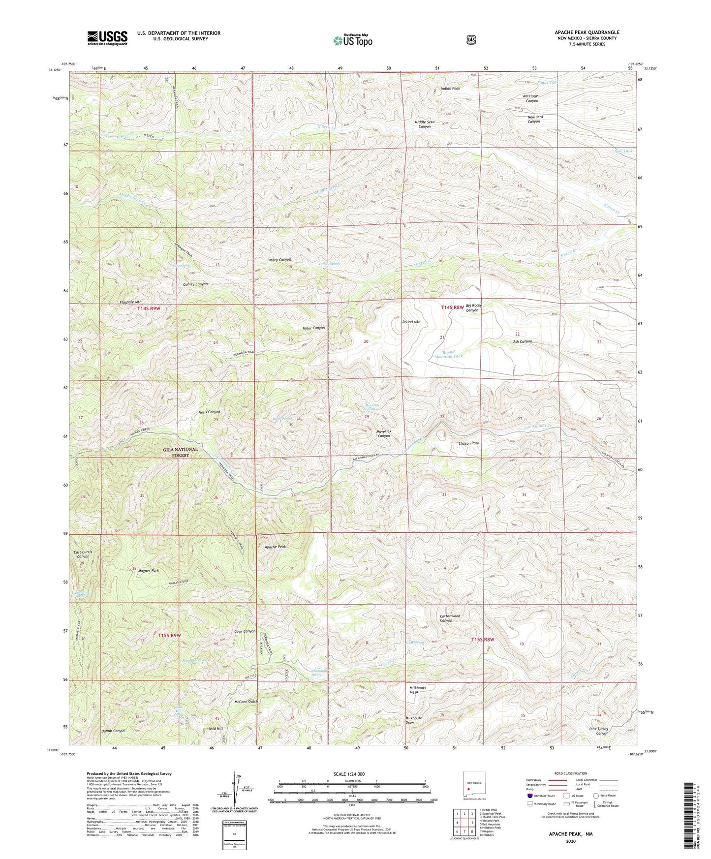
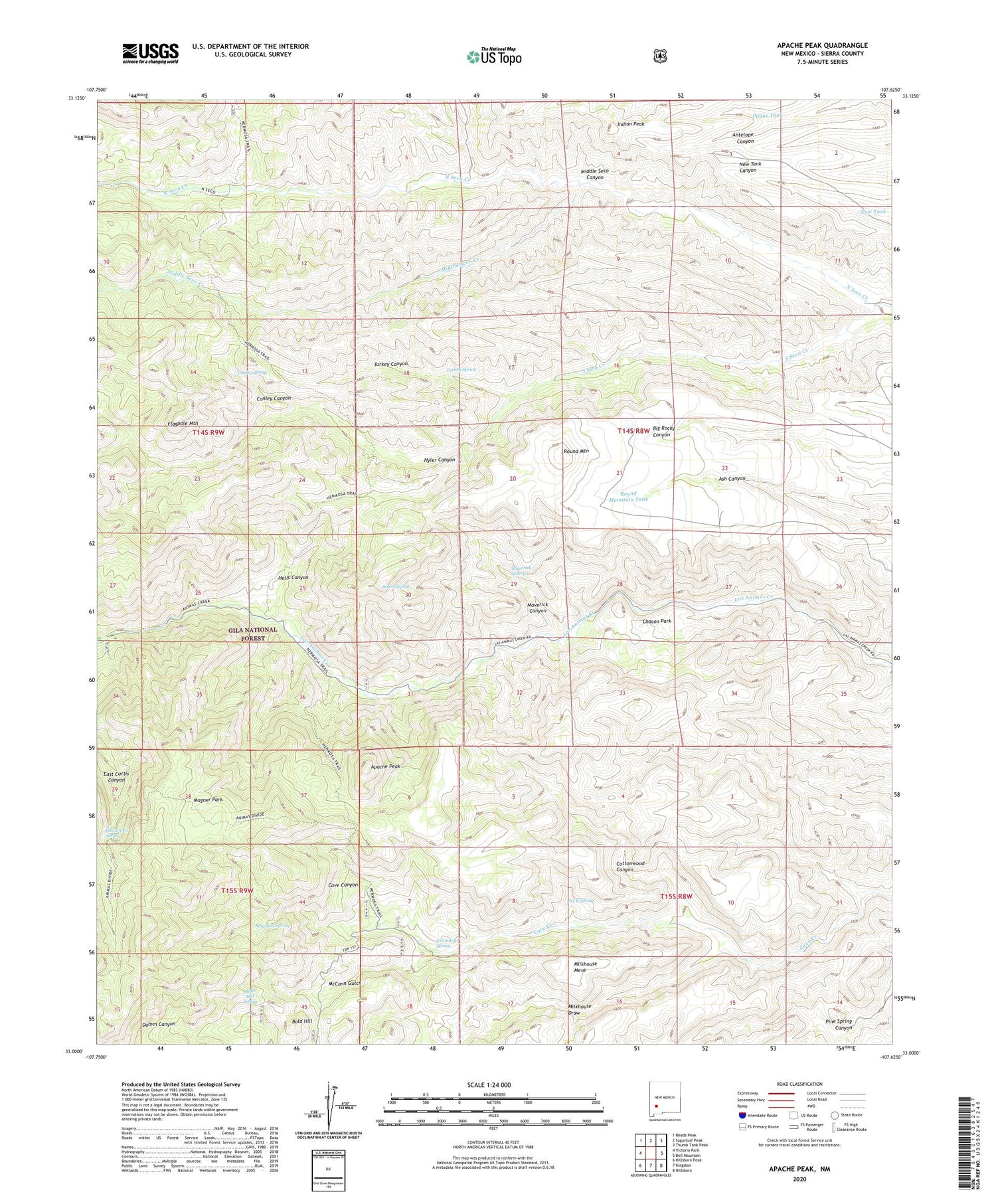
2020 topographic map quadrangle Apache Peak in the state of New Mexico. Scale: 1:24000. Based on the newly updated USGS 7.5' US Topo map series, this map is in the following counties: Sierra. The map contains contour data, water features, and other items you are used to seeing on USGS maps, but also has updated roads and other features. This is the next generation of topographic maps. Printed on high-quality waterproof paper with UV fade-resistant inks.
Quads adjacent to this one:
West: Victorio Park
Northwest: Reeds Peak
North: Sugarloaf Peak
Northeast: Thumb Tank Peak
East: Bell Mountain
Southeast: Hillsboro
South: Kingston
Southwest: Hillsboro Peak
Contains the following named places: Apache Camp, Apache Peak, Bald Hill, Bald Hill Spring, Beam Spring, Cave Canyon, Chacon Corral, Chacon Park, Conley Canyon, Conley Spring, Cottonwood Canyon, Davis Well, Dumm Place, East Curtis Spring, Escondida Spring, Flagpole Mountain, Hells Canyon, Hells Canyon Well, Hilton Corral, Hyler Canyon, Indian Peak, Indian Tank, Ingersoll Mine, Juniper Tank, L M Bar Ranch, Magner Park, Magnum Spring, Maverick Canyon, Maverick Spring, McCann Gulch, Middle Seco Canyon, Middle Seco Creek, Milkhouse Draw, Milkhouse Mesa, New Tank, North Seco Creek, North Seco Well, Pague Tank, Pague Well, Round Mountain, Round Mountain Tank, Six B Spring, South Seco Creek, South Seco Windmill, Turkey Canyon, Turkey Spring, Turkey Well, Walnut Corral