MyTopo
Apache Springs New Mexico US Topo Map
Couldn't load pickup availability
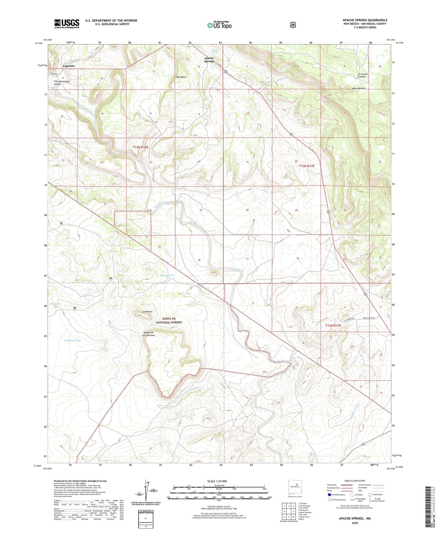
2020 topographic map quadrangle Apache Springs in the state of New Mexico. Scale: 1:24000. Based on the newly updated USGS 7.5' US Topo map series, this map is in the following counties: San Miguel. The map contains contour data, water features, and other items you are used to seeing on USGS maps, but also has updated roads and other features. This is the next generation of topographic maps. Printed on high-quality waterproof paper with UV fade-resistant inks.
Quads adjacent to this one:
West: Villanueva
Northwest: Tecolote
North: Los Montoyas
Northeast: La Liendre
East: Mesa Chupinas
Southeast: Dilia
South: Anton Chico
Southwest: San Juan
Contains the following named places: Adlin, Apache Springs, Arroyo Leguino, Aurupa, Boggy Tank, Calicito Tank, East Tank, La Mesita, Ladrones Tank, Lagunita, Lagunita Post Office, Mesita de los Ladrones, Middle Mesa, Red Tank, Tecolote Windmill, Tres Hermanos Canon, Tres Hermanos Creek, Virginia