MyTopo
Apache Summit New Mexico US Topo Map
Couldn't load pickup availability
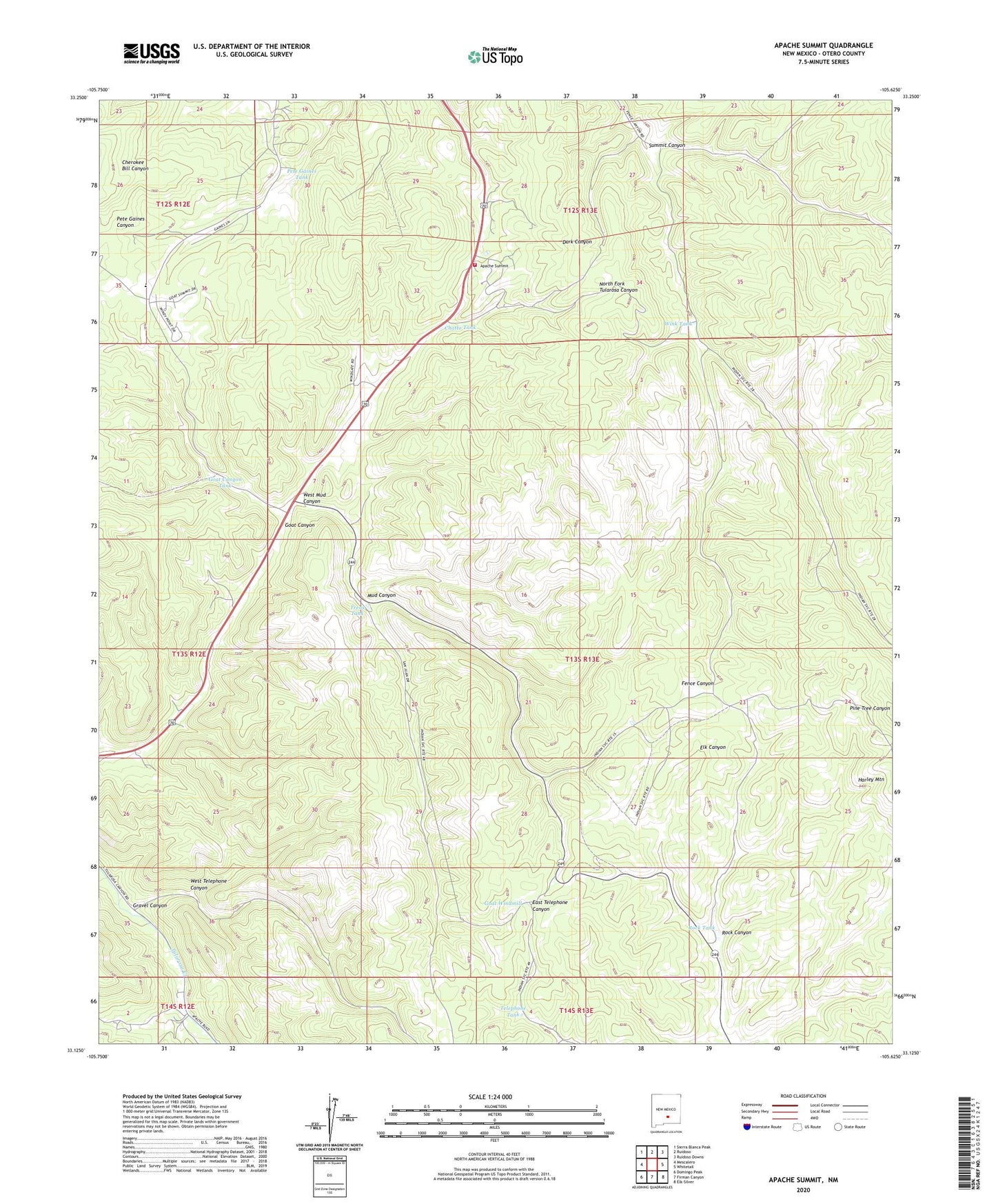
2020 topographic map quadrangle Apache Summit in the state of New Mexico. Scale: 1:24000. Based on the newly updated USGS 7.5' US Topo map series, this map is in the following counties: Otero. The map contains contour data, water features, and other items you are used to seeing on USGS maps, but also has updated roads and other features. This is the next generation of topographic maps. Printed on high-quality waterproof paper with UV fade-resistant inks.
Quads adjacent to this one:
West: Mescalero
Northwest: Sierra Blanca Peak
North: Ruidoso
Northeast: Ruidoso Downs
East: Whitetail
Southeast: Elk-Silver
South: Firman Canyon
Southwest: Domingo Peak
Contains the following named places: Apache Summit, Bureau of Indian Affairs Forestry Branch, Campbell Tank, Chatto Tank, Fence Canyon Well, Goat Canyon, Goat Canyon Tank, Goat Windmill, Gravel Canyon, Harley Mountain, Mescalero Apache Fire Rescue Station, Mescalero Apache Pit, Mud Canyon, Pete Gaines Tank, Pete Gaines Well, Rock Canyon, Rock Tank, Summit Canyon, Telephone Tank, Treas Tank, West Mud Canyon, West Telephone Canyon, Windmill, Wink Tank