MyTopo
Aragon New Mexico US Topo Map
Couldn't load pickup availability
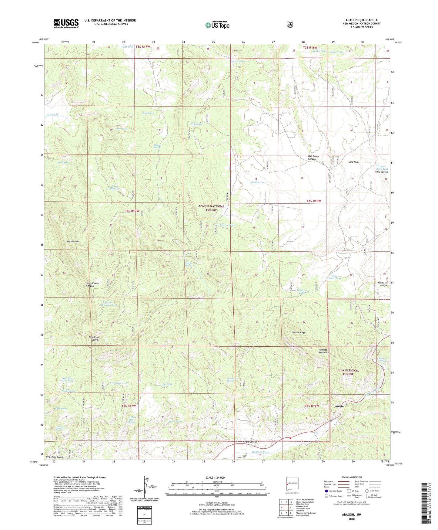
2020 topographic map quadrangle Aragon in the state of New Mexico. Scale: 1:24000. Based on the newly updated USGS 7.5' US Topo map series, this map is in the following counties: Catron. The map contains contour data, water features, and other items you are used to seeing on USGS maps, but also has updated roads and other features. This is the next generation of topographic maps. Printed on high-quality waterproof paper with UV fade-resistant inks.
Quads adjacent to this one:
West: Queens Head
Northwest: Gallo Mountains West
North: Gallo Mountains East
Northeast: Slaughter Mesa
East: Tularosa Canyon
Southeast: John Kerr Peak
South: Squirrel Springs Canyon
Southwest: Cruzville
Contains the following named places: Apache Mountain, Apache Mountain Tank, Apache Spring, Aragon, Aragon Census Designated Place, Banta Spring, Bull Camp Canyon, Castillo Tank, Cruzville - Apache Creek / Aragon Fire Department, Deep Well, E Robertson Tank, Fort Tularosa, Horse Pasture Tank, Indio Road Tank, Jacob Draw Tank, Kline Tank, Malpais Spring, Mata Spring, Means Tank, Miller Spring, Negrito Springs, Negrito Tank, Negro Canyon, New Red Steer Tank, NH Tank, Orono Spring, Owl Water Spring, Pit Tank, Rankin Tank, Red Steer Spring, Rock Spring, Sand Flat Airstrip, Sand Spring, Sand Tank, Santonino School, Spring Tank, Tularosa Mountain, Tularosa Mountains, Tularosa Spring, Tularosa Tank, Willow Bush Spring, ZIP Code: 87820