MyTopo
Whitetail New Mexico US Topo Map
Couldn't load pickup availability
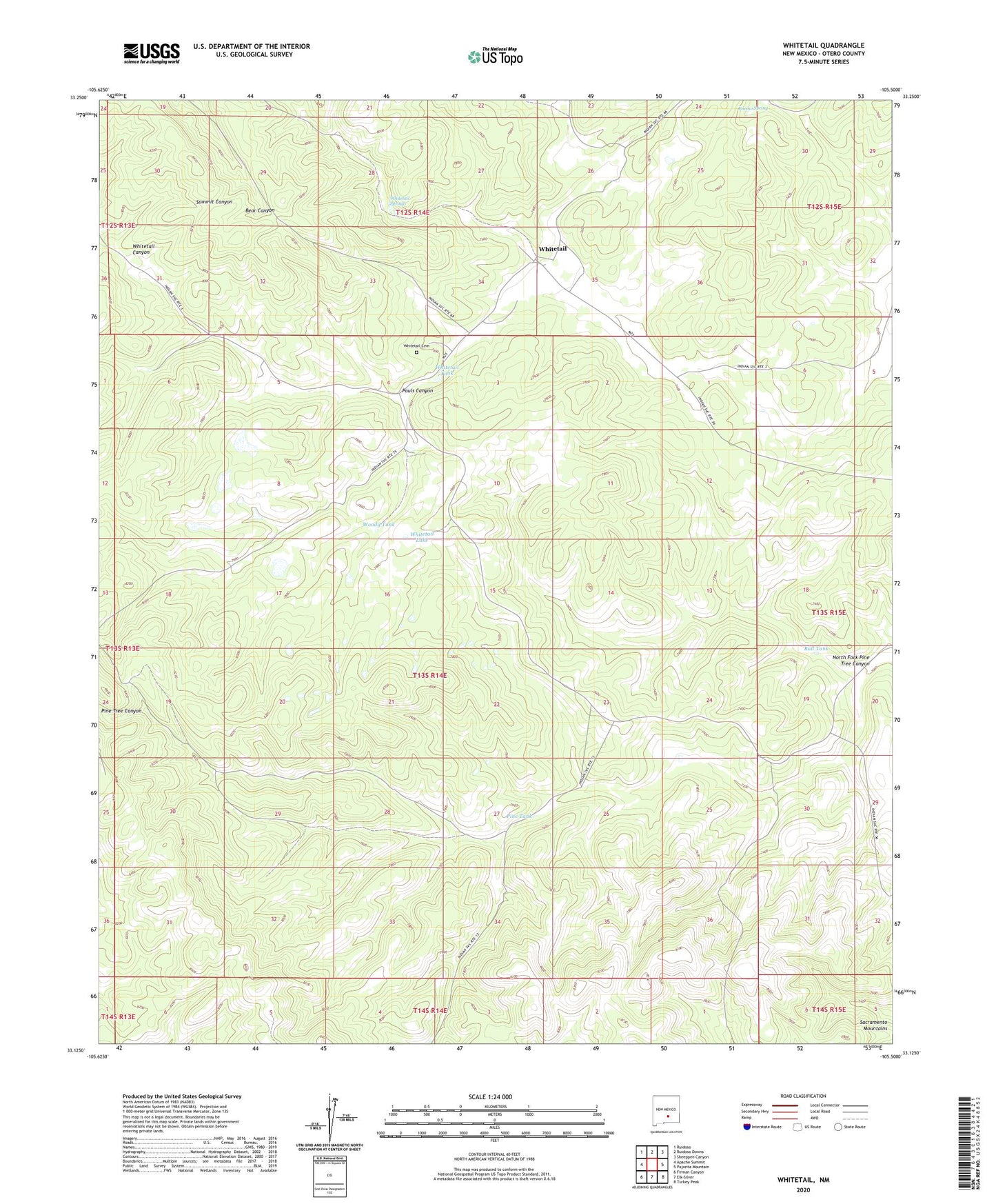
2020 topographic map quadrangle Whitetail in the state of New Mexico. Scale: 1:24000. Based on the newly updated USGS 7.5' US Topo map series, this map is in the following counties: Otero. The map contains contour data, water features, and other items you are used to seeing on USGS maps, but also has updated roads and other features. This is the next generation of topographic maps. Printed on high-quality waterproof paper with UV fade-resistant inks.
Quads adjacent to this one:
West: Apache Summit
Northwest: Ruidoso
North: Ruidoso Downs
Northeast: Sheeppen Canyon
East: Pajarita Mountain
Southeast: Turkey Peak
South: Elk-Silver
Southwest: Firman Canyon
Contains the following named places: Bull Tank, Bull Well, Encino Spring, Mescalero Apache Reservation Historical Marker, Mescalero Division, Mescalero Reservation, North Fork Pine Tree Canyon, Pauls Canyon, Pine Tank, Pine Tree Canyon Damsite Number 1 Dam, Pine Tree Canyon Damsite Number 2 Dam, Pine Tree Canyon Damsite Number Seven Dam, Pine Tree Canyon Damsite Number Six Dam, Whitetail, Whitetail Cemetery, Whitetail Dam Number Five, Whitetail Dam Number Six, Whitetail Lake, Whitetail Spring, Whitetail Springs, Whitetail Tank, Whitetail Weather Station, Whitetail Well, Woody Tank, ZIP Code: 88340