
MyTopo
Yankee New Mexico US Topo Map
Couldn't load pickup availability
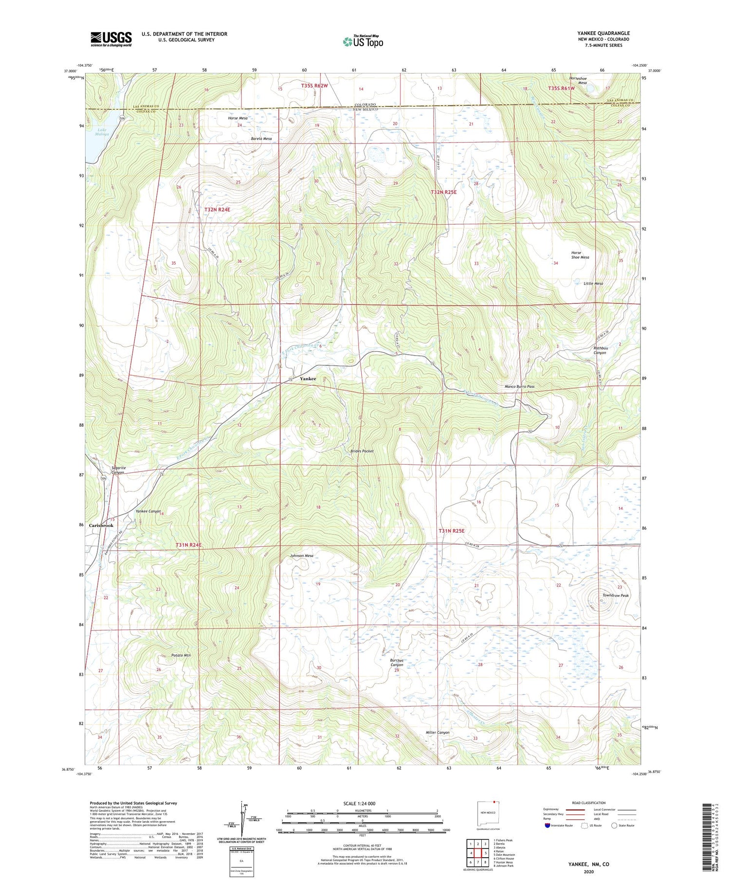
2020 topographic map quadrangle Yankee in the states of New Mexico, Colorado. Scale: 1:24000. Based on the newly updated USGS 7.5' US Topo map series, this map is in the following counties: Colfax, Las Animas. The map contains contour data, water features, and other items you are used to seeing on USGS maps, but also has updated roads and other features. This is the next generation of topographic maps. Printed on high-quality waterproof paper with UV fade-resistant inks.
Quads adjacent to this one:
West: Raton
Northwest: Fishers Peak
North: Barela
Northeast: Abeyta
East: Dale Mountain
Southeast: Johnson Park
South: Hunter Mesa
Southwest: Clifton House
Contains the following named places: Barela Mesa, Block Coal Mine Number Two, Brides Pocket, Carisbrook, Carisbrook Post Office, Davis Mine, Denton, Denton Mine, East Fork Chicorica Creek, Evans, Franks Mine, Guerra, Hartzel Mine, Harvey-Genta Mine, Hobbs Mine, Horse Coal Mine, Horse Mesa, Horse Shoe Mesa, Johnson Mesa, Klantchnik Mine, Lake Maloya, Lake Maloya Dam, Little Mesa, Llewellyn Mine, M and M Mine, Manco Burro Pass, McClafferty Mine, Mendelsohn Mine, New Yankee Number 4 Claim, Newton Mine, Newton-Talbott Mine, Old Honeyfield Mine, Old Latimore Mine, Potato Mountain, Rathbun Canyon, Reynolds Mine, Schwachheim Creek, Scoop Prospect, Sperry Mine, Sugarite Canyon, Sugarite Mine, Sunset Coal Mine, Sunshine Mine, Tondrow Peak Mine, Towndrow, Towndrow Peak, Turner, Turner Mine, Turner Mine Number Two, Yankee, Yankee Canyon, Yankee Number Five Mine, Yankee Number Four Mine, Yankee Number One Mine, Yankee Number Three Mine, Yankee Number Two Mine, Yankee Post Office, Yankee-Reynolds Prospect


