MyTopo
Afton New York US Topo Map
Couldn't load pickup availability
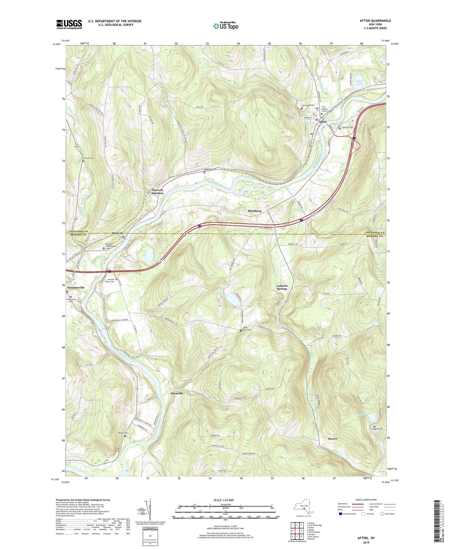
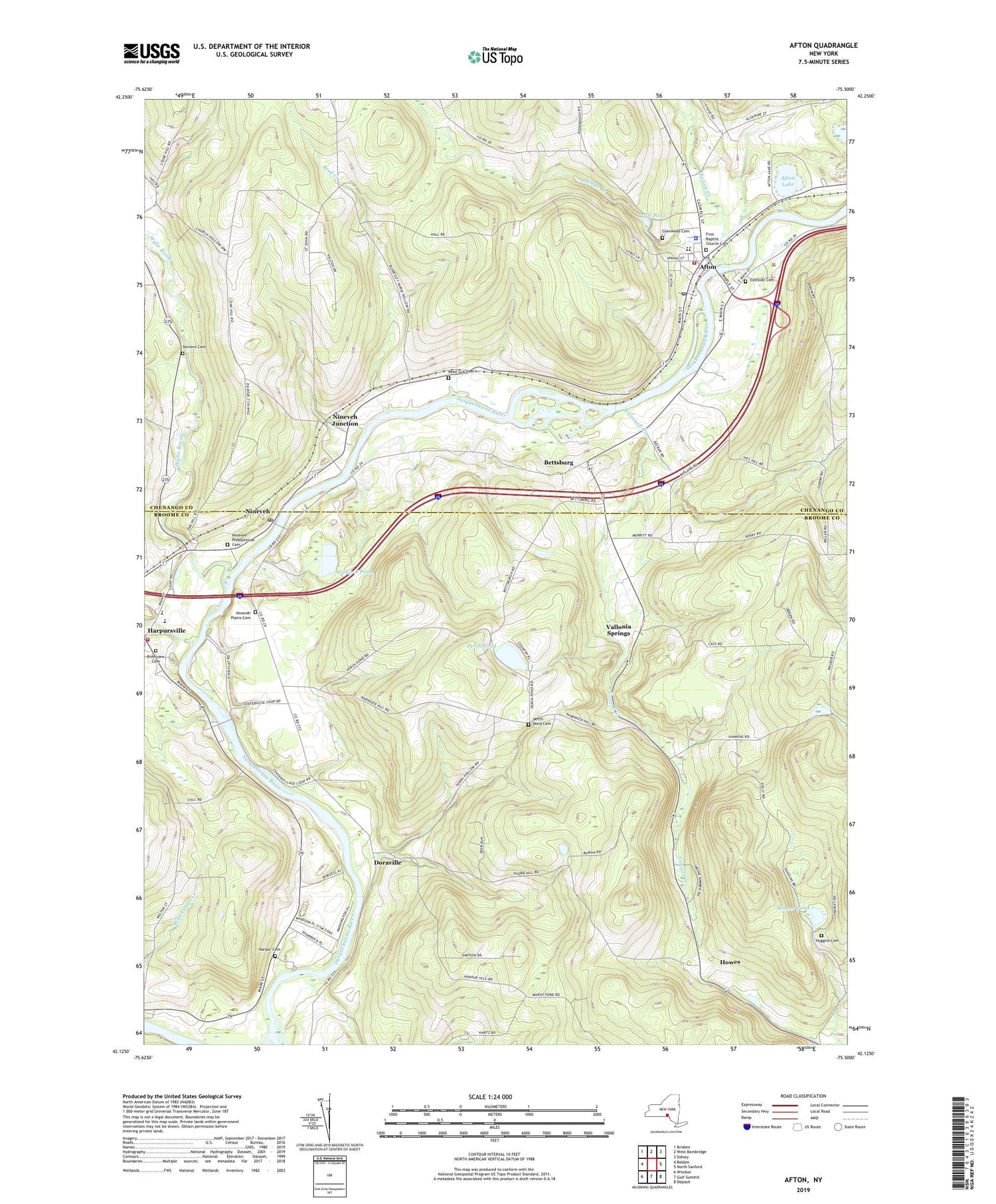
2019 topographic map quadrangle Afton in the state of New York. Scale: 1:24000. Based on the newly updated USGS 7.5' US Topo map series, this map is in the following counties: Broome, Chenango. The map contains contour data, water features, and other items you are used to seeing on USGS maps, but also has updated roads and other features. This is the next generation of topographic maps. Printed on high-quality waterproof paper with UV fade-resistant inks.
Quads adjacent to this one:
West: Belden
Northwest: Brisben
North: West Bainbridge
Northeast: Sidney
East: North Sanford
Southeast: Deposit
South: Gulf Summit
Southwest: Windsor
Contains the following named places: Afton, Afton Elementary School, Afton Fire Department, Afton Free Library, Afton Golf Club, Afton Lake, Afton Middle - High School, Afton Post Office, Afton Presbyterian Church, Afton United Methodist Church, Beaver Pond, Belden Brook, Bettsburg, Bumps Creek, Center Village, Cornell Creek, Doraville, Eastside Cemetery, First Baptist Church, First Baptist Church Cemetery, Glenwood Cemetery, Harpur Cemetery, Harpursville, Harpursville Fire Department Station 1, Harpursville Junior - Senior High School, Higher Ground Christian Church, Hope Congregational Church, Howes, Huggins Cemetery, Kellystone Park, Kelsey Creek, Nineveh, Nineveh Junction, Nineveh Plains Cemetery, Nineveh Post Office, Nineveh Presbyterian Cemetery, Nineveh Presbyterian Church, Nineveh Public Library of Colesville Township, Perch Pond, Perch Pond Cemetery, Pickerel Pond, Reed Creek, Reed Guy Cemetery, Riverview Cemetery, Saint Agnes Catholic Church, Saint Anns Episcopal Church, Stevens Cemetery, Taft Pond, Three Pines Community Church, Town of Afton, Vallonia Springs, Village of Afton, W A Olmsted Elementary School, Wylie Brook, ZIP Codes: 13730, 13813