MyTopo
Albert Marsh New York US Topo Map
Couldn't load pickup availability
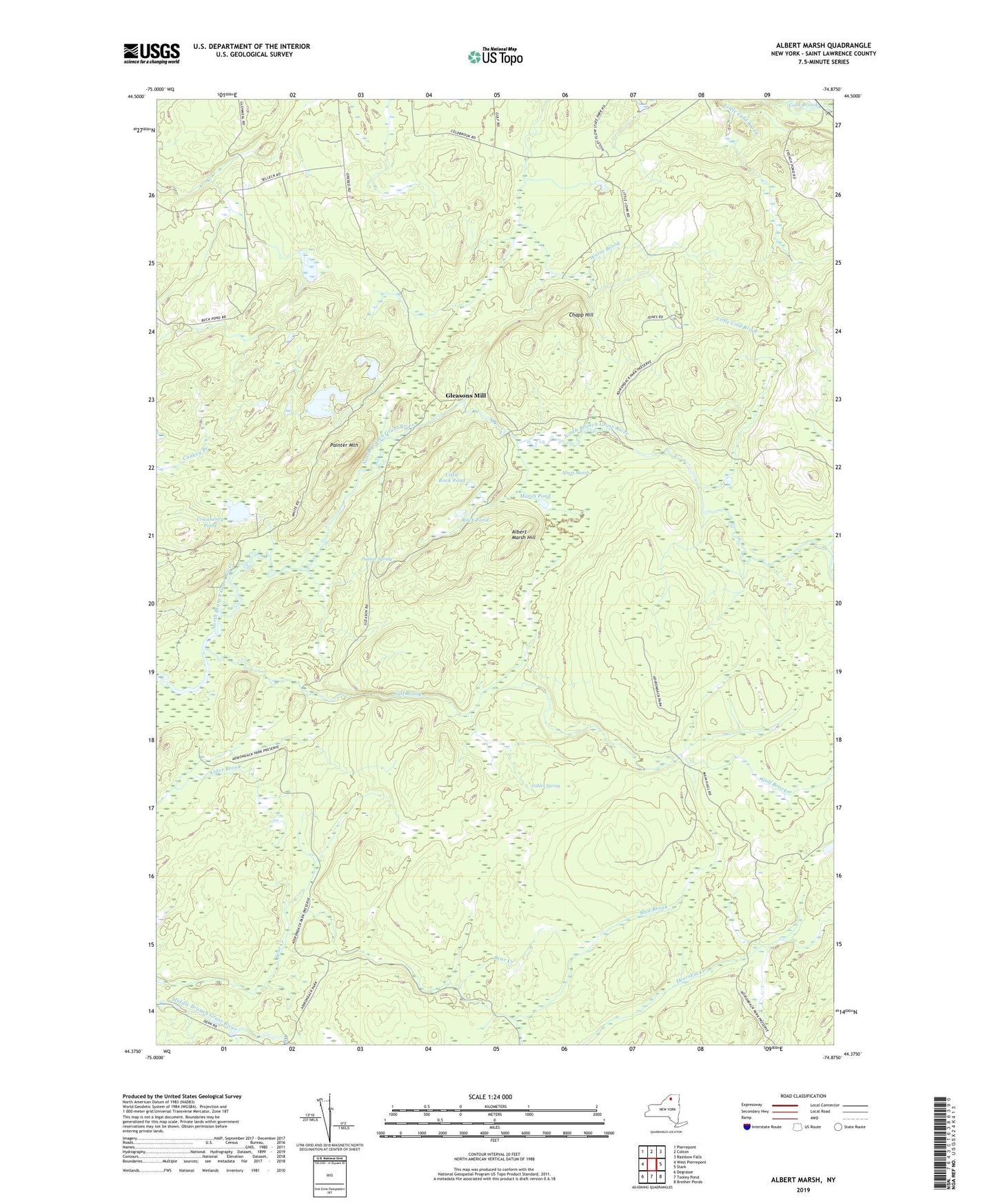
2019 topographic map quadrangle Albert Marsh in the state of New York. Scale: 1:24000. Based on the newly updated USGS 7.5' US Topo map series, this map is in the following counties: St. Lawrence. The map contains contour data, water features, and other items you are used to seeing on USGS maps, but also has updated roads and other features. This is the next generation of topographic maps. Printed on high-quality waterproof paper with UV fade-resistant inks.
Quads adjacent to this one:
West: West Pierrepont
Northwest: Pierrepont
North: Colton
Northeast: Rainbow Falls
East: Stark
Southeast: Brother Ponds
South: Tooley Pond
Southwest: Degrasse
Contains the following named places: Albert Marsh, Albert Marsh Hill, Chapp Hill, Cranberry Pond, Gleasons Mill, Goblet Spring, Gulf Brook, Higley Flow State Park, L Pond, Little Rock Pond, Marsh Pond, Painter Mountain, Palmer Spring, Rock Pond, Sellecks Corners, Sellecks Lower Camp, Twin Ponds