MyTopo
Altona New York US Topo Map
Couldn't load pickup availability
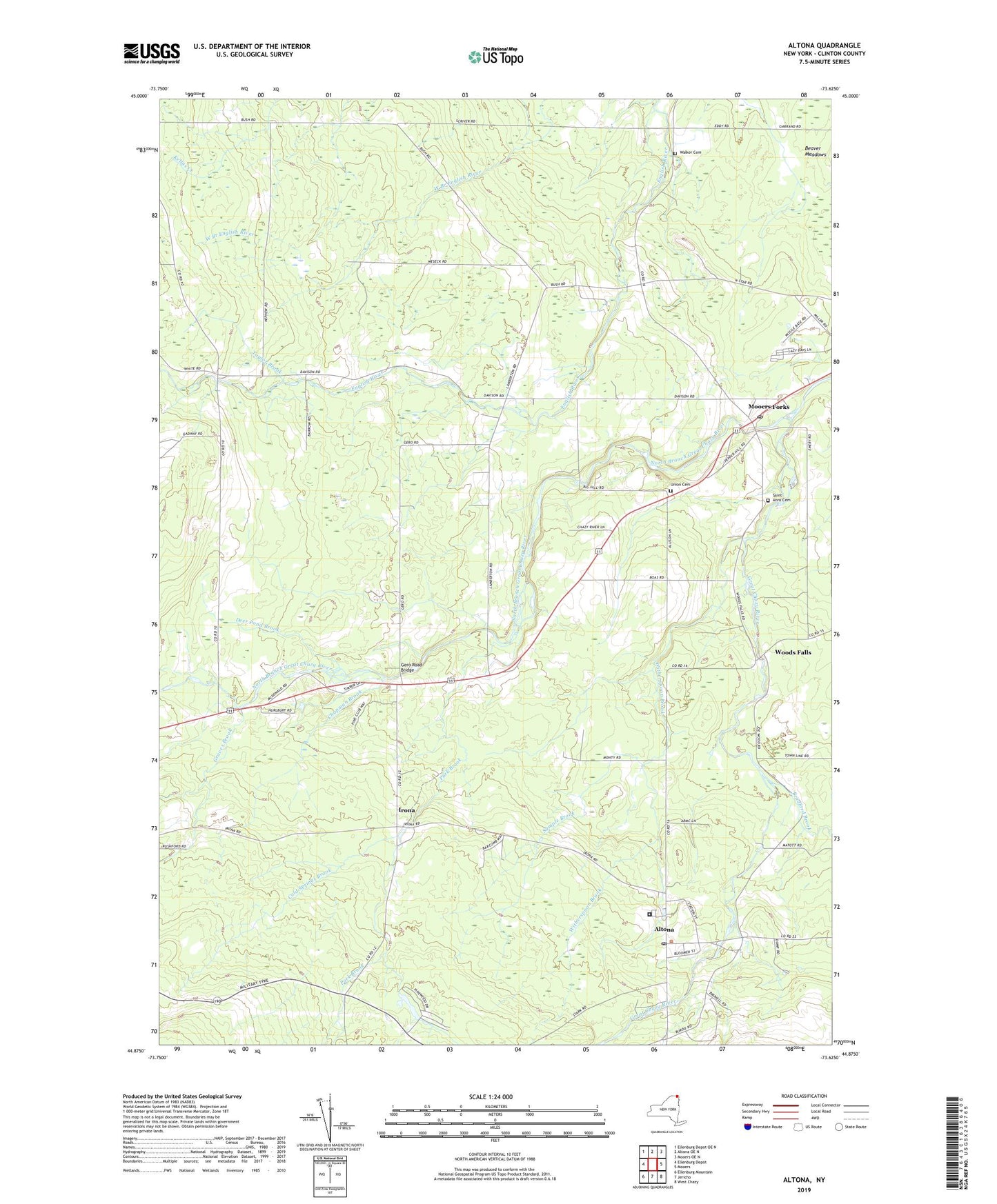
2019 topographic map quadrangle Altona in the state of New York. Scale: 1:24000. Based on the newly updated USGS 7.5' US Topo map series, this map is in the following counties: Clinton. The map contains contour data, water features, and other items you are used to seeing on USGS maps, but also has updated roads and other features. This is the next generation of topographic maps. Printed on high-quality waterproof paper with UV fade-resistant inks.
Quads adjacent to this one:
West: Ellenburg Depot
Northwest: Ellenburg Depot OE N
North: Altona OE N
Northeast: Mooers OE N
East: Mooers
Southeast: West Chazy
South: Jericho
Southwest: Ellenburg Mountain
Contains the following named places: Altona, Altona Census Designated Place, Altona Central School, Altona Correctional Facility, Altona Post Office, Beaver Meadows, Bradford Brook, Cannon Corners, Chapman Brook, Cold Springs Brook, Deer Pond, Deer Pond Brook, Emerson School, Feinburg Park, First Church, Gero Road Bridge, Graves Brook, Holy Angels Church, Irona, Mooers Forks, Mooers Forks Post Office, North Branch Great Chazy River, Park Brook, Saint Anns Cemetery, Saint Anns Church, Sample Brook, Taylor Brook, Town of Mooers, Union Cemetery, Walker Cemetery, White School, Witherspoon Brook, Woods Falls, ZIP Code: 12959