MyTopo
Ampersand Lake New York US Topo Map
Couldn't load pickup availability
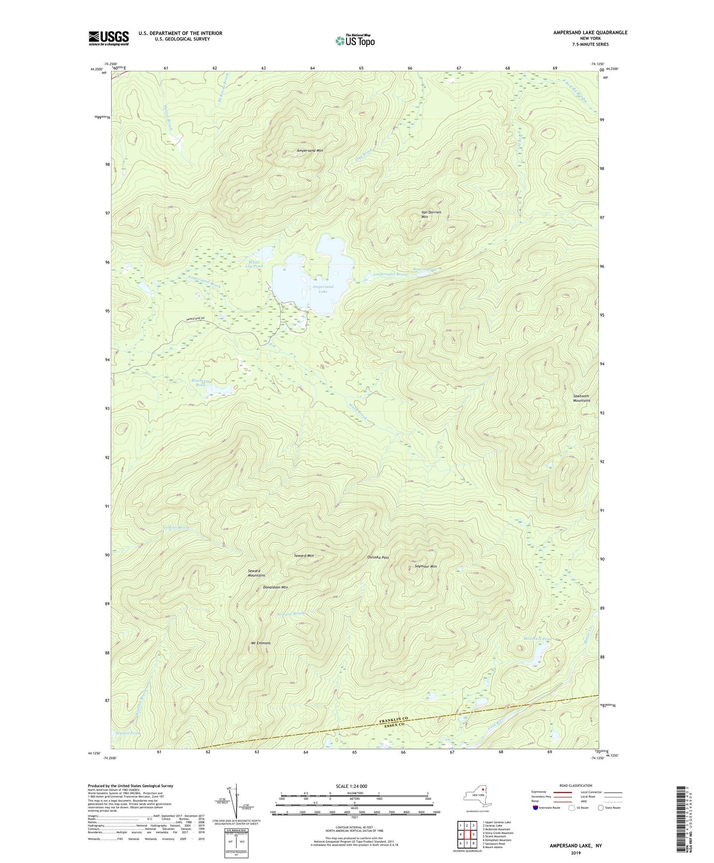
2019 topographic map quadrangle Ampersand Lake in the state of New York. Scale: 1:24000. Based on the newly updated USGS 7.5' US Topo map series, this map is in the following counties: Franklin, Essex. The map contains contour data, water features, and other items you are used to seeing on USGS maps, but also has updated roads and other features. This is the next generation of topographic maps. Printed on high-quality waterproof paper with UV fade-resistant inks.
Quads adjacent to this one:
West: Stony Creek Mountain
Northwest: Upper Saranac Lake
North: Saranac Lake
Northeast: McKenzie Mountain
East: Street Mountain
Southeast: Mount Adams
South: Santanoni Peak
Southwest: Kempshall Mountain
Contains the following named places: Ampersand Lake, Beaver Pond, Blueberry Pond, Donaldson Mountain, East Branch Cold Brook, Moose Creek, Mount Emmons, Mountain Pond, Ouluska Pass, Seward Mountain, Seward Mountains, Seymour Mountain, Town of Harrietstown, Van Dorrien Mountain, Ward Brook, White Lily Pond