MyTopo
Angelica New York US Topo Map
Couldn't load pickup availability
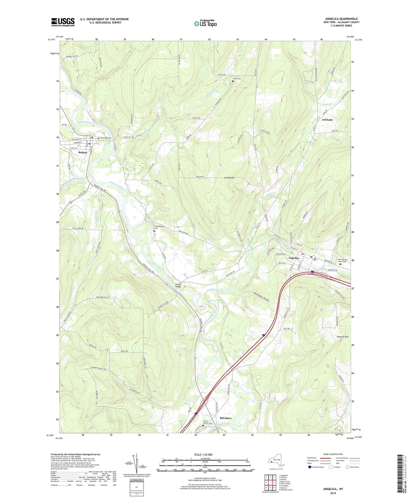
2019 topographic map quadrangle Angelica in the state of New York. Scale: 1:24000. Based on the newly updated USGS 7.5' US Topo map series, this map is in the following counties: Allegany. The map contains contour data, water features, and other items you are used to seeing on USGS maps, but also has updated roads and other features. This is the next generation of topographic maps. Printed on high-quality waterproof paper with UV fade-resistant inks.
Quads adjacent to this one:
West: Black Creek
Northwest: Houghton
North: Fillmore
Northeast: Birdsall
East: West Almond
Southeast: Wellsville North
South: Belmont
Southwest: Friendship
Contains the following named places: Allegany County, Allegany County Landfill, Allen Cemetery, Angelica, Angelica Creek, Angelica Fire and Rescue Department, Angelica Free Library, Angelica Park Circle Historic District, Angelica Post Office, Angelica United Methodist Church, Aristotle, Baker Creek, Bartlett Memorial Library, Basswood Hill Farm, Belfast, Belfast Census Designated Place, Belfast Fire Department, Belfast Post Office, Belfast Town Hall, Belfast United Methodist Church, Belvidere, Black Creek, Brentwood Camp, Central School, Chamberlain Cemetery, Christ Church, Christ Church Cemetery, Erb Acres Airport, Evergreen Trails Campground, First Baptist Church, First Free Methodist Church, Grace Episcopal Church, Hyland Landfill, Jacobs Hill, Nineteen Gully, Riverside Cemetery, Saint Patrick's Roman Catholic Church, Town of Angelica, Transit Bridge, Transit Bridge Church, Until the Day Dawn Cemetery, Van Campen Creek, Village of Angelica, Village Park, Wellspring Ministries, White Creek, Wigwam Creek, ZIP Code: 14711