MyTopo
Augerhole Falls New York US Topo Map
Couldn't load pickup availability
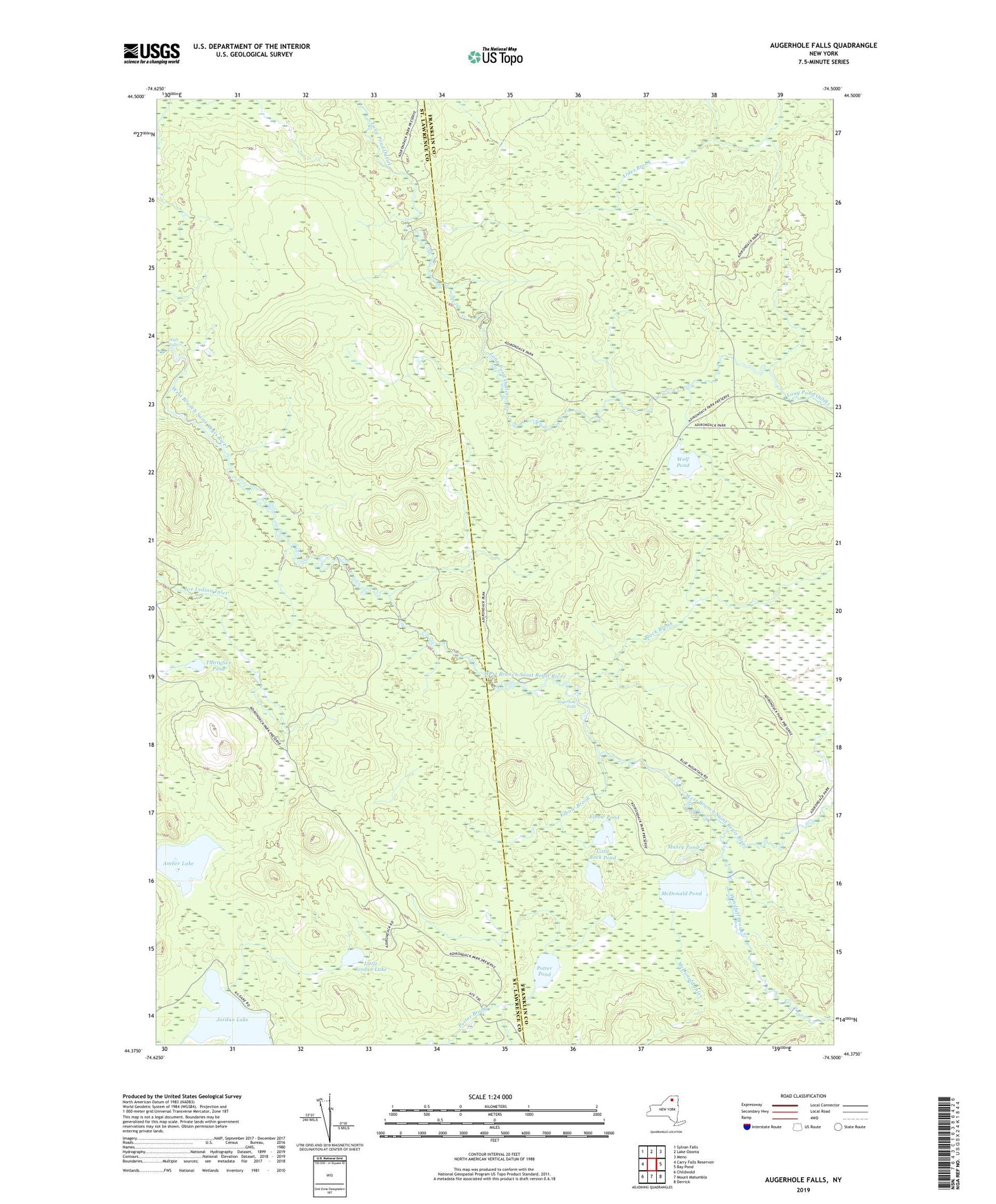
2019 topographic map quadrangle Augerhole Falls in the state of New York. Scale: 1:24000. Based on the newly updated USGS 7.5' US Topo map series, this map is in the following counties: Franklin, St. Lawrence. The map contains contour data, water features, and other items you are used to seeing on USGS maps, but also has updated roads and other features. This is the next generation of topographic maps. Printed on high-quality waterproof paper with UV fade-resistant inks.
Quads adjacent to this one:
West: Carry Falls Reservoir
Northwest: Sylvan Falls
North: Lake Ozonia
Northeast: Meno
East: Bay Pond
Southeast: Derrick
South: Mount Matumbla
Southwest: Childwold
Contains the following named places: Amber Lake, Augerhole Camp, Augerhole Falls, Black Brook, Buckley Camp, Camp Number Two, Cuttings Camp, Elbow Brook, Elbow Pond, High Falls, Jordan Lake, Little Jordan Lake, Little Rock Pond, Maxey Pond, McDonald Inlet, McDonald Outlet, McDonald Pond, Potter Pond, Sullivan Camp, Thirtyfive Pond, Windfall Brook, Wolf Pond, Wolf Pond Camp