MyTopo
Bangor New York US Topo Map
Couldn't load pickup availability
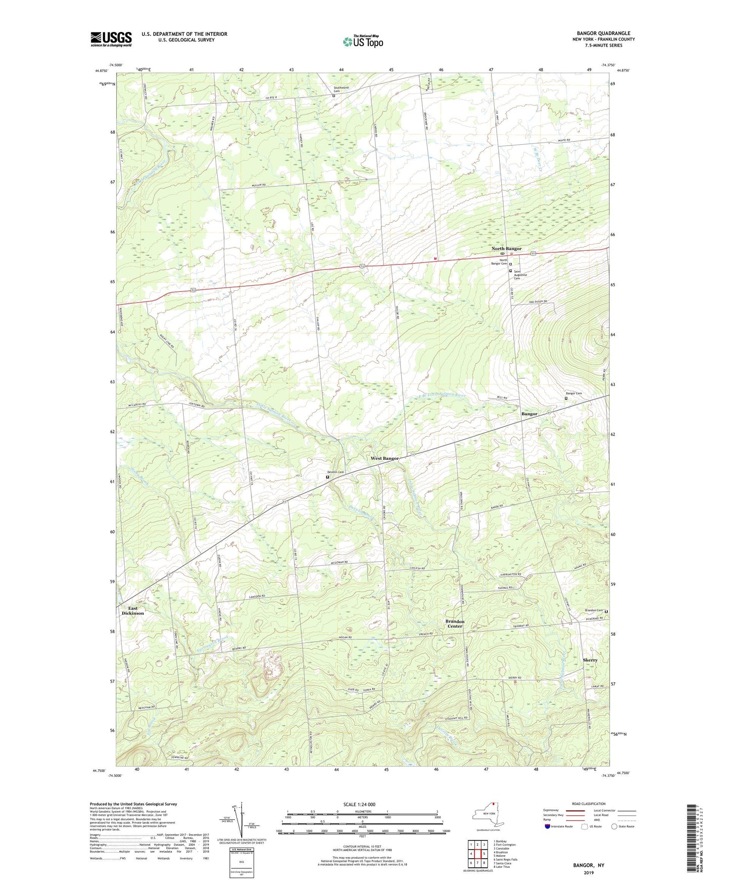
2019 topographic map quadrangle Bangor in the state of New York. Scale: 1:24000. Based on the newly updated USGS 7.5' US Topo map series, this map is in the following counties: Franklin. The map contains contour data, water features, and other items you are used to seeing on USGS maps, but also has updated roads and other features. This is the next generation of topographic maps. Printed on high-quality waterproof paper with UV fade-resistant inks.
Quads adjacent to this one:
West: Brushton
Northwest: Bombay
North: Fort Covington
Northeast: Constable
East: Malone
Southeast: Lake Titus
South: Santa Clara
Southwest: Saint Regis Falls
Contains the following named places: Bangor, Bangor Baptist Chapel, Bangor Cemetery, Bangor Fire Department, Bangor Station, Brandon Cemetery, Brandon Center, Develin Brook, Develin Cemetery, East Branch Little Salmon River, East Dickinson, Malone Quarry, North Bangor, North Bangor Cemetery, North Bangor Post Office, North Bangor Seventh Day Adventist Church, Plumb Hill Farm, Saint Augustine Cemetery, School Number 11, School Number 2, School Number 3, School Number 4, School Number 5, School Number 6, School Number 7, School Number 9, Skerry, Southworth Cemetery, Town of Bangor, West Bangor, ZIP Code: 12966