MyTopo
Bearsville New York US Topo Map
Couldn't load pickup availability
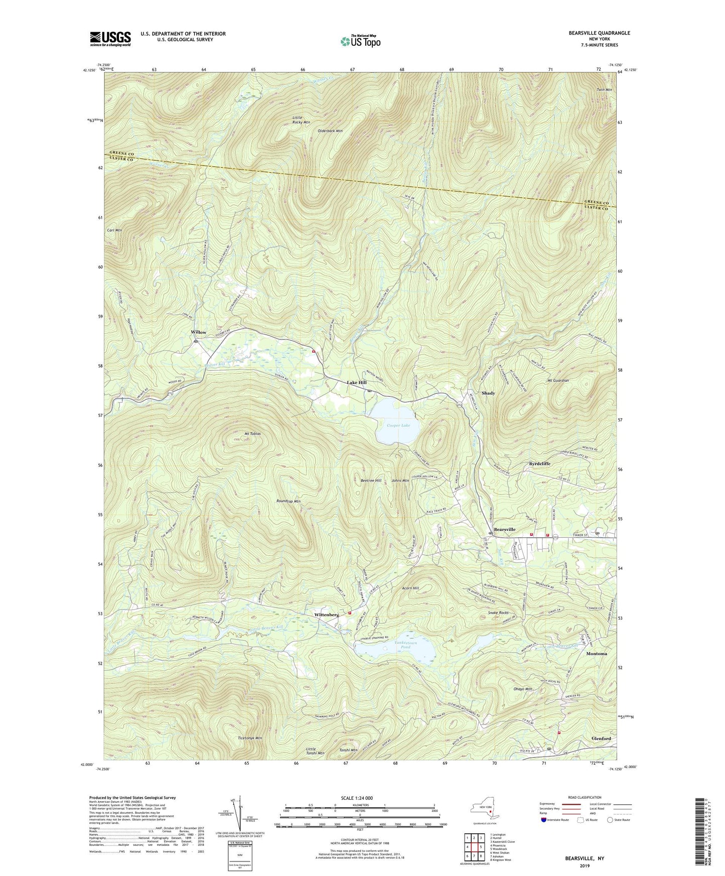
2019 topographic map quadrangle Bearsville in the state of New York. Scale: 1:24000. Based on the newly updated USGS 7.5' US Topo map series, this map is in the following counties: Ulster, Greene. The map contains contour data, water features, and other items you are used to seeing on USGS maps, but also has updated roads and other features. This is the next generation of topographic maps. Printed on high-quality waterproof paper with UV fade-resistant inks.
Quads adjacent to this one:
West: Phoenicia
Northwest: Lexington
North: Hunter
Northeast: Kaaterskill Clove
East: Woodstock
Southeast: Kingston West
South: Ashokan
Southwest: West Shokan
Contains the following named places: Acorn Hill, Bearsville, Bearsville Post Office, Beetree Hill, Byrdcliffe, Carl Mountain, Cooper Lake, Glenford, Glenford Fire Department Engine Company 4, Glenford Post Office, Hoyt Hollow, Johns Mountain, Lake Hill, Lake Hill Post Office, Little Rocky Mountain, Mink Hollow, Montoma, Mount Guardian, Mount Tobias, Ohayo Mountain, Olderbark Mountain, Overlook United Methodist Church, Roundtop Mountain, School Number 1, School Number 3, School Number 4, School Number 5, Shady, Snake Rocks, Ticetonyk Mountain, Tonshi Mountain, Town of Woodstock, Willow, Willow Post Office, Wittenberg, Woodstock Fire District Company 1, Woodstock Fire District Lake Hill Company 3, Woodstock Fire District Rescue Squad Company 5, Woodstock Fire District Wittenberg - Bearsville Company 2, Woodstock Manor Home Assisted Living Facility, Woodstock Post Office, Yankeetown Pond, ZIP Codes: 12409, 12433, 12448, 12495