MyTopo
Andover Ohio US Topo Map
Couldn't load pickup availability
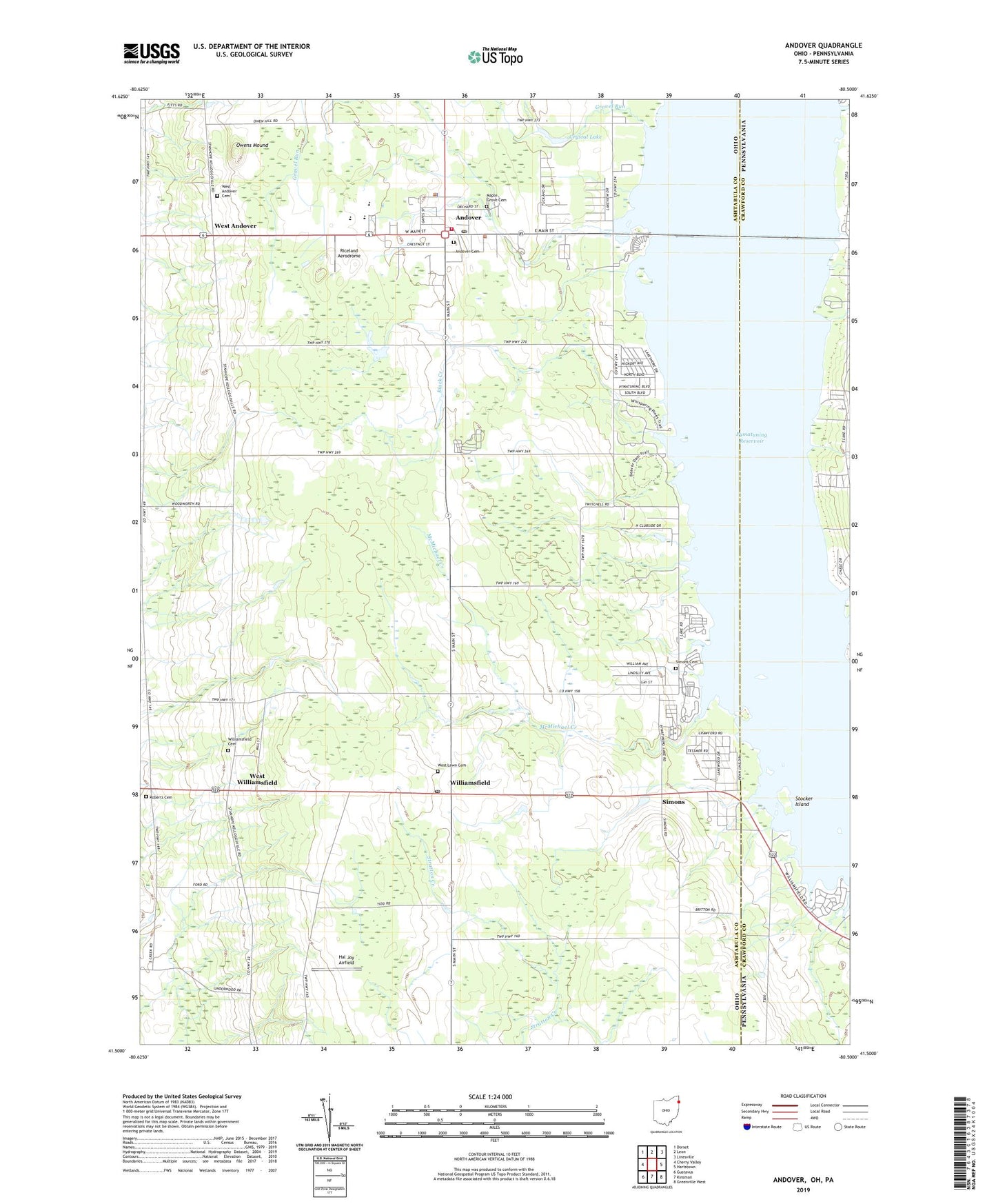
2019 topographic map quadrangle Andover in the states of Ohio, Pennsylvania. Scale: 1:24000. Based on the newly updated USGS 7.5' US Topo map series, this map is in the following counties: Ashtabula, Crawford. The map contains contour data, water features, and other items you are used to seeing on USGS maps, but also has updated roads and other features. This is the next generation of topographic maps. Printed on high-quality waterproof paper with UV fade-resistant inks.
Quads adjacent to this one:
West: Cherry Valley
Northwest: Dorset
North: Leon
Northeast: Linesville
East: Hartstown
Southeast: Greenville West
South: Kinsman
Southwest: Gustavus
Contains the following named places: Andover, Andover Cemetery, Andover Country Meadows, Andover Post Office, Andover Public Library, Andover Village Police Department, Andover Volunteer Fire Department, Black Creek, Crystal Lake, Golden Ridge Farm, Gravel Run, Hal Joy Airfield, Maple Grove Cemetery, McMichael Creek, Owens Mound, Pilgrim Church, Pilgrim Goose Hatchery, Pymatuning Ambulance Service, Pymatuning Lake Drive-In, Pymatuning Valley High School, Pymatuning Valley Primary School, Ri Valley Farm, Riceland Aerodrome, Roberts Cemetery, Simons, Simons Cemetery, Stocker Island, Topside Farms, Township of Andover, Township of Williamsfield, Village of Andover, West Andover, West Andover Cemetery, West Andover Post Office, West Lawn Cemetery, West Williamsfield, Williamsfield, Williamsfield Cemetery, Williamsfield Post Office, Williamsfield United Methodist Church, Windhorse Farm, Winding Brook Farms, ZIP Codes: 44003, 44093