MyTopo
Adams Oklahoma US Topo Map
Couldn't load pickup availability
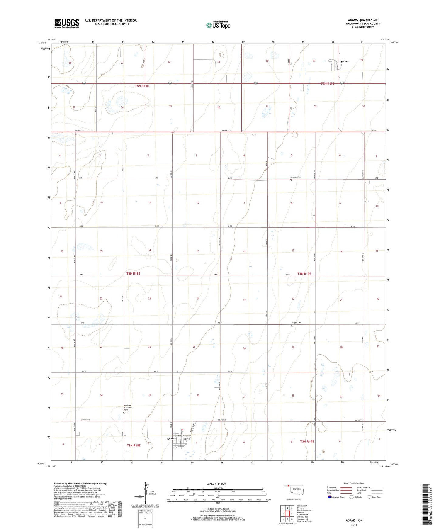
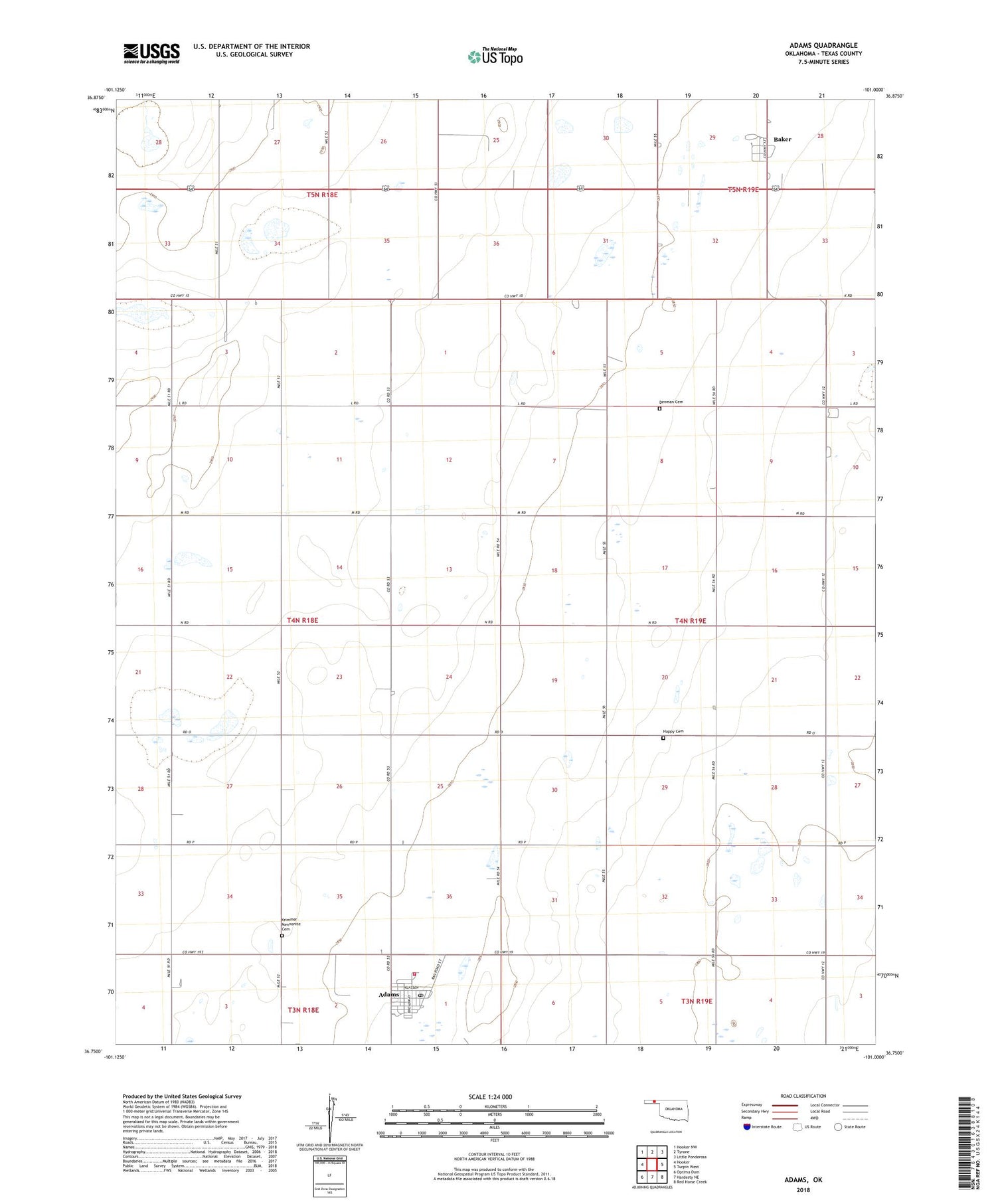
2018 topographic map quadrangle Adams in the state of Oklahoma. Scale: 1:24000. Based on the newly updated USGS 7.5' US Topo map series, this map is in the following counties: Texas. The map contains contour data, water features, and other items you are used to seeing on USGS maps, but also has updated roads and other features. This is the next generation of topographic maps. Printed on high-quality waterproof paper with UV fade-resistant inks.
Quads adjacent to this one:
West: Hooker
Northwest: Hooker NW
North: Tyrone
Northeast: Little Ponderosa
East: Turpin West
Southeast: Red Horse Creek
South: Hardesty NE
Southwest: Optima Dam
Contains the following named places: Adams, Adams Census Designated Place, Adams Post Office, Adams Rural Volunteer Fire District, Baker, Baker Census Designated Place, Baker Fire Protection Association, Denman Cemetery, Happy Cemetery, Krimmer Mennonite Cemetery, Township of Nabisco