
MyTopo
Adel Oklahoma US Topo Map
Couldn't load pickup availability
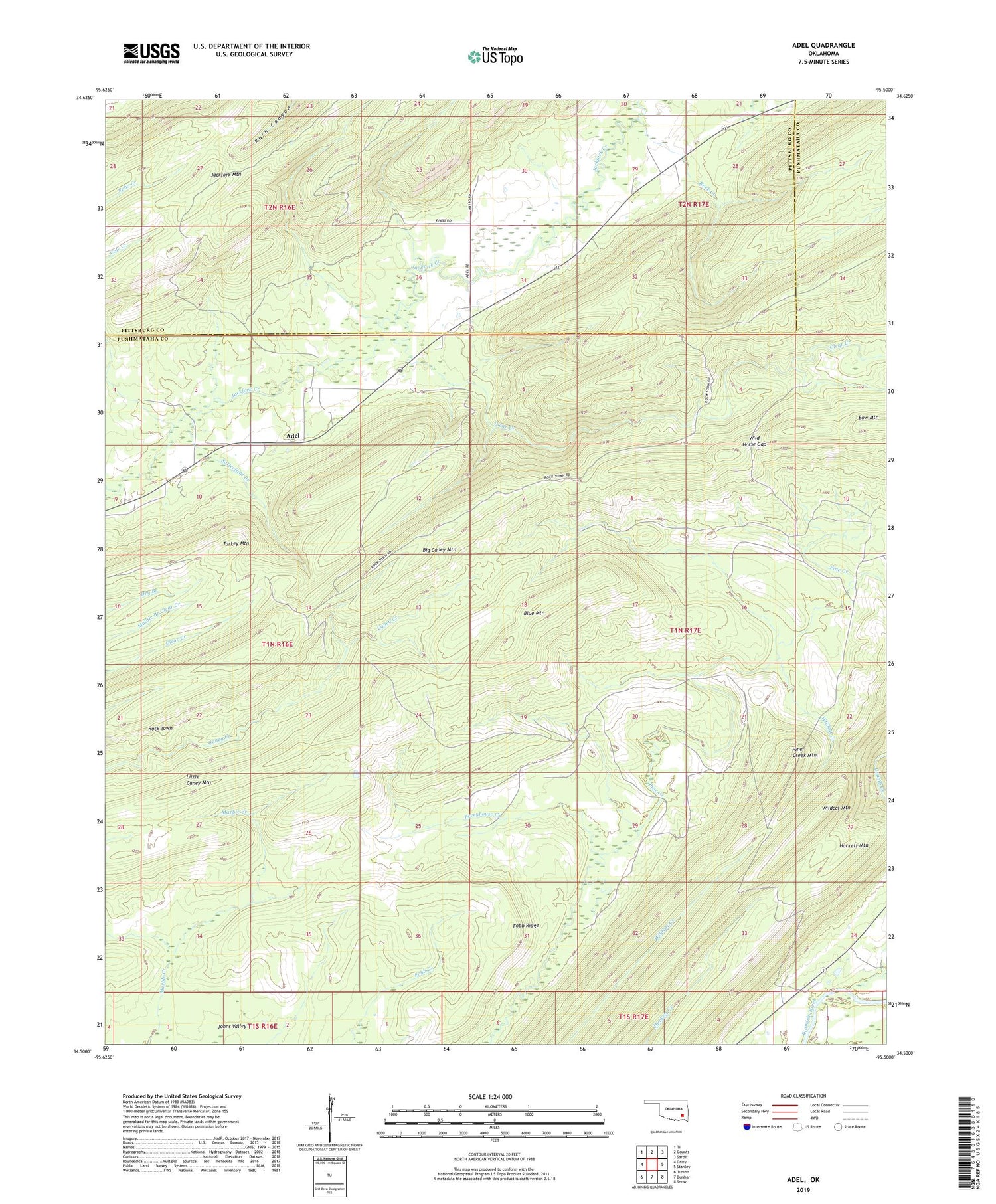
2019 topographic map quadrangle Adel in the state of Oklahoma. Scale: 1:24000. Based on the newly updated USGS 7.5' US Topo map series, this map is in the following counties: Pushmataha, Pittsburg. The map contains contour data, water features, and other items you are used to seeing on USGS maps, but also has updated roads and other features. This is the next generation of topographic maps. Printed on high-quality waterproof paper with UV fade-resistant inks.
Quads adjacent to this one:
West: Daisy
Northwest: Ti
North: Counts
Northeast: Sardis
East: Stanley
Southeast: Snow
South: Dunbar
Southwest: Jumbo
Contains the following named places: Adel, Big Caney Mountain, Blue Mountain, Bow Mountain, Clear Creek, Fobb Ridge, Hackett Mountain, Little Caney Mountain, Peveyhouse Creek, Pine Creek Mountain, Rock Creek, Rock Town, Satterfield Branch, Turkey Mountain, Wild Horse Gap, Wildcat Creek, Wildcat Mountain


