MyTopo
Albion Oklahoma US Topo Map
Couldn't load pickup availability
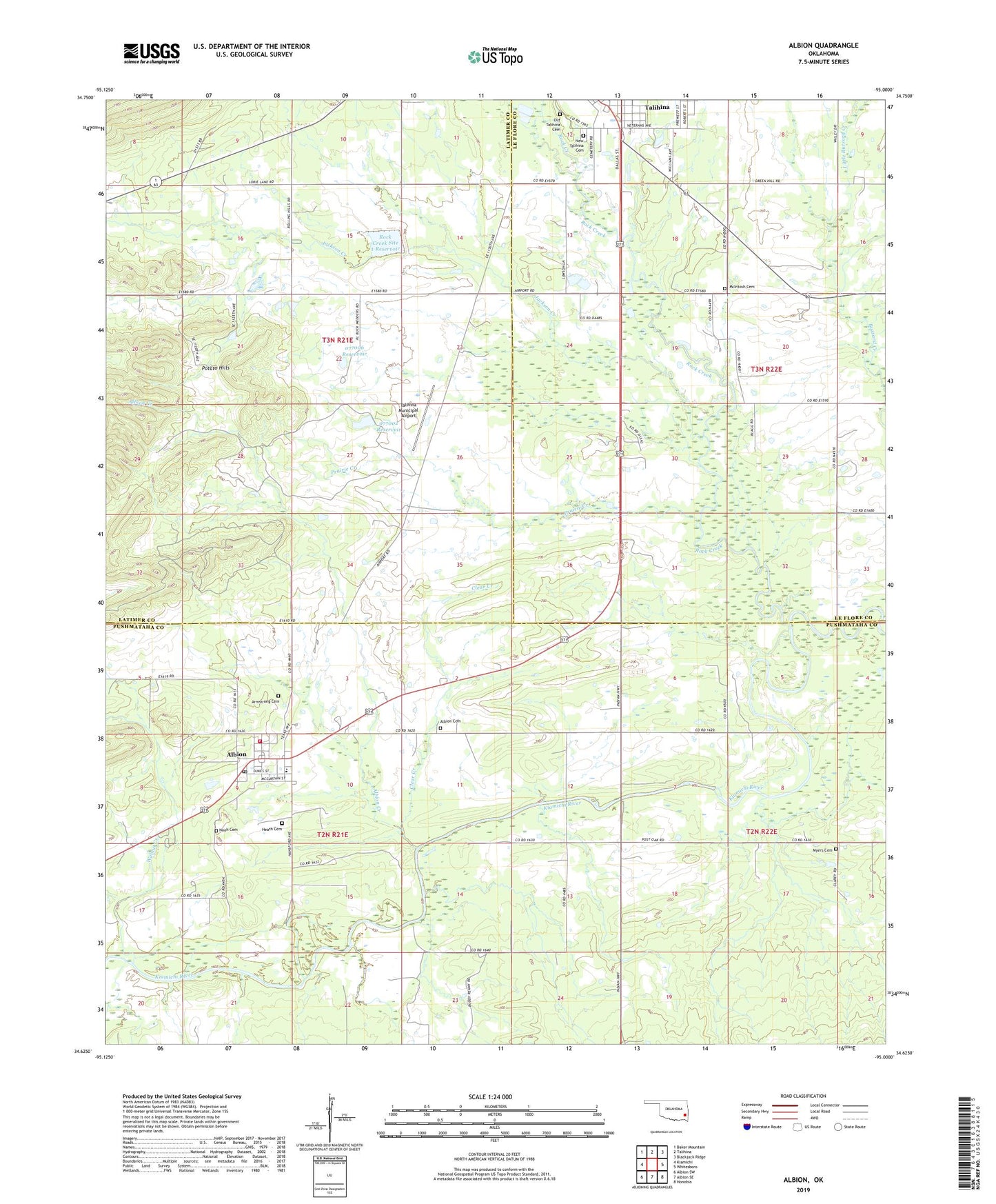
2019 topographic map quadrangle Albion in the state of Oklahoma. Scale: 1:24000. Based on the newly updated USGS 7.5' US Topo map series, this map is in the following counties: Pushmataha, Latimer, Le Flore. The map contains contour data, water features, and other items you are used to seeing on USGS maps, but also has updated roads and other features. This is the next generation of topographic maps. Printed on high-quality waterproof paper with UV fade-resistant inks.
Quads adjacent to this one:
West: Kiamichi
Northwest: Baker Mountain
North: Talihina
Northeast: Blackjack Ridge
East: Whitesboro
Southeast: Honobia
South: Albion SE
Southwest: Albion SW
Contains the following named places: Albion, Albion Cemetery, Albion Creek, Albion Elementary School, Albion Fire Department, Albion Post Office, Armstrong Cemetery, Clear Creek, Evangelistic Tabernacle, Green Hill Church, Head Church, Heath Cemetery, Homer Ranch Airport, Jackson Creek, Little Buzzard Creek, Martha Lingenfelter Lake, Martha Lingenfelter Lake Dam, McIntosh Cemetery, Myers Cemetery, New Talihina Cemetery, Noah Cemetery, Oknoname 077002 Dam, Oknoname 077002 Reservoir, Oknoname 077006 Dam, Oknoname 077006 Reservoir, Old Talihina Cemetery, Prairie Creek, Rock Creek, Rock Creek Site 1 Dam, Rock Creek Site 1 Reservoir, Talihina Municipal Airport, Town of Albion, Walnut Creek, ZIP Code: 74521