MyTopo
Albion SE Oklahoma US Topo Map
Couldn't load pickup availability
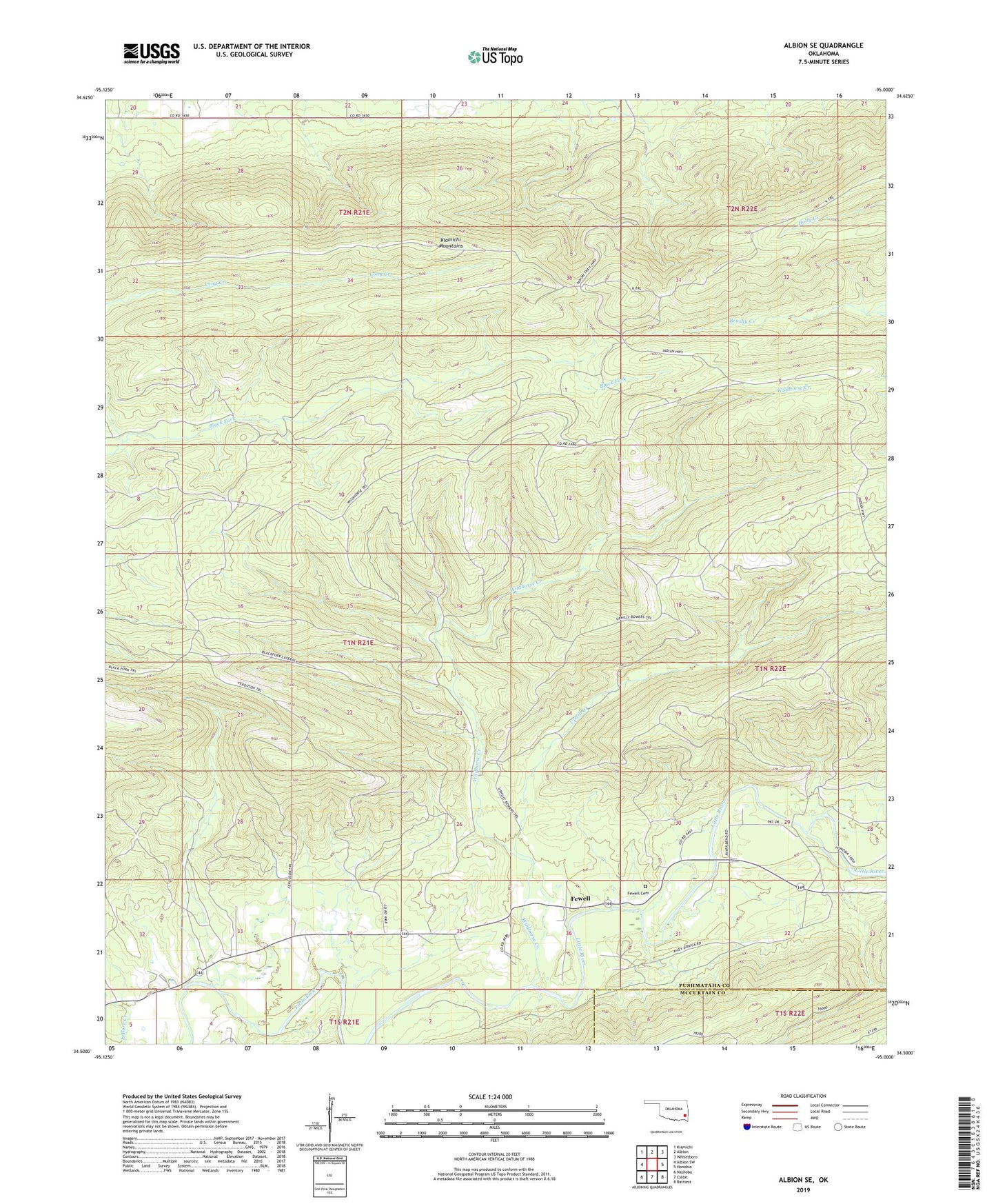
2019 topographic map quadrangle Albion SE in the state of Oklahoma. Scale: 1:24000. Based on the newly updated USGS 7.5' US Topo map series, this map is in the following counties: Pushmataha, McCurtain. The map contains contour data, water features, and other items you are used to seeing on USGS maps, but also has updated roads and other features. This is the next generation of topographic maps. Printed on high-quality waterproof paper with UV fade-resistant inks.
Quads adjacent to this one:
West: Albion SW
Northwest: Kiamichi
North: Albion
Northeast: Whitesboro
East: Honobia
Southeast: Battiest
South: Clebit
Southwest: Nashoba
Contains the following named places: Black Fork Lateral, Ferguson Trail, Fewell, Fewell Cemetery, K Trail, Polecat Creek, Uphill Creek, Uphilly Bowers Trail, Wildhorse Creek, Wildhorse Trail