MyTopo
Aledo Oklahoma US Topo Map
Couldn't load pickup availability
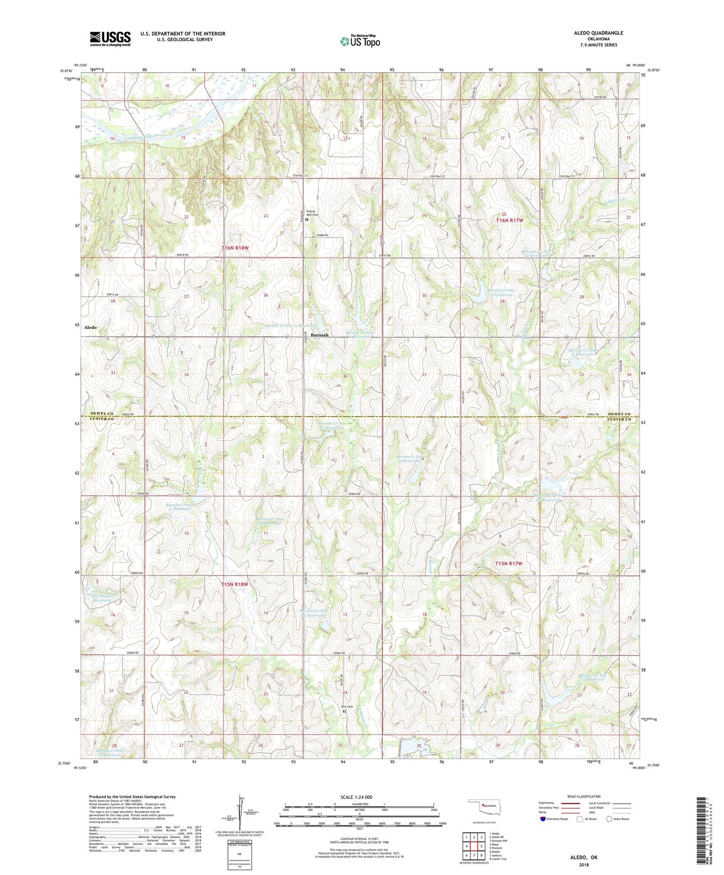
2018 topographic map quadrangle Aledo in the state of Oklahoma. Scale: 1:24000. Based on the newly updated USGS 7.5' US Topo map series, this map is in the following counties: Custer, Dewey. The map contains contour data, water features, and other items you are used to seeing on USGS maps, but also has updated roads and other features. This is the next generation of topographic maps. Printed on high-quality waterproof paper with UV fade-resistant inks.
Quads adjacent to this one:
West: Rhea
Northwest: Webb
North: Aledo NE
Northeast: Putnam NW
East: Putnam
Southeast: Custer City
South: Anthon
Southwest: Butler
Contains the following named places: Aledo, Barnitz Creek Site 105 Dam, Barnitz Creek Site 105 Reservoir, Barnitz Creek Site 11 Dam, Barnitz Creek Site 11 Reservoir, Barnitz Creek Site 12 Dam, Barnitz Creek Site 12 Reservoir, Barnitz Creek Site 13 Dam, Barnitz Creek Site 13 Reservoir, Barnitz Creek Site 14 Dam, Barnitz Creek Site 14 Reservoir, Barnitz Creek Site 15 Dam, Barnitz Creek Site 15 Reservoir, Barnitz Creek Site 17 Dam, Barnitz Creek Site 17 Reservoir, Barnitz Creek Site 18 Dam, Barnitz Creek Site 18 Reservoir, Barnitz Creek Site 23 Dam, Barnitz Creek Site 23 Reservoir, Barnitz Creek Site 24 Dam, Barnitz Creek Site 24 Reservoir, Barnitz Creek Site 25 Dam, Barnitz Creek Site 25 Reservoir, Barnitz Creek Site 27 Dam, Barnitz Creek Site 27 Reservoir, Barnitz Creek Site 28 Dam, Barnitz Creek Site 28 Reservoir, Barnitz Creek Site 30 Dam, Barnitz Creek Site 30 Reservoir, Barnitz Creek Site 31 Dam, Barnitz Creek Site 31 Reservoir, Burmah, Elm Cemetery, Prairie Bell Cemetery, Prairie Bell Church, Roy Higgins Dam, Roy Higgins Reservoir, Township of Harrison