MyTopo
Allen Oklahoma US Topo Map
Couldn't load pickup availability
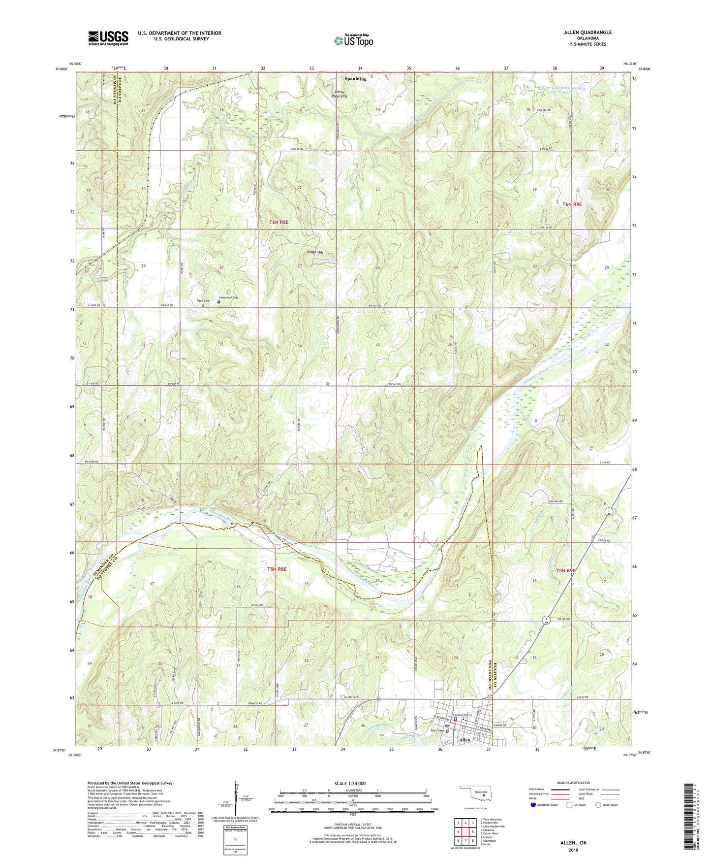
2018 topographic map quadrangle Allen in the state of Oklahoma. Scale: 1:24000. Based on the newly updated USGS 7.5' US Topo map series, this map is in the following counties: Hughes, Pontotoc, Seminole. The map contains contour data, water features, and other items you are used to seeing on USGS maps, but also has updated roads and other features. This is the next generation of topographic maps. Printed on high-quality waterproof paper with UV fade-resistant inks.
Quads adjacent to this one:
West: Sasakwa
Northwest: Tate Mountain
North: Holdenville
Northeast: Lake Holdenville
East: Calvin West
Southeast: Gerty
South: Steedman
Southwest: Francis
Contains the following named places: Allen, Allen Cemetery, Allen Elementary School, Allen High School, Allen Oil Field, Allen Police Department, Allen Post Office, Allen Volunteer Fire Department, Arbeca Creek, Baker Branch, Boy Scout Camp Dam, Boy Scout Camp Reservoir, Camp Sasakwa, Greenleaf Cemetery, Holdenville Oil Field, Leonard Wemer Dam, Leonard Wemer Reservoir, Little River Hill, McCall School, Oknoname 063002 Dam, Oknoname 063002 Reservoir, Oknoname 063037 Dam, Osage Hill, R W Borders Dam, R W Borders Reservoir, Tiger Family Cemetery, Town of Allen, Township of Bilby, Wemer-Leonard Company Lake Number 1, Wemer-Leonard Company Lake Number 1 Dam