MyTopo
Altus Oklahoma US Topo Map
Couldn't load pickup availability
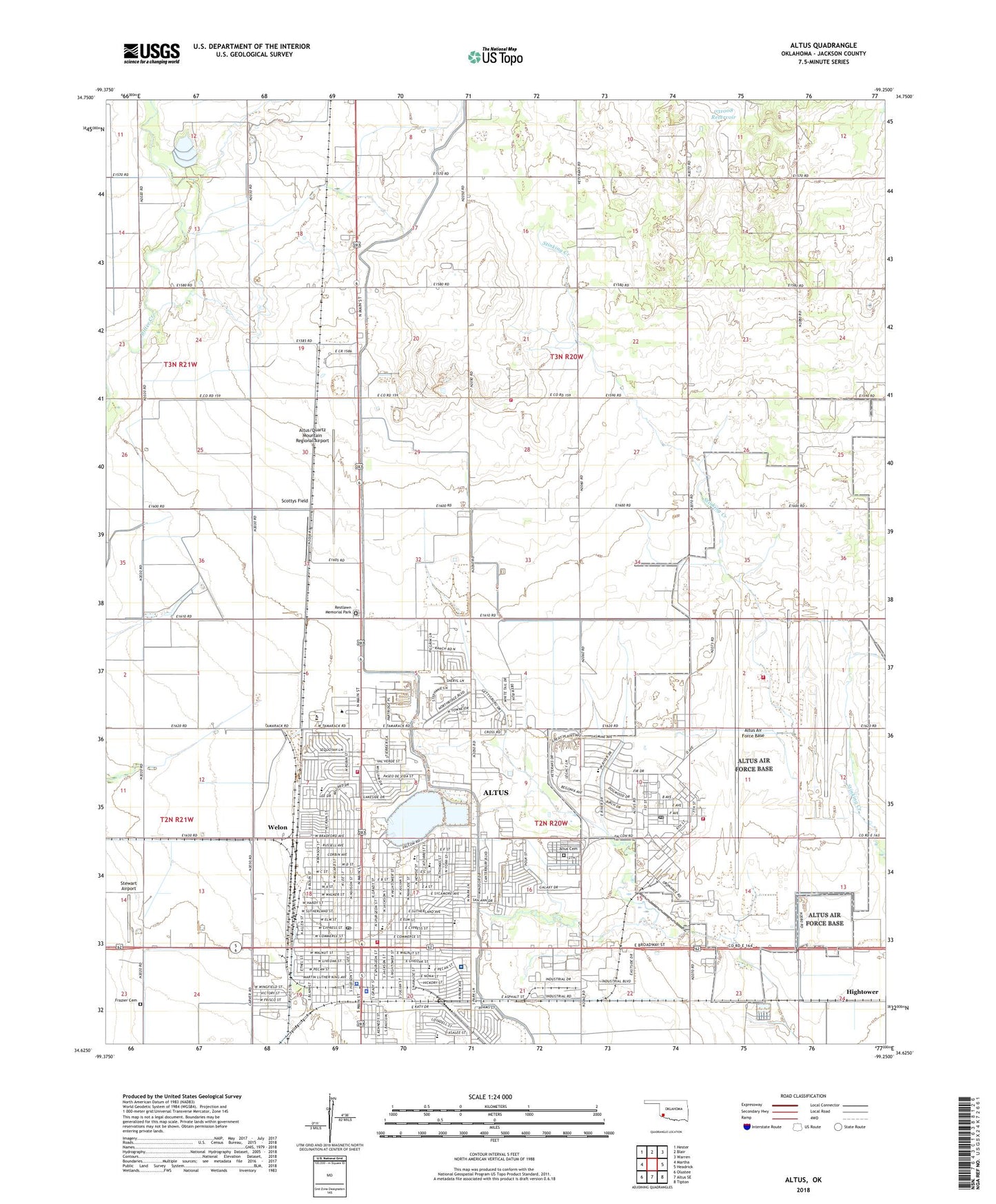
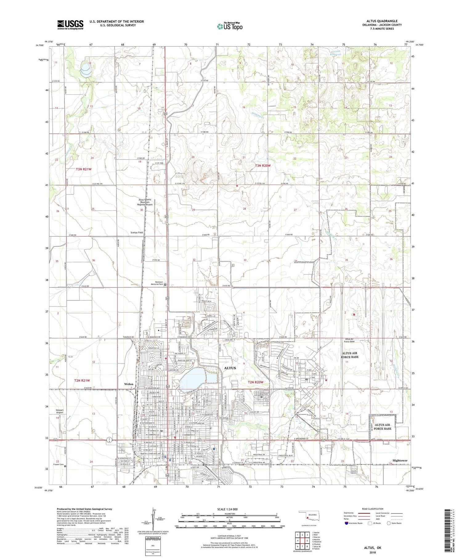
2018 topographic map quadrangle Altus in the state of Oklahoma. Scale: 1:24000. Based on the newly updated USGS 7.5' US Topo map series, this map is in the following counties: Jackson. The map contains contour data, water features, and other items you are used to seeing on USGS maps, but also has updated roads and other features. This is the next generation of topographic maps. Printed on high-quality waterproof paper with UV fade-resistant inks.
Quads adjacent to this one:
West: Martha
Northwest: Hester
North: Blair
Northeast: Warren
East: Headrick
Southeast: Tipton
South: Altus SE
Southwest: Olustee
Contains the following named places: Altus, Altus Air Force Base, Altus Air Force Base Fire Department Station 1 Headquarters, Altus Air Force Base Fire Department Station 2, Altus Air Force Base Post Office, Altus Canal, Altus Cemetery, Altus Central Fire Station, Altus Christian Fellowship, Altus City Reservoir Dam, Altus Division, Altus Fire Department Station 2, Altus High School, Altus Intermediate School, Altus Plaza Shopping Center and Mall, Altus Police Department, Altus Post Office, Altus Public Schools Security, Altus Reservoir, Altus Reservoir Dam, Altus/Quartz Mountain Regional Airport, Assembly of God Glad Tidings, Baptist Student Union, Central Junior High School, Church of Christ, Church of God, Church of the Nazarene, City of Altus, Emmanuel Baptist Church, Eugene Field School, Faith Lutheran Church, Falcon School, Family Worship Center, First Assembly of God, First Baptist Church, First Christian Church, First Presbyterian Church, First United Methodist Church, First United Pentecostal Church, Frazier Cemetery, Friendship Volunteer Fire Department Station 2, Grace Chapel, Grace United Methodist Church, Great Plains Baptist Church, Highland Heights Methodist Church, Hightower, Jackson County Emergency Medical Services, Jackson County Jail, Jackson County Memorial Hospital, Jackson County Sheriff's Office, KEYB-FM (Altus), KKVO-FM (Altus), KWHW-AM (Altus), Lincoln Park, Oklahoma State Highway Patrol Troop M, Oknoname 031008 Dam, Oknoname 031008 Reservoir, Our Saviours Lutheran Church, Park Lane Shopping Center, Prince of Peace Catholic Church, Restlawn Memorial Park, Rivers Elementary School, Robert E Lee School, Roosevelt Elementary School, Saint Pauls Episcopal Church, Scottys Field, Southside Baptist Church, Southwest Technology Center, Stewart Airport, Sunset Elementary School, Tabernacle Baptist Church, Township of Martha, Washington Elementary School, Welon, Western Oklahoma State College, Will Rogers Elementary School, Wilson School, ZIP Code: 73521