MyTopo
Anadarko East Oklahoma US Topo Map
Couldn't load pickup availability
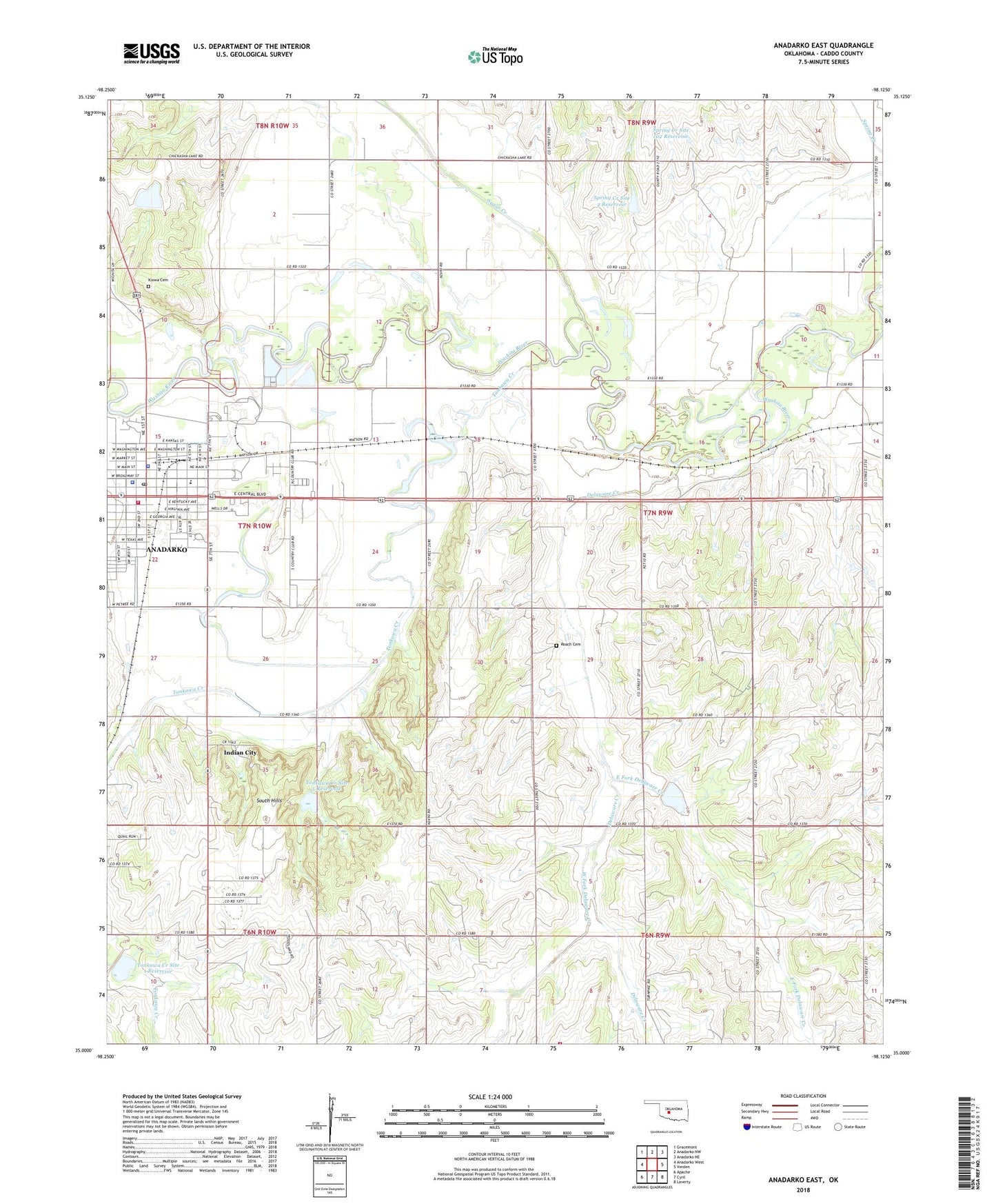
2018 topographic map quadrangle Anadarko East in the state of Oklahoma. Scale: 1:24000. Based on the newly updated USGS 7.5' US Topo map series, this map is in the following counties: Caddo. The map contains contour data, water features, and other items you are used to seeing on USGS maps, but also has updated roads and other features. This is the next generation of topographic maps. Printed on high-quality waterproof paper with UV fade-resistant inks.
Quads adjacent to this one:
West: Anadarko West
Northwest: Gracemont
North: Anadarko NW
Northeast: Anadarko NE
East: Verden
Southeast: Laverty
South: Cyril
Southwest: Apache
Contains the following named places: Anadarko, Anadarko Fire Department, Anadarko Police Department, Anadarko Post Office, Caddo Country Club, Caddo County Jail, Caddo County Sheriff's Office, Church of the Nazarene, City of Anadarko, Delaware Creek, Delaware Creek Site 8 Dam, Delaware Creek Site 8 Reservoir, East Elementary School, East Fork Delaware Creek, First Christian Church, Grace Church, Greater First Baptist Church, Indian Capital Baptist Church, Indian City, Lincoln School, New Hope Church, New Hope Volunteer Fire Association, Riverside Cemetery, Riverside Indian School, Roach Cemetery, Saint Pauls United Methodist Church, Saint Thomas Lutheran Church, South Hills, Spring Creek Site 102 Dam, Spring Creek Site 102 Reservoir, Spring Creek Site 2 Dam, Spring Creek Site 2 Reservoir, Sugar Creek, Tonkawa Creek, Tonkawa Creek Site 1 Dam, Tonkawa Creek Site 1 Reservoir, Tonkawa Creek Site 5 Dam, Tonkawa Creek Site 5 Reservoir, Township of Delaware, Township of East McKinley, Victory Assembly of God, Virginia Avenue Baptist Church, West Fork Delaware Creek, West School, ZIP Code: 73005