MyTopo
Anthon Oklahoma US Topo Map
Couldn't load pickup availability
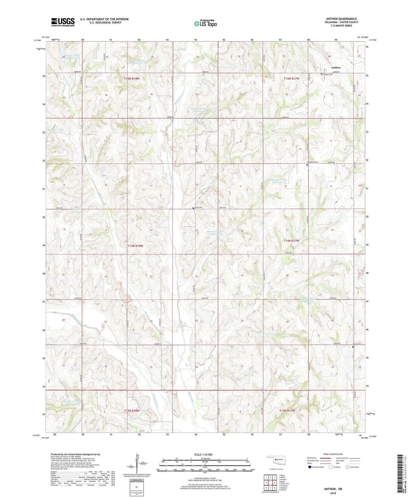
2018 topographic map quadrangle Anthon in the state of Oklahoma. Scale: 1:24000. Based on the newly updated USGS 7.5' US Topo map series, this map is in the following counties: Custer. The map contains contour data, water features, and other items you are used to seeing on USGS maps, but also has updated roads and other features. This is the next generation of topographic maps. Printed on high-quality waterproof paper with UV fade-resistant inks.
Quads adjacent to this one:
West: Butler
Northwest: Rhea
North: Aledo
Northeast: Putnam
East: Custer City
Southeast: Clinton
South: Stafford
Southwest: Foss Dam
Contains the following named places: Anthon, Anthon Cemetery, Barnitz Creek Site 21 Dam, Barnitz Creek Site 21 Reservoir, Barnitz Creek Site 22 Dam, Barnitz Creek Site 22 Reservoir, Barnitz Creek Site 29 Dam, Barnitz Creek Site 29 Reservoir, Barnitz Creek Site 32 Dam, Barnitz Creek Site 32 Reservoir, Barnitz Creek Site 33 Dam, Barnitz Creek Site 33 Reservoir, Barnitz Creek Site 34 Dam, Barnitz Creek Site 34 Reservoir, Barnitz Creek Site 52 Dam, Barnitz Creek Site 52 Reservoir, Barnitz Creek Site 56 Dam, Barnitz Creek Site 56 Reservoir, Barnitz Creek Site 65 Dam, Barnitz Creek Site 65 Reservoir, Barnitz Creek Site 68 Dam, Barnitz Creek Site 68 Reservoir, Barnitz Creek Site 70 Dam, Barnitz Creek Site 70 Reservoir, Custer County, Dry Creek, Gyp Cemetery, Pleasant Valley Church, Sare Cemetery, Vicksburg Cemetery, Vicksburg Church