MyTopo
Antlers East Oklahoma US Topo Map
Couldn't load pickup availability
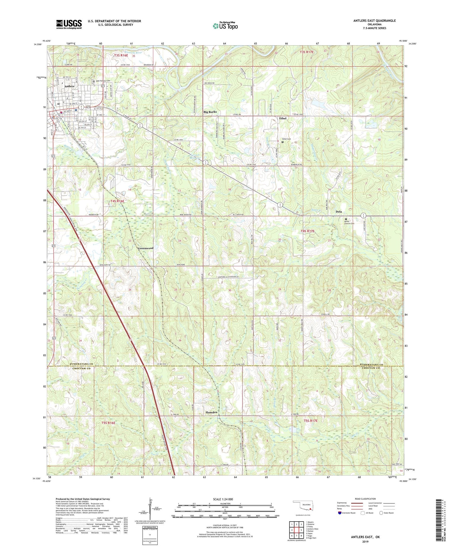
2019 topographic map quadrangle Antlers East in the state of Oklahoma. Scale: 1:24000. Based on the newly updated USGS 7.5' US Topo map series, this map is in the following counties: Pushmataha, Choctaw. The map contains contour data, water features, and other items you are used to seeing on USGS maps, but also has updated roads and other features. This is the next generation of topographic maps. Printed on high-quality waterproof paper with UV fade-resistant inks.
Quads adjacent to this one:
West: Antlers West
Northwest: Moyers
North: Kosoma
Northeast: Finley
East: Rattan
Southeast: Hugo Dam
South: Hugo
Southwest: Soper
Contains the following named places: Antlers, Antlers Fire Department and Emergency Medical Services, Antlers High School, Antlers Police Department, Antlers Post Office, Assembly of God Church, Beaver Creek, Big Rocks, Brantly Elementary School, Church of Christ, Church of the Nazarene, City of Antlers, Dela, Dela Cemetery, Dumpling Creek, East Town Village, Ethel, Ethel Cemetery, First Baptist Church, First Christian Church, First Presbyterian Church, Greenwood, Haggerman Creek, Hamden, Holly Branch, Kingdom Hall-Jehovahs Witness, Little Cedar Creek, Obuch Middle School, Odd Fellows Cemetery, Oknoname 127006 Dam, Oknoname 127006 Reservoir, Pushmataha County Jail, Pushmataha County Sheriff's Office, Pushmataha Hospital, Saint Agnes Catholic Church, Souls Harbor Church, ZIP Code: 74523