MyTopo
Arbuckle Hill Oklahoma US Topo Map
Couldn't load pickup availability
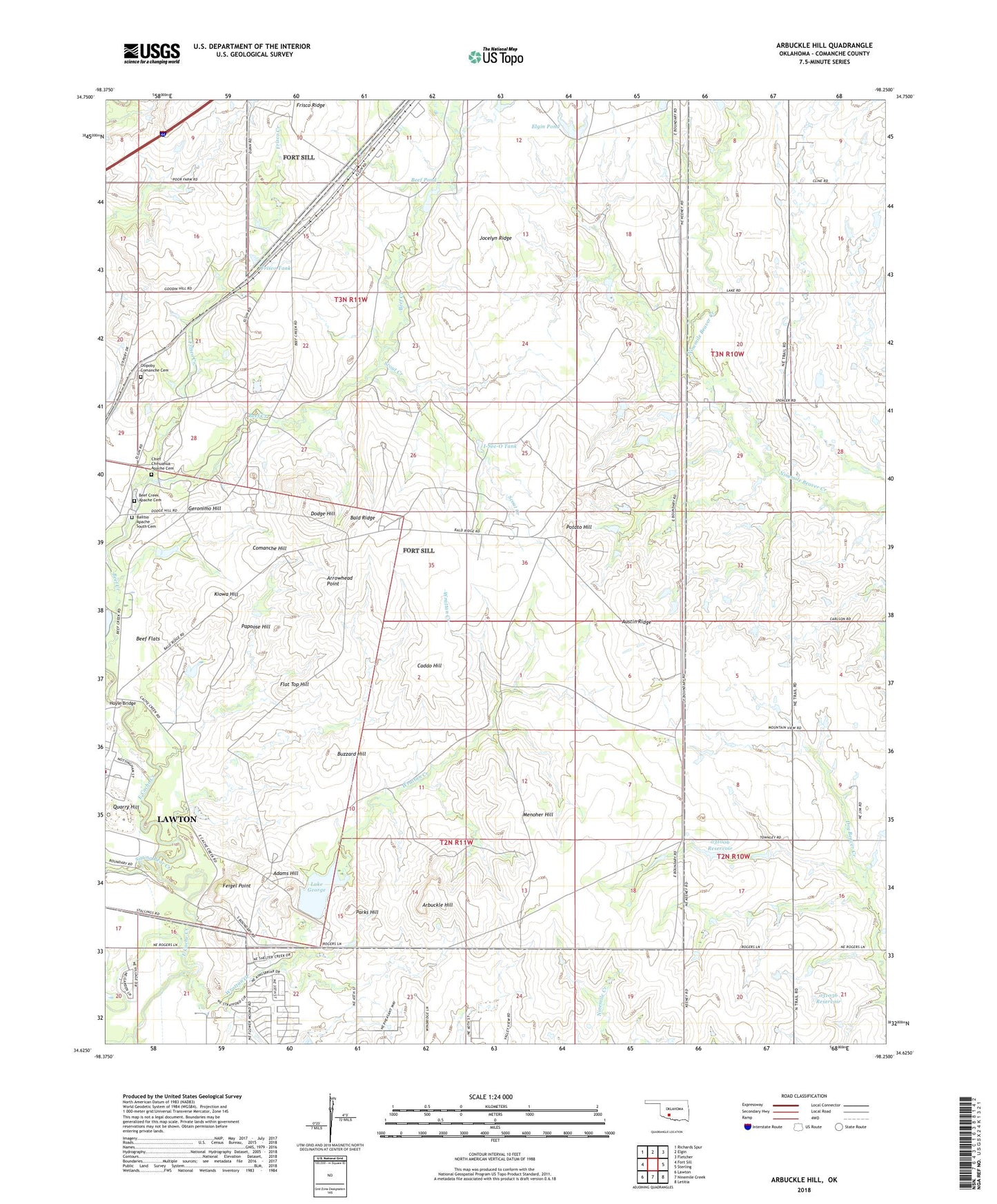
2018 topographic map quadrangle Arbuckle Hill in the state of Oklahoma. Scale: 1:24000. Based on the newly updated USGS 7.5' US Topo map series, this map is in the following counties: Comanche. The map contains contour data, water features, and other items you are used to seeing on USGS maps, but also has updated roads and other features. This is the next generation of topographic maps. Printed on high-quality waterproof paper with UV fade-resistant inks.
Quads adjacent to this one:
West: Fort Sill
Northwest: Richards Spur
North: Elgin
Northeast: Fletcher
East: Sterling
Southeast: Letitia
South: Ninemile Creek
Southwest: Lawton
Contains the following named places: Adams Hill, Arbuckle Hill, Arrowhead Point, Austin Ridge, Bailtso Apache South Cemetery, Bald Ridge, Beef Creek Apache Cemetery, Beef Flats, Beef Pond, Buzzard Hill, Caddo Hill, Chief Chihuahua Apache Cemetery, Comanche Hill, Dodge Hill, Elgin Pond, Feigel Point, Flat Top Hill, Frisco Creek, Frisco Ridge Airfield, Frisco Tank, Geronimo Hill, Hoyle Bridge, I-See-O Tank, Jocelyn Ridge, Kiowa Hill, Lake George, Lake George Dam, Menoher Hill, Oknoname 031006 Dam, Oknoname 031006 Reservoir, Oknoname 031036 Dam, Oknoname 031036 Reservoir, Otipoby Comanche Cemetery, Papoose Hill, Parks Hill, Potato Hill, Quarry Hill, Scout Creek, Sitting Bear Creek, Southeast Corner Airfield, Wrattan Creek