MyTopo
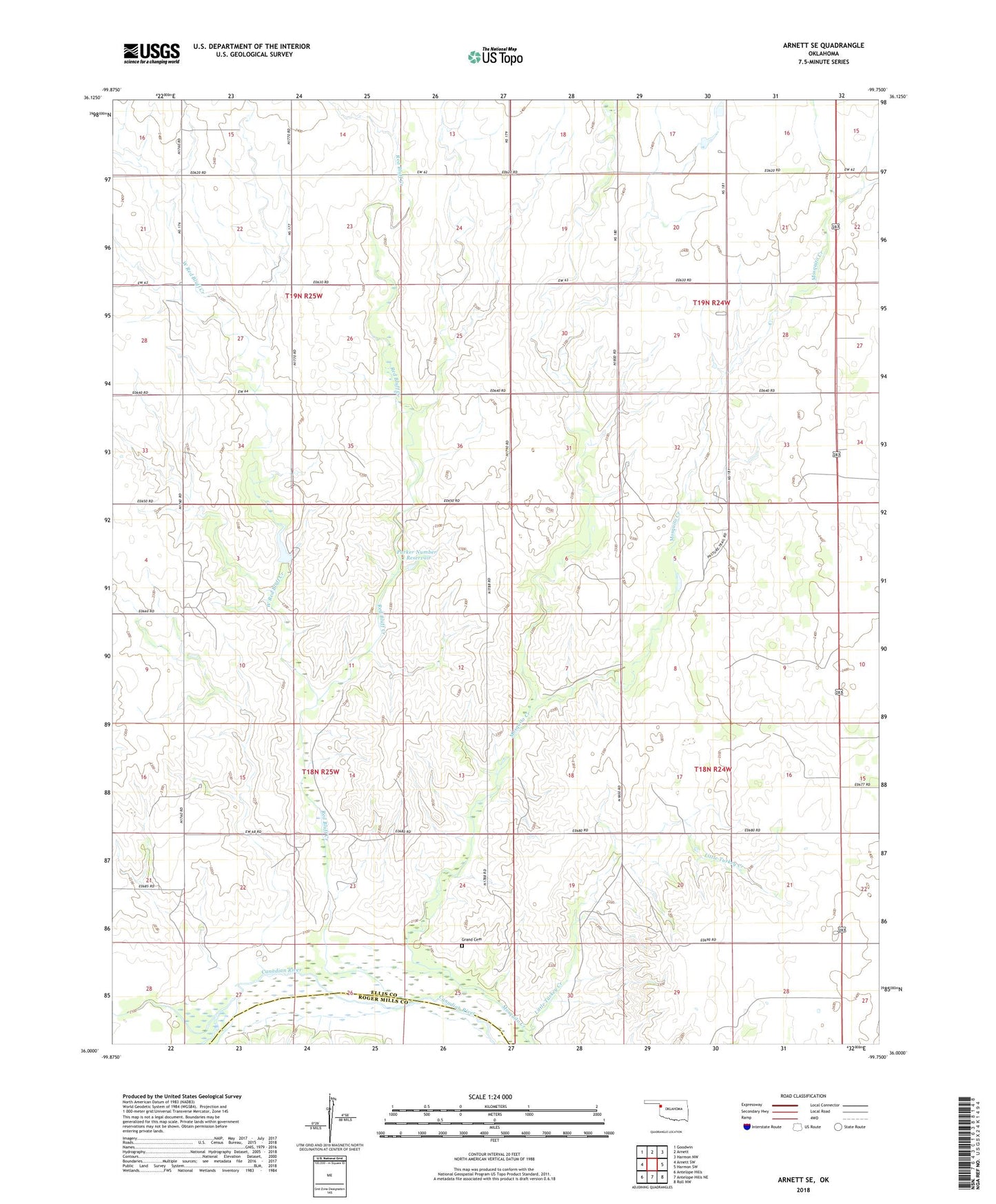
Arnett SE Oklahoma US Topo Map
Couldn't load pickup availability
2018 topographic map quadrangle Arnett SE in the state of Oklahoma. Scale: 1:24000. Based on the newly updated USGS 7.5' US Topo map series, this map is in the following counties: Ellis, Roger Mills. The map contains contour data, water features, and other items you are used to seeing on USGS maps, but also has updated roads and other features. This is the next generation of topographic maps. Printed on high-quality waterproof paper with UV fade-resistant inks.
Quads adjacent to this one:
West: Arnett SW
Northwest: Goodwin
North: Arnett
Northeast: Harmon NW
East: Harmon SW
Southeast: Roll NW
South: Antelope Hills NE
Southwest: Antelope Hills
Contains the following named places: Commission Creek, Grand Cemetery, Little Turkey Creek, Mosquito Creek, Parker Number 1 Dam, Parker Number 1 Reservoir, Red Bluff Creek, West Red Bluff Creek