MyTopo
White Lake Oklahoma US Topo Map
Couldn't load pickup availability
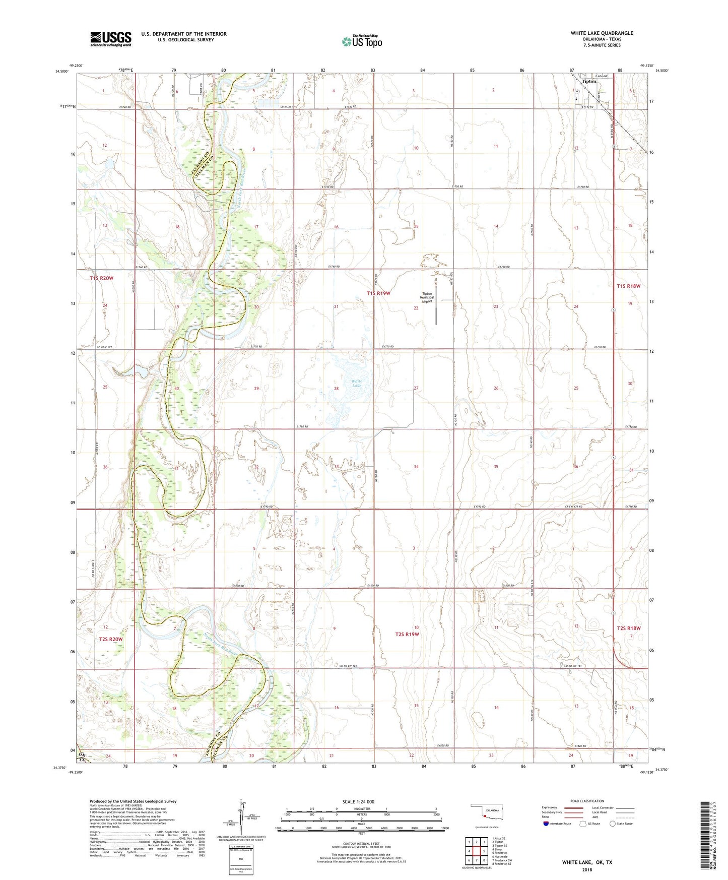
2018 topographic map quadrangle White Lake in the state of Oklahoma. Scale: 1:24000. Based on the newly updated USGS 7.5' US Topo map series, this map is in the following counties: Tillman, Jackson, Wilbarger. The map contains contour data, water features, and other items you are used to seeing on USGS maps, but also has updated roads and other features. This is the next generation of topographic maps. Printed on high-quality waterproof paper with UV fade-resistant inks.
Quads adjacent to this one:
West: Elmer
Northwest: Altus SE
North: Tipton
Northeast: Tipton SE
East: Frederick
Southeast: Frederick SE
South: Frederick SW
Southwest: Northside
Contains the following named places: Pinsons Cottonpatch Airport, Tesca Church, Tipton Elementary School, Tipton High School, Tipton Municipal Airport, Township of Richland, Weaver School, White Lake, Wilson 115 Dam